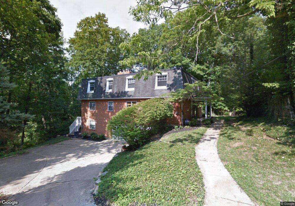
1207 Isis Ave Unit I Cincinnati, OH 45208
Mount Lookout NeighborhoodEstimated Value: $479,000 - $697,000
3
Beds
3
Baths
2,249
Sq Ft
$265/Sq Ft
Est. Value
About This Home
This home is located at 1207 Isis Ave Unit I, Cincinnati, OH 45208 and is currently estimated at $596,013, approximately $265 per square foot. 1207 Isis Ave Unit I is a home located in Hamilton County with nearby schools including Kilgour Elementary School, Clark Montessori High School, and Shroder High School.
Ownership History
Date
Name
Owned For
Owner Type
Purchase Details
Closed on
Mar 23, 2021
Sold by
Remington Andrew and Remington Christina
Bought by
Veracity Capital Llc
Current Estimated Value
Purchase Details
Closed on
Oct 8, 2015
Sold by
Aubuchon Kurt D and Aubuchon Mira
Bought by
Remington Andrew and Remington Christina
Home Financials for this Owner
Home Financials are based on the most recent Mortgage that was taken out on this home.
Original Mortgage
$209,700
Interest Rate
3.25%
Mortgage Type
Adjustable Rate Mortgage/ARM
Purchase Details
Closed on
May 16, 2012
Sold by
Aubuchon Kurt D and Aubuchon Mira
Bought by
Aubuchon Kurt D and Aubuchon Mira
Purchase Details
Closed on
Dec 15, 2005
Sold by
Flynn Land Ii Llc
Bought by
Kutermankiewicz Bozena
Home Financials for this Owner
Home Financials are based on the most recent Mortgage that was taken out on this home.
Original Mortgage
$229,500
Interest Rate
6.17%
Mortgage Type
Purchase Money Mortgage
Purchase Details
Closed on
Nov 14, 2005
Sold by
Kutermankiewicz Bozena and Sanford James
Bought by
Aubuchon Kurt D and Aubuchon Mira
Home Financials for this Owner
Home Financials are based on the most recent Mortgage that was taken out on this home.
Original Mortgage
$229,500
Interest Rate
6.17%
Mortgage Type
Purchase Money Mortgage
Purchase Details
Closed on
Jul 28, 2004
Sold by
Kutermankiewicz Bozena
Bought by
Kutermankiewicz Bozena
Purchase Details
Closed on
Aug 28, 2003
Sold by
Flynn Land Ii Llc
Bought by
Kutermankiewicz Bozena
Home Financials for this Owner
Home Financials are based on the most recent Mortgage that was taken out on this home.
Original Mortgage
$344,000
Interest Rate
6.44%
Mortgage Type
Purchase Money Mortgage
Purchase Details
Closed on
Jun 28, 2002
Sold by
Michael Flynn and Michael Monica M
Bought by
Flynn Land Ii Llc
Purchase Details
Closed on
Jul 1, 1994
Sold by
Roberts Ellsworth M and Roberts Dana W
Bought by
Flynn Michael
Home Financials for this Owner
Home Financials are based on the most recent Mortgage that was taken out on this home.
Original Mortgage
$225,000
Interest Rate
8.61%
Mortgage Type
Purchase Money Mortgage
Create a Home Valuation Report for This Property
The Home Valuation Report is an in-depth analysis detailing your home's value as well as a comparison with similar homes in the area
Home Values in the Area
Average Home Value in this Area
Purchase History
| Date | Buyer | Sale Price | Title Company |
|---|---|---|---|
| Veracity Capital Llc | -- | None Available | |
| Remington Andrew | $233,000 | Attorney | |
| Aubuchon Kurt D | -- | Attorney | |
| Kutermankiewicz Bozena | -- | None Available | |
| Aubuchon Kurt D | $270,000 | None Available | |
| Kutermankiewicz Bozena | -- | -- | |
| Kutermankiewicz Bozena | $430,000 | -- | |
| Flynn Land Ii Llc | -- | -- | |
| Flynn Michael | -- | -- |
Source: Public Records
Mortgage History
| Date | Status | Borrower | Loan Amount |
|---|---|---|---|
| Previous Owner | Remington Andrew | $209,700 | |
| Previous Owner | Aubuchon Kurt D | $229,500 | |
| Previous Owner | Kutermankiewicz Bozena | $344,000 | |
| Previous Owner | Flynn Michael | $225,000 |
Source: Public Records
Tax History Compared to Growth
Tax History
| Year | Tax Paid | Tax Assessment Tax Assessment Total Assessment is a certain percentage of the fair market value that is determined by local assessors to be the total taxable value of land and additions on the property. | Land | Improvement |
|---|---|---|---|---|
| 2024 | $7,979 | $126,210 | $54,740 | $71,470 |
| 2023 | $7,993 | $126,210 | $54,740 | $71,470 |
| 2022 | $6,717 | $95,414 | $48,321 | $47,093 |
| 2021 | $6,244 | $95,414 | $48,321 | $47,093 |
| 2020 | $6,427 | $95,414 | $48,321 | $47,093 |
| 2019 | $6,074 | $81,550 | $41,300 | $40,250 |
| 2018 | $6,083 | $81,550 | $41,300 | $40,250 |
| 2017 | $5,776 | $81,550 | $41,300 | $40,250 |
| 2016 | $7,402 | $103,313 | $38,850 | $64,463 |
| 2015 | $7,020 | $103,313 | $38,850 | $64,463 |
| 2014 | $7,057 | $103,313 | $38,850 | $64,463 |
| 2013 | $6,471 | $93,076 | $35,000 | $58,076 |
Source: Public Records
Map
Nearby Homes
- 1225 Corbett St
- 1227 Corbett St
- 1137 Delta Ave
- 3161 Niles St
- 1065 Delta Ave
- 1338 Suncrest Dr
- 3246 Observatory Ave
- 3306 Lambert Place
- 1332 Herschel Ave
- 3109 Linwood Ave
- 1221 Herschel Woods Ln
- 3290 Observatory Ave
- 1029 Kinmont St
- 2922 Utopia Place
- 2997 Linwood Ave
- 3122 Kinmont St
- 3458 Observatory Place
- 1141 Herschel Ave
- 3008 Erie Ave
- 3293 Linwood Ave
- 1207 Isis Ave
- 1207 Isis Ave Unit A
- 1207 Isis Ave Unit B
- 1211 Isis Ave
- 1215 Isis Ave
- 1244 Delta Ave
- 1206 Isis Ave
- 1235 Isis Ave
- 1250 Delta Ave
- 1246 Delta Ave Unit 1
- 1252 Delta Ave
- 1208 Isis Ave
- 1242 Delta Ave
- 1216 Delta Ave
- 1212 Isis Ave
- 1214 Delta Ave
- 1216 Isis Ave
- 1222 Isis Ave
- 1 Isis Ave
- 1262 Delta Ave