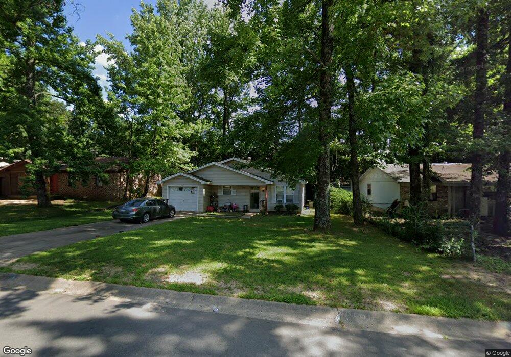
1207 Liberty Dr Jacksonville, AR 72076
Estimated Value: $109,278 - $132,000
--
Bed
3
Baths
1,118
Sq Ft
$108/Sq Ft
Est. Value
About This Home
This home is located at 1207 Liberty Dr, Jacksonville, AR 72076 and is currently estimated at $121,070, approximately $108 per square foot. 1207 Liberty Dr is a home located in Pulaski County with nearby schools including Murrell Taylor Elementary School, Jacksonville Middle School, and Jacksonville High School.
Ownership History
Date
Name
Owned For
Owner Type
Purchase Details
Closed on
Apr 29, 2003
Sold by
Griffis Gentry S
Bought by
Harris Cynthia Ann
Current Estimated Value
Home Financials for this Owner
Home Financials are based on the most recent Mortgage that was taken out on this home.
Original Mortgage
$62,500
Outstanding Balance
$26,652
Interest Rate
5.65%
Mortgage Type
FHA
Estimated Equity
$94,418
Purchase Details
Closed on
Oct 13, 2000
Sold by
Humphrey Michael C and Humphrey Mary R
Bought by
Griffis Gentry S
Home Financials for this Owner
Home Financials are based on the most recent Mortgage that was taken out on this home.
Original Mortgage
$59,500
Interest Rate
7.89%
Mortgage Type
FHA
Create a Home Valuation Report for This Property
The Home Valuation Report is an in-depth analysis detailing your home's value as well as a comparison with similar homes in the area
Home Values in the Area
Average Home Value in this Area
Purchase History
| Date | Buyer | Sale Price | Title Company |
|---|---|---|---|
| Harris Cynthia Ann | $64,000 | Lenders Title Co | |
| Griffis Gentry S | $60,000 | United Abstract & Title Co |
Source: Public Records
Mortgage History
| Date | Status | Borrower | Loan Amount |
|---|---|---|---|
| Open | Harris Cynthia Ann | $62,500 | |
| Previous Owner | Griffis Gentry S | $59,500 |
Source: Public Records
Tax History Compared to Growth
Tax History
| Year | Tax Paid | Tax Assessment Tax Assessment Total Assessment is a certain percentage of the fair market value that is determined by local assessors to be the total taxable value of land and additions on the property. | Land | Improvement |
|---|---|---|---|---|
| 2025 | $962 | $17,231 | $1,200 | $16,031 |
| 2024 | $773 | $17,231 | $1,200 | $16,031 |
| 2023 | $773 | $17,231 | $1,200 | $16,031 |
| 2022 | $842 | $17,231 | $1,200 | $16,031 |
| 2021 | $802 | $13,060 | $740 | $12,320 |
| 2020 | $427 | $13,060 | $740 | $12,320 |
| 2019 | $427 | $13,060 | $740 | $12,320 |
| 2018 | $452 | $13,060 | $740 | $12,320 |
| 2017 | $452 | $13,060 | $740 | $12,320 |
| 2016 | $564 | $14,880 | $2,600 | $12,280 |
| 2015 | $801 | $14,880 | $2,600 | $12,280 |
| 2014 | $801 | $14,880 | $2,600 | $12,280 |
Source: Public Records
Map
Nearby Homes
- 1302 King St
- 910 Ray Rd
- 419 Church St
- 13 Michelle Ln Unit A
- 602 Ray Rd
- 1404 Southeastern Ave
- 29 Collins Rd
- 134 Pike Ave
- 111 Joiner Ave
- 720 Southeastern Ave
- 219 Lonsdale Cir
- 1401 Tamara Park
- 10 Park Dr
- 1110 Wright St
- 305 Smart St
- 191 Roosevelt Rd
- 127 Wilson St
- 221 Pearl St
- 600 Sorrells Dr
- 109 Galloway Cir
- 1211 Liberty Dr
- 1203 Liberty Dr
- 1301 Liberty Dr
- 1206 Liberty Dr
- 1210 Liberty Dr
- 1204 Liberty Dr
- 1303 Liberty Dr
- 1113 Liberty Dr
- 0 Liberty Dr
- 1202 Liberty Dr
- 91 John Hancock Cir
- 7 John Hancock Cir
- 1302 Liberty Dr
- 1305 Liberty Dr
- 1109 Liberty Dr
- 11 John Hancock Cir
- 0 John Hancock Cir Unit 15028117
- 0 John Hancock Cir Unit 16008072
- 0 John Hancock Cir Unit 18004301
- 0 John Hancock Cir Unit 17029900