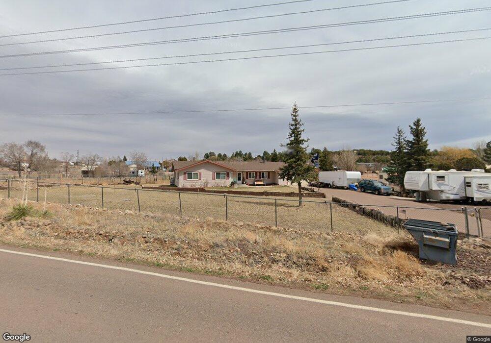
1207 Lone Pine Dam Rd Show Low, AZ 85901
Estimated Value: $403,000 - $523,000
3
Beds
2
Baths
68
Sq Ft
$6,767/Sq Ft
Est. Value
About This Home
This home is located at 1207 Lone Pine Dam Rd, Show Low, AZ 85901 and is currently estimated at $460,134, approximately $6,766 per square foot. 1207 Lone Pine Dam Rd is a home located in Navajo County with nearby schools including Linden Elementary School, Show Low High School, and Show Low Junior High School.
Ownership History
Date
Name
Owned For
Owner Type
Purchase Details
Closed on
Jan 29, 2019
Sold by
Monson Tandra R and Ortiz Tandra R
Bought by
Monson Tandra R
Current Estimated Value
Purchase Details
Closed on
Jan 18, 2014
Sold by
Ortiz Joe
Bought by
Ortiz Tandra R and Monson Tandra R
Purchase Details
Closed on
Apr 4, 2013
Sold by
Fannie Mae
Bought by
Monson Tandra R
Home Financials for this Owner
Home Financials are based on the most recent Mortgage that was taken out on this home.
Original Mortgage
$135,418
Outstanding Balance
$96,147
Interest Rate
3.6%
Mortgage Type
New Conventional
Estimated Equity
$363,987
Purchase Details
Closed on
Feb 5, 2013
Sold by
Gmac Mortgage Llc
Bought by
Federal National Mortgage Association
Home Financials for this Owner
Home Financials are based on the most recent Mortgage that was taken out on this home.
Original Mortgage
$135,418
Outstanding Balance
$96,147
Interest Rate
3.6%
Mortgage Type
New Conventional
Estimated Equity
$363,987
Purchase Details
Closed on
Jan 25, 2013
Sold by
Wahl Karen Ann and Wahl Steven R
Bought by
Gmac Mortgage Llc
Purchase Details
Closed on
Feb 14, 2008
Sold by
Wahl Karen Ann and Wahl Steven R
Bought by
Wahl Steven R and Wahl Karen Ann
Home Financials for this Owner
Home Financials are based on the most recent Mortgage that was taken out on this home.
Original Mortgage
$285,700
Interest Rate
5.72%
Mortgage Type
Stand Alone Refi Refinance Of Original Loan
Purchase Details
Closed on
Jan 4, 2006
Sold by
Wahl Steven R and Wahl Karen Ann
Bought by
Wahl Steven R and Wahl Karen Ann
Create a Home Valuation Report for This Property
The Home Valuation Report is an in-depth analysis detailing your home's value as well as a comparison with similar homes in the area
Home Values in the Area
Average Home Value in this Area
Purchase History
| Date | Buyer | Sale Price | Title Company |
|---|---|---|---|
| Monson Tandra R | -- | Accommodation | |
| Ortiz Tandra R | -- | None Available | |
| Monson Tandra R | $132,710 | Old Republic Title Agency | |
| Federal National Mortgage Association | -- | First American Title Ins Co | |
| Federal National Mortgage Association | -- | First American Title Ins Co | |
| Gmac Mortgage Llc | $199,617 | First American Title Ins Co | |
| Wahl Steven R | -- | Title Source Inc | |
| Wahl Karen Ann | -- | Title Source Inc | |
| Wahl Steven R | -- | Pacific Corporate & Title | |
| Wahl Steven R | -- | Pacific Corporate & Title |
Source: Public Records
Mortgage History
| Date | Status | Borrower | Loan Amount |
|---|---|---|---|
| Open | Monson Tandra R | $135,418 | |
| Previous Owner | Wahl Karen Ann | $285,700 |
Source: Public Records
Tax History Compared to Growth
Tax History
| Year | Tax Paid | Tax Assessment Tax Assessment Total Assessment is a certain percentage of the fair market value that is determined by local assessors to be the total taxable value of land and additions on the property. | Land | Improvement |
|---|---|---|---|---|
| 2026 | $1,358 | -- | -- | -- |
| 2025 | $1,336 | $34,239 | $6,821 | $27,418 |
| 2024 | $1,255 | $35,245 | $8,427 | $26,818 |
| 2023 | $1,336 | $26,801 | $4,777 | $22,024 |
| 2022 | $1,255 | $0 | $0 | $0 |
| 2021 | $1,274 | $0 | $0 | $0 |
| 2020 | $1,186 | $0 | $0 | $0 |
| 2019 | $1,187 | $0 | $0 | $0 |
| 2018 | $1,125 | $0 | $0 | $0 |
| 2017 | $1,026 | $0 | $0 | $0 |
| 2016 | $1,013 | $0 | $0 | $0 |
| 2015 | $956 | $9,541 | $2,958 | $6,583 |
Source: Public Records
Map
Nearby Homes
- 7092 Shilo Trail
- 1188 Outlaw Pass
- 7075 Bryant Blvd
- 1182 Outlaw Pass
- 7130 White Gate Way
- 7046 Stagecoach Pass
- 7141 Pair O Dice Rd
- 7018 Shilo Trail
- 1276 Lone Pine Dam Rd
- 7070 Juniper Way
- 7019 Stagecoach Pass
- 7019 Stagecoach Pass Unit 93
- 7007 Stagecoach Pass
- 7022 Kims Way
- 1092 Cedar Dr
- 1070 Lone Pine Dam Rd
- 1075 Rim View Dr
- 1085 Pine Ridge Dr
- 7125 Elk Trail
- 1009 Chaparral Dr
- 7073 Rocky Rim Rd
- 1206 Lone Pine Dam Rd Unit FS13
- 1197 Lone Pine Dam Rd
- 1197 Lone Pine Dam Rd Unit 13
- 1217 Lone Pine Dam Rd
- 7119 Rocky Rim Rd
- 7114 Rocky Rim Rd
- 7096 Shilo Trail
- 7092 Rocky Rim Rd
- 1191 Lone Pine Dam Rd
- 1199 Lone Pine Dam Rd
- 7095 Bryant Blvd
- 7122 Rocky Rim Rd
- 1195 Lone Pine Dam Rd
- 7088 Shilo Trail
- 7097 Shilo Trail
- 7093 Shilo Trail
- 1203 Lone Pine Dam Rd
- 1185 Lone Pine Dam Rd
- 7109 White Gate Way