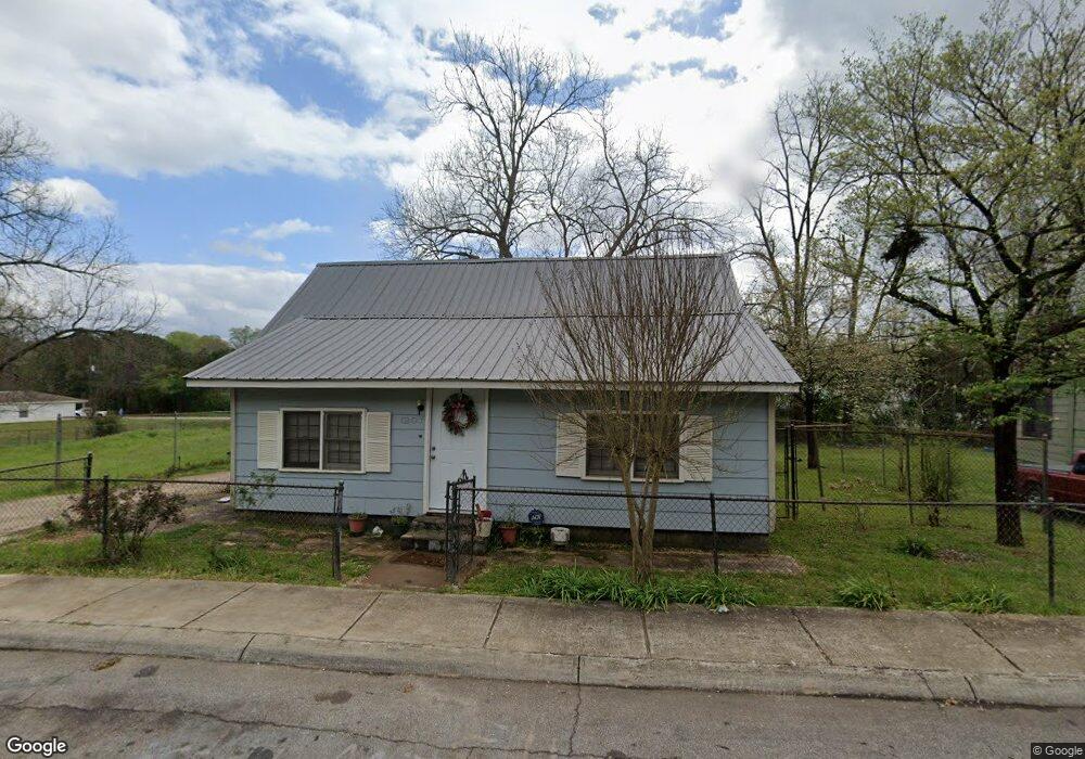
1207 Polk St Lagrange, GA 30240
Estimated Value: $70,000 - $170,000
3
Beds
1
Bath
1,511
Sq Ft
$85/Sq Ft
Est. Value
About This Home
This home is located at 1207 Polk St, Lagrange, GA 30240 and is currently estimated at $127,833, approximately $84 per square foot. 1207 Polk St is a home located in Troup County with nearby schools including Berta Weathersbee Elementary School, Whitesville Road Elementary School, and Rosemont Elementary School.
Ownership History
Date
Name
Owned For
Owner Type
Purchase Details
Closed on
Nov 6, 2002
Sold by
Ligon Cecila
Bought by
Adams Cecelia N
Current Estimated Value
Purchase Details
Closed on
Jan 11, 2002
Sold by
Frank Ligon
Bought by
Ligon Cecila
Purchase Details
Closed on
Dec 20, 2001
Sold by
Frank Ligon
Bought by
Frank Ligon
Purchase Details
Closed on
Dec 19, 2001
Sold by
Carsell Ligon
Bought by
Frank Ligon
Purchase Details
Closed on
Jan 1, 1966
Sold by
Frank Dowell
Bought by
Carsell Ligon
Create a Home Valuation Report for This Property
The Home Valuation Report is an in-depth analysis detailing your home's value as well as a comparison with similar homes in the area
Purchase History
We collect this data history from publicly available records. To have your information removed, we recommend requesting removal directly through your county’s website.
| Date | Buyer | Sale Price | Title Company |
|---|---|---|---|
| Adams Cecelia N | -- | -- | |
| Ligon Cecila | -- | -- | |
| Frank Ligon | -- | -- | |
| Frank Ligon | -- | -- | |
| Carsell Ligon | -- | -- |
Source: Public Records
Tax History
| Year | Tax Paid | Tax Assessment Tax Assessment Total Assessment is a certain percentage of the fair market value that is determined by local assessors to be the total taxable value of land and additions on the property. | Land | Improvement |
|---|---|---|---|---|
| 2025 | $834 | $34,560 | $8,000 | $26,560 |
| 2024 | $736 | $28,960 | $4,000 | $24,960 |
| 2023 | $630 | $25,080 | $4,000 | $21,080 |
| 2022 | $546 | $21,560 | $4,000 | $17,560 |
| 2021 | $512 | $18,960 | $4,000 | $14,960 |
| 2020 | $512 | $18,960 | $4,000 | $14,960 |
| 2019 | $437 | $16,488 | $1,768 | $14,720 |
| 2018 | $437 | $16,488 | $1,768 | $14,720 |
| 2017 | $437 | $16,488 | $1,768 | $14,720 |
| 2016 | $423 | $15,995 | $1,768 | $14,227 |
| 2015 | $424 | $15,995 | $1,768 | $14,227 |
| 2014 | $450 | $16,845 | $1,768 | $15,077 |
| 2013 | -- | $17,925 | $1,768 | $16,157 |
Source: Public Records
Map
Nearby Homes
- 1300 Murphy Ave
- 1005 Callaway Ave
- 1191 Whitesville St
- 1201 Whitesville St
- 914 Todd St
- 1205 Park Ave
- 1308 Park Ave
- 606 Poplar St
- 900 B N Pkwy
- 0 Bagley St
- 304 Butler St
- 0 Boggs St Unit 10550243
- 0 Boggs St Unit 10550231
- 0 Boggs St Unit 10550239
- 0 Boggs St Unit 10550250
- 799 Hunnicutt St
- 797 Hunnicutt St
- 109 Bell St
- LOT 33 E Hillside Dr
- LOT 34 E Hillside Dr
- 1018 Lindsey St
- 1203 Lindsey St
- 1206 Lindsey St
- 1204 Lindsey St
- 1205 Lindsey St
- 1207 Lindsey St
- 1208 Lindsey St
- 1209 Lindsey St
- 1202 Lindsey St
- 1210 Lindsey St
- 1203 Polk St
- 1211 Lindsey St
- 1209 Polk St
- 1201 Polk St
- 1212 Lindsey St
- 1200 Lindsey St
- 1211 Polk St
- 1199 Polk St
- 1205 Polk St
- 0 Polk St Unit 9016301
Your Personal Tour Guide
Ask me questions while you tour the home.