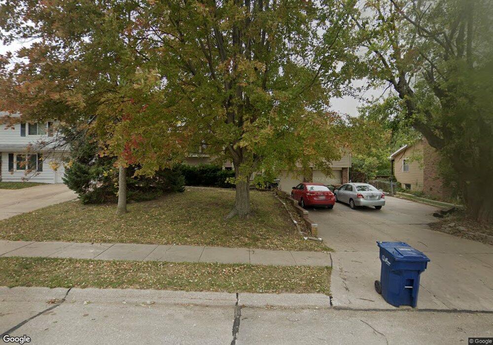
1207 Potter Rd Bellevue, NE 68005
Estimated Value: $272,000 - $290,887
3
Beds
5
Baths
2,063
Sq Ft
$136/Sq Ft
Est. Value
About This Home
This home is located at 1207 Potter Rd, Bellevue, NE 68005 and is currently estimated at $280,722, approximately $136 per square foot. 1207 Potter Rd is a home located in Sarpy County with nearby schools including Birchcrest Elementary School, Logan Fontenelle Middle School, and Bellevue East High School.
Ownership History
Date
Name
Owned For
Owner Type
Purchase Details
Closed on
Sep 10, 2001
Sold by
Sink Bonnie Trustee
Bought by
Herzberg Bradrick L and Herzberg Tami L
Current Estimated Value
Home Financials for this Owner
Home Financials are based on the most recent Mortgage that was taken out on this home.
Original Mortgage
$124,402
Outstanding Balance
$48,404
Interest Rate
6.96%
Estimated Equity
$232,318
Purchase Details
Closed on
Oct 9, 2000
Sold by
Sink Bonnie
Bought by
Sink Bonnie and The Bonnie Sink Trust
Create a Home Valuation Report for This Property
The Home Valuation Report is an in-depth analysis detailing your home's value as well as a comparison with similar homes in the area
Home Values in the Area
Average Home Value in this Area
Purchase History
| Date | Buyer | Sale Price | Title Company |
|---|---|---|---|
| Herzberg Bradrick L | $131,000 | -- | |
| Sink Bonnie | -- | -- |
Source: Public Records
Mortgage History
| Date | Status | Borrower | Loan Amount |
|---|---|---|---|
| Open | Herzberg Bradrick L | $124,402 |
Source: Public Records
Tax History
| Year | Tax Paid | Tax Assessment Tax Assessment Total Assessment is a certain percentage of the fair market value that is determined by local assessors to be the total taxable value of land and additions on the property. | Land | Improvement |
|---|---|---|---|---|
| 2025 | -- | $281,074 | $38,000 | $243,074 |
| 2024 | $5,035 | $270,776 | $34,000 | $236,776 |
| 2023 | $5,035 | $238,423 | $30,000 | $208,423 |
| 2022 | $4,535 | $210,731 | $27,000 | $183,731 |
| 2021 | $4,439 | $204,074 | $27,000 | $177,074 |
| 2020 | $4,222 | $193,474 | $21,000 | $172,474 |
| 2019 | $3,876 | $178,752 | $21,000 | $157,752 |
| 2018 | $3,572 | $169,163 | $21,000 | $148,163 |
| 2017 | $3,414 | $160,556 | $21,000 | $139,556 |
| 2016 | $3,259 | $156,649 | $21,000 | $135,649 |
| 2015 | $3,216 | $155,496 | $21,000 | $134,496 |
| 2014 | $3,188 | $153,122 | $21,000 | $132,122 |
| 2012 | -- | $151,769 | $21,000 | $130,769 |
Source: Public Records
Map
Nearby Homes
- LOT 11A1B Tbd
- 1302 Wilroy Rd Unit 1
- 1206 Skyview Dr
- 1503 Pelton Ave
- 1314 Hansen Ave
- 703 Vernon Ave
- 1010 Bellevue Blvd S
- 1704 Pelton Ave
- 1703 Pelton Ave
- 1712 Pelton Ave
- 420 Waldruh Dr
- 1811 Brenda Dr
- 403 Garden Ave
- Lot 13 Hidden Hills Dr
- 703 Marie Dr
- 302 Kings Dr
- 1216 Hillcrest Dr
- 206 Bellevue Blvd S
- 1227 Sunset Dr
- 2010 Jackson St
- 1209 Potter Rd
- 1205 Potter Rd
- 20.74 Acres
- 19204 State St
- 1203 Potter Rd
- 1211 Potter Rd
- 1225 Saint Andrews Rd
- 1223 Saint Andrews Rd
- 1223 St Andrews Rd
- 1227 Saint Andrews Rd
- 1221 Saint Andrews Rd
- 1201 Potter Rd
- 1301 Potter Rd
- 1227 St Andrews Rd
- 1217 Saint Andrews Rd
- 1229 Saint Andrews Rd
- 1208 Potter Rd
- 1221 St Andrews Rd
- 1206 Potter Rd
- 1215 Saint Andrews Rd
Your Personal Tour Guide
Ask me questions while you tour the home.