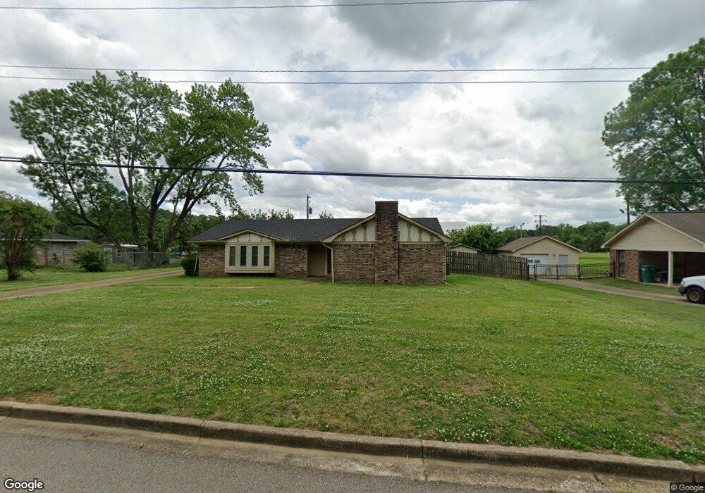
1207 Queensgate Dr Tupelo, MS 38801
Estimated Value: $182,000 - $208,425
Studio
--
Bath
1,550
Sq Ft
$125/Sq Ft
Est. Value
About This Home
This home is located at 1207 Queensgate Dr, Tupelo, MS 38801 and is currently estimated at $193,356, approximately $124 per square foot. 1207 Queensgate Dr is a home located in Lee County with nearby schools including Lawndale Elementary School, Parkway Elementary School, and Tupelo Middle School.
Ownership History
Date
Name
Owned For
Owner Type
Purchase Details
Closed on
Aug 22, 2018
Sold by
Us Bank National Association Not In Its
Bought by
Brownlee Marvin
Current Estimated Value
Purchase Details
Closed on
Sep 28, 2007
Sold by
Gladney Annie M Berry and Glandey Handun
Bought by
Lee Jacqueline
Home Financials for this Owner
Home Financials are based on the most recent Mortgage that was taken out on this home.
Original Mortgage
$106,000
Interest Rate
6.49%
Mortgage Type
Purchase Money Mortgage
Create a Home Valuation Report for This Property
The Home Valuation Report is an in-depth analysis detailing your home's value as well as a comparison with similar homes in the area
Purchase History
| Date | Buyer | Sale Price | Title Company |
|---|---|---|---|
| Brownlee Marvin | -- | None Available | |
| Lee Jacqueline | -- | -- |
Source: Public Records
Mortgage History
| Date | Status | Borrower | Loan Amount |
|---|---|---|---|
| Previous Owner | Lee Jacqueline | $106,000 |
Source: Public Records
Tax History
| Year | Tax Paid | Tax Assessment Tax Assessment Total Assessment is a certain percentage of the fair market value that is determined by local assessors to be the total taxable value of land and additions on the property. | Land | Improvement |
|---|---|---|---|---|
| 2025 | $1,704 | $12,530 | $0 | $0 |
| 2024 | $1,694 | $12,460 | $0 | $0 |
| 2023 | $1,463 | $10,930 | $0 | $0 |
| 2022 | $1,242 | $10,930 | $0 | $0 |
| 2021 | $1,196 | $10,930 | $0 | $0 |
| 2020 | $1,463 | $10,930 | $0 | $0 |
| 2019 | $1,156 | $10,359 | $0 | $0 |
| 2018 | $2,185 | $15,539 | $0 | $0 |
| 2017 | $2,177 | $15,539 | $0 | $0 |
| 2016 | $1,301 | $10,359 | $0 | $0 |
| 2015 | $1,150 | $9,445 | $0 | $0 |
| 2014 | $1,150 | $9,445 | $0 | $0 |
Source: Public Records
Map
Nearby Homes
- Lot 1 Dunbarton Place
- 9 Cambridge Dr
- 1103 Lawndale Dr
- 1702 Fillmore Dr
- 1011 Coolidge St
- 1712 Valley View Dr
- 1904 Bob White Dr
- 1811 Cardinal Dr
- 920 Eisenhower Dr
- 2010 Lawndale Dr
- 1914 Cardinal Dr
- 1015 Taft St
- 1009 Taft St
- 1909 President Ave
- 1303 Van Buren Ave
- 404 Smith St
- 400 Smith St
- 2102 Fillmore Dr
- 911 Rockefeller Ave
- 219 Lakeview Dr
- 1207 Queensgate Dr
- 1205 Queensgate Dr
- 1205 Queensgate Dr
- 1209 Queensgate Dr
- 1209 Queensgate Dr
- 1206 Queensgate Dr
- 1204 Queensgate Dr
- 1204 Queensgate Dr
- 1203 Queensgate Dr
- 1211 Queensgate Dr
- 1208 Queensgate Dr
- 1208 Queensgate Dr
- 1202 Queensgate Dr
- 1205 Harrison St
- 1201 Queensgate Dr
- 1209 Harrison St
- 1209 Harrison St
- 1213 Queensgate Dr
- 1213 Queensgate Dr
- 1203 Harrison St
Your Personal Tour Guide
Ask me questions while you tour the home.