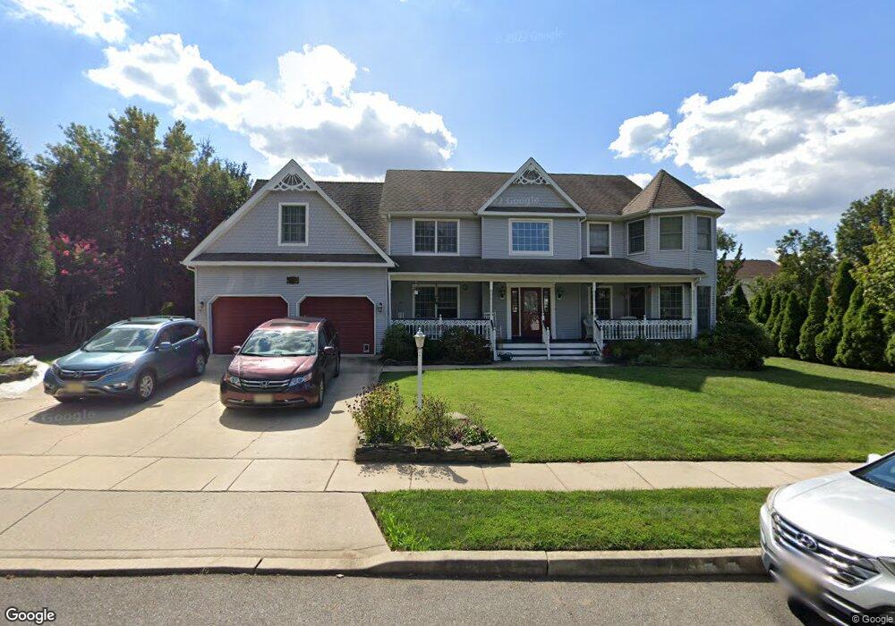
1207 Royal Ln West Deptford, NJ 08086
West Deptford Township NeighborhoodEstimated Value: $621,383 - $690,000
--
Bed
--
Bath
3,176
Sq Ft
$205/Sq Ft
Est. Value
About This Home
This home is located at 1207 Royal Ln, West Deptford, NJ 08086 and is currently estimated at $651,596, approximately $205 per square foot. 1207 Royal Ln is a home located in Gloucester County with nearby schools including Green-Fields Elementary School, Oakview Elementary School, and Red Bank Elementary School.
Ownership History
Date
Name
Owned For
Owner Type
Purchase Details
Closed on
May 31, 2001
Sold by
Kernan Audriann
Bought by
Cargill Robert S and Cargill Kathryn Lav
Current Estimated Value
Home Financials for this Owner
Home Financials are based on the most recent Mortgage that was taken out on this home.
Original Mortgage
$239,200
Outstanding Balance
$90,783
Interest Rate
7.09%
Estimated Equity
$560,813
Purchase Details
Closed on
May 3, 2001
Sold by
Kernan J Timothy
Bought by
Kernan Audriann
Home Financials for this Owner
Home Financials are based on the most recent Mortgage that was taken out on this home.
Original Mortgage
$239,200
Outstanding Balance
$90,783
Interest Rate
7.09%
Estimated Equity
$560,813
Purchase Details
Closed on
Apr 22, 1999
Sold by
Laverty Mary S and Laverty Edward M
Bought by
Kernan J Timothy and Kernan Audriann
Home Financials for this Owner
Home Financials are based on the most recent Mortgage that was taken out on this home.
Original Mortgage
$234,000
Interest Rate
7.02%
Create a Home Valuation Report for This Property
The Home Valuation Report is an in-depth analysis detailing your home's value as well as a comparison with similar homes in the area
Home Values in the Area
Average Home Value in this Area
Purchase History
| Date | Buyer | Sale Price | Title Company |
|---|---|---|---|
| Cargill Robert S | $299,000 | -- | |
| Kernan Audriann | -- | -- | |
| Kernan J Timothy | $260,000 | Congress Title Corp |
Source: Public Records
Mortgage History
| Date | Status | Borrower | Loan Amount |
|---|---|---|---|
| Open | Cargill Robert S | $239,200 | |
| Previous Owner | Kernan J Timothy | $234,000 |
Source: Public Records
Tax History Compared to Growth
Tax History
| Year | Tax Paid | Tax Assessment Tax Assessment Total Assessment is a certain percentage of the fair market value that is determined by local assessors to be the total taxable value of land and additions on the property. | Land | Improvement |
|---|---|---|---|---|
| 2025 | $13,112 | $375,500 | $69,400 | $306,100 |
| 2024 | $12,943 | $375,500 | $69,400 | $306,100 |
| 2023 | $12,943 | $375,500 | $69,400 | $306,100 |
| 2022 | $12,883 | $375,500 | $69,400 | $306,100 |
| 2021 | $12,838 | $375,500 | $69,400 | $306,100 |
| 2020 | $12,808 | $375,500 | $69,400 | $306,100 |
| 2019 | $12,452 | $375,500 | $69,400 | $306,100 |
| 2018 | $12,114 | $375,500 | $69,400 | $306,100 |
| 2017 | $11,832 | $375,500 | $69,400 | $306,100 |
| 2016 | $11,502 | $375,500 | $69,400 | $306,100 |
| 2015 | $11,246 | $385,400 | $69,400 | $316,000 |
| 2014 | $10,687 | $385,400 | $69,400 | $316,000 |
Source: Public Records
Map
Nearby Homes
- 1220 Royal Ln
- 87 Woodway Dr Unit 87
- 1102 Barnesdale Rd
- 12 Highbridge Ln Unit I2
- 125 Lionheart Ln Unit C125
- 863 Doncaster Dr
- 1012 Moore Rd Unit 6
- 1066 Buckingham Dr
- 1091 Buckingham Dr Unit 45
- 640 Worcester Dr
- 4 Saint Emilion Ct
- 51 Holly Dr
- 1311 Barnesdale Rd
- 10 Meadow Ln
- 740 Carter Hill Dr
- 1810 Fernwood Dr
- 0 Greenwood & Shivers Ave
- 8 Clark Dr
- 6 Cypress Cir
- 94 Aviary Rd
- 1208 Plantation Dr
- 1209 Royal Ln
- 1205 Royal Ln
- 1210 Plantation Dr
- 1206 Plantation Dr
- 1208 Royal Ln
- 1211 Royal Ln
- 1203 Royal Ln
- 1212 Plantation Dr
- 1204 Plantation Dr
- 1204 Parkland Commons
- 1207 Plantation Dr
- 1201 Parkland Commons
- 1201 Parkland Commons
- 1205 Plantation Dr
- 1209 Plantation Dr
- 1213 Royal Ln
- 1214 Plantation Dr
- 1201 Royal Ln
- 1202 Plantation Dr