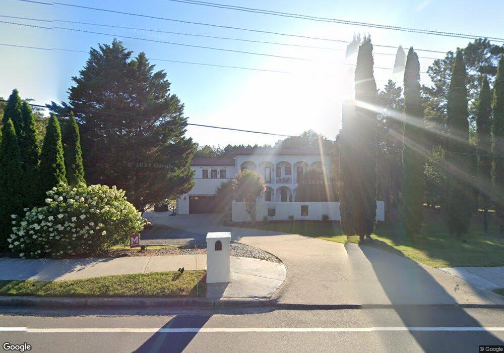
12070 King Rd Roswell, GA 30075
Estimated Value: $1,083,000 - $1,198,000
4
Beds
5
Baths
4,371
Sq Ft
$263/Sq Ft
Est. Value
About This Home
This home is located at 12070 King Rd, Roswell, GA 30075 and is currently estimated at $1,148,461, approximately $262 per square foot. 12070 King Rd is a home located in Fulton County with nearby schools including Mountain Park Elementary School, Crabapple Middle School, and Fellowship Christian School.
Ownership History
Date
Name
Owned For
Owner Type
Purchase Details
Closed on
Feb 22, 2010
Sold by
Jsd Properties Llc
Bought by
White Phillip J and Vossough Samira
Current Estimated Value
Home Financials for this Owner
Home Financials are based on the most recent Mortgage that was taken out on this home.
Original Mortgage
$387,000
Outstanding Balance
$255,359
Interest Rate
4.97%
Mortgage Type
New Conventional
Estimated Equity
$893,102
Purchase Details
Closed on
Sep 30, 2009
Sold by
Morgan Stanley Cr Corp
Bought by
Jsd Properties Llc
Home Financials for this Owner
Home Financials are based on the most recent Mortgage that was taken out on this home.
Original Mortgage
$282,020
Interest Rate
5.05%
Purchase Details
Closed on
Jul 7, 2009
Sold by
Gerasimenko Oksana Y
Bought by
Morgan Stanley Cr Corp
Create a Home Valuation Report for This Property
The Home Valuation Report is an in-depth analysis detailing your home's value as well as a comparison with similar homes in the area
Home Values in the Area
Average Home Value in this Area
Purchase History
| Date | Buyer | Sale Price | Title Company |
|---|---|---|---|
| White Phillip J | $430,000 | -- | |
| Jsd Properties Llc | $252,000 | -- | |
| Morgan Stanley Cr Corp | $386,829 | -- |
Source: Public Records
Mortgage History
| Date | Status | Borrower | Loan Amount |
|---|---|---|---|
| Open | White Phillip J | $387,000 | |
| Previous Owner | Jsd Properties Llc | $282,020 |
Source: Public Records
Tax History Compared to Growth
Tax History
| Year | Tax Paid | Tax Assessment Tax Assessment Total Assessment is a certain percentage of the fair market value that is determined by local assessors to be the total taxable value of land and additions on the property. | Land | Improvement |
|---|---|---|---|---|
| 2025 | $1,459 | $489,120 | $55,640 | $433,480 |
| 2023 | $10,596 | $375,400 | $49,440 | $325,960 |
| 2022 | $6,017 | $301,680 | $48,040 | $253,640 |
| 2021 | $7,126 | $257,160 | $41,720 | $215,440 |
| 2020 | $7,228 | $247,600 | $60,920 | $186,680 |
| 2019 | $1,154 | $260,840 | $52,120 | $208,720 |
| 2018 | $6,393 | $254,720 | $50,880 | $203,840 |
| 2017 | $5,960 | $221,960 | $30,640 | $191,320 |
| 2016 | $5,931 | $221,960 | $30,640 | $191,320 |
| 2015 | $7,163 | $221,960 | $30,640 | $191,320 |
| 2014 | $5,346 | $187,160 | $26,680 | $160,480 |
Source: Public Records
Map
Nearby Homes
- 680 Brookfield Pkwy Unit 1
- 125 Fortuna Ct
- 870 Hickory Oak Hollow
- 515 Kent Rd
- 570 Wheatridge Bluff
- 865 Ferncroft Ct
- 105 Kensington Pond Ct
- 11850 Chaffin Rd
- 1005 Hedgerose Ln
- 345 Chaffin Ridge Ct
- 12620 Old Surrey Place
- 120 Cedarwood Ln
- 140 Cedarwood Ln
- 130 Cedarwood Ln
- 160 Cedarwood Ln
- 2512 Waters Edge Trail Unit 2512
- 5210 Davenport Place
- 3412 Waters Edge Trail
- 180 Cedarwood Ln
- 150 Cedarwood Ln
- 12080 King Rd
- 12060 King Rd
- 0 King Rd Unit 7476325
- 0 King Rd Unit 7434259
- 0 King Rd Unit 8792467
- 0 King Rd Unit 8638299
- 0 King Rd Unit 8297396
- 0 King Rd Unit 8218649
- 0 King Rd Unit 8005265
- 0 King Rd Unit 7302691
- 0 King Rd Unit 8577715
- 0 King Rd Unit 7290286
- 0 King Rd Unit 7178839
- 0 King Rd Unit 8056906
- 0 King Rd Unit 3104464
- 0 King Rd Unit 7494765
- 0 King Rd Unit 7331183
- 0 King Rd Unit 7307088
- 0 King Rd Unit 3261013
- 0 King Rd Unit 3121973