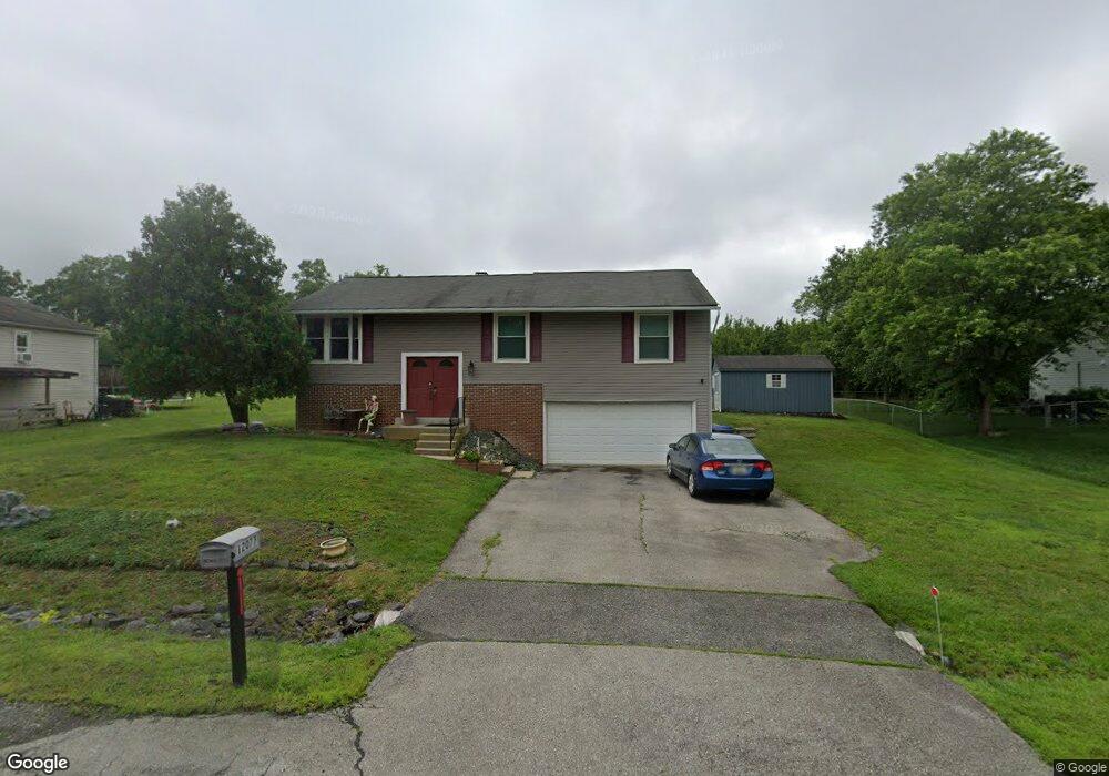
12077 Pierce Rd Waldorf, MD 20601
Estimated Value: $389,000 - $429,000
--
Bed
3
Baths
1,144
Sq Ft
$353/Sq Ft
Est. Value
About This Home
This home is located at 12077 Pierce Rd, Waldorf, MD 20601 and is currently estimated at $404,332, approximately $353 per square foot. 12077 Pierce Rd is a home located in Charles County with nearby schools including C. Paul Barnhart Elementary School, Mattawoman Middle School, and Thomas Stone High School.
Ownership History
Date
Name
Owned For
Owner Type
Purchase Details
Closed on
May 2, 2002
Sold by
Fenner Mary A
Bought by
Labrie Russell J and Labrie Marianna
Current Estimated Value
Purchase Details
Closed on
Mar 4, 1985
Sold by
Coleman Glen R
Bought by
Fenner Mary A
Purchase Details
Closed on
Mar 22, 1982
Sold by
Munoz Gabriel C and Munoz Josefa R
Bought by
Coleman Glen R
Home Financials for this Owner
Home Financials are based on the most recent Mortgage that was taken out on this home.
Original Mortgage
$6,000
Interest Rate
17.12%
Create a Home Valuation Report for This Property
The Home Valuation Report is an in-depth analysis detailing your home's value as well as a comparison with similar homes in the area
Home Values in the Area
Average Home Value in this Area
Purchase History
| Date | Buyer | Sale Price | Title Company |
|---|---|---|---|
| Labrie Russell J | $177,000 | -- | |
| Fenner Mary A | $82,000 | -- | |
| Coleman Glen R | $73,000 | -- |
Source: Public Records
Mortgage History
| Date | Status | Borrower | Loan Amount |
|---|---|---|---|
| Previous Owner | Coleman Glen R | $6,000 |
Source: Public Records
Tax History Compared to Growth
Tax History
| Year | Tax Paid | Tax Assessment Tax Assessment Total Assessment is a certain percentage of the fair market value that is determined by local assessors to be the total taxable value of land and additions on the property. | Land | Improvement |
|---|---|---|---|---|
| 2025 | $9,258 | $297,567 | -- | -- |
| 2024 | $4,020 | $280,800 | $126,700 | $154,100 |
| 2023 | $3,834 | $268,300 | $0 | $0 |
| 2022 | $3,636 | $255,800 | $0 | $0 |
| 2021 | $3,281 | $243,300 | $96,700 | $146,600 |
| 2020 | $3,281 | $232,200 | $0 | $0 |
| 2019 | $3,118 | $221,100 | $0 | $0 |
| 2018 | $2,932 | $210,000 | $90,700 | $119,300 |
| 2017 | $2,925 | $210,000 | $0 | $0 |
| 2016 | -- | $210,000 | $0 | $0 |
| 2015 | $2,828 | $211,000 | $0 | $0 |
| 2014 | $2,828 | $211,000 | $0 | $0 |
Source: Public Records
Map
Nearby Homes
- 12061 Pierce Rd
- 12276 Wendy Ln
- 12288 Wendy Ln
- 12113 Farrar Place
- 2002 English Oak Ct
- 2204 Holly Oak Ct
- 2031 Tanglewood Dr
- 2073 Tanglewood Dr
- 11748 Torcello Ct
- 2545 Enterprise Place
- 11565 Timberbrook Dr
- 2704 Tred Avon Ct
- HAYDEN Plan at Acton Park
- 2522 Regal Place
- 2712 Tred Avon Ct
- 12820 Twin Oak Dr
- 12720 Bar Oak Dr
- 16659 Green Glade Dr
- 16655 Green Glade Dr
- 12606 Sub Station Rd
- 12081 Pierce Rd
- 12073 Pierce Rd
- 12085 Pierce Rd
- 12069 Pierce Rd
- 12078 Pierce Rd
- 2315 Uncle Willies Place
- 12074 Pierce Rd
- 12084 Pierce Rd
- 12070 Pierce Rd
- 12065 Pierce Rd
- 2246 Delight Ct
- 2375 Uncle Willies Place
- 12066 Pierce Rd
- 2247 Delight Ct
- 12217 Wendy Ln
- 2305 Uncle Willies Place
- 2242 Delight Ct
- 12213 Wendy Ln
- 12062 Pierce Rd
- 12141 Mustard Seed Ct