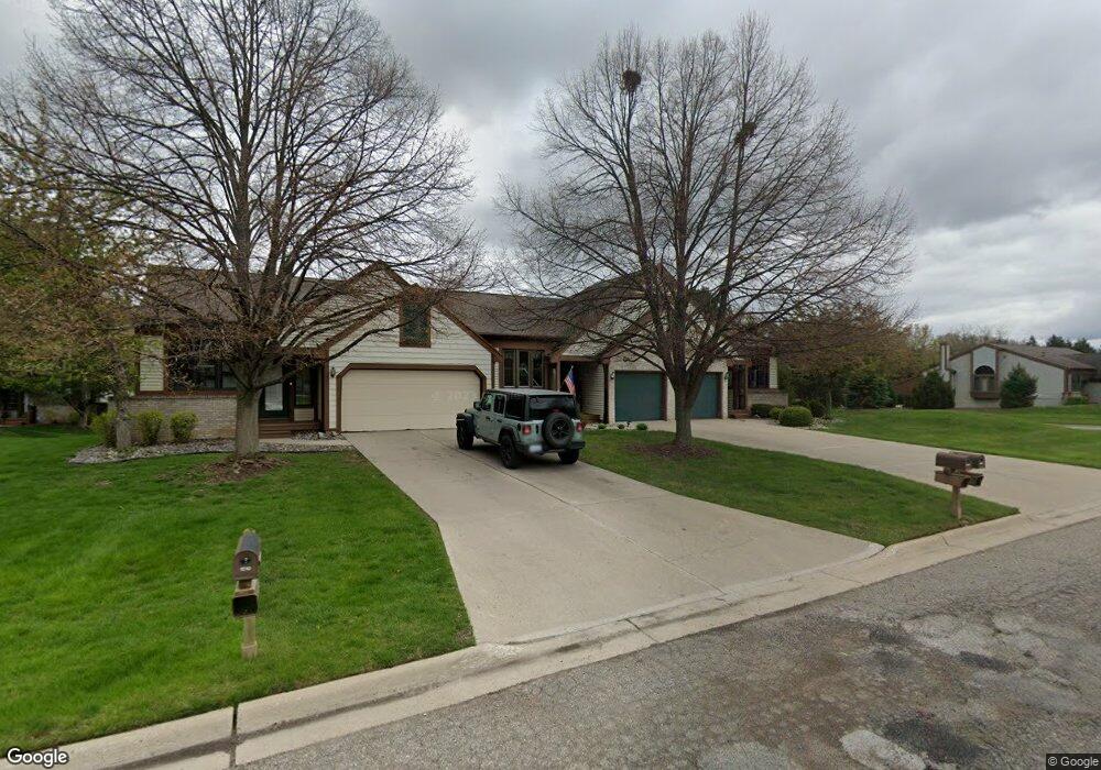
1208 Brookside Dr Unit 67 Lansing, MI 48917
Estimated Value: $233,013 - $244,000
1
Bed
2
Baths
981
Sq Ft
$243/Sq Ft
Est. Value
About This Home
This home is located at 1208 Brookside Dr Unit 67, Lansing, MI 48917 and is currently estimated at $238,503, approximately $243 per square foot. 1208 Brookside Dr Unit 67 is a home located in Eaton County with nearby schools including Willow Ridge Elementary School, Leon W. Hayes Middle School, and Grand Ledge High School.
Ownership History
Date
Name
Owned For
Owner Type
Purchase Details
Closed on
Dec 30, 2024
Sold by
Beach Marilyn Ann
Bought by
Beach Marilyn Ann and Living Trust
Current Estimated Value
Purchase Details
Closed on
Aug 19, 2019
Sold by
Bowman Trent C
Bought by
Beach Marilyn Ann and Jerry Robert Beach & Marilyn Ann Beach R
Purchase Details
Closed on
Jun 19, 2014
Sold by
Wells Fargo Financial America Inc
Bought by
Bowman Trent C
Home Financials for this Owner
Home Financials are based on the most recent Mortgage that was taken out on this home.
Original Mortgage
$73,600
Interest Rate
4.11%
Mortgage Type
New Conventional
Purchase Details
Closed on
Nov 8, 2013
Sold by
Kavanaugh Maureen G
Bought by
Wells Fargo Financial America Inc
Create a Home Valuation Report for This Property
The Home Valuation Report is an in-depth analysis detailing your home's value as well as a comparison with similar homes in the area
Home Values in the Area
Average Home Value in this Area
Purchase History
| Date | Buyer | Sale Price | Title Company |
|---|---|---|---|
| Beach Marilyn Ann | -- | None Listed On Document | |
| Beach Marilyn Ann | -- | None Listed On Document | |
| Beach Marilyn Ann | -- | None Listed On Document | |
| Beach Marilyn Ann | $163,000 | None Available | |
| Bowman Trent C | $92,000 | Change Of Title Inc | |
| Wells Fargo Financial America Inc | $136,999 | Dataquick Title |
Source: Public Records
Mortgage History
| Date | Status | Borrower | Loan Amount |
|---|---|---|---|
| Previous Owner | Bowman Trent C | $73,600 |
Source: Public Records
Tax History
| Year | Tax Paid | Tax Assessment Tax Assessment Total Assessment is a certain percentage of the fair market value that is determined by local assessors to be the total taxable value of land and additions on the property. | Land | Improvement |
|---|---|---|---|---|
| 2025 | $3,382 | $100,200 | $0 | $0 |
| 2024 | $3,151 | $91,500 | $0 | $0 |
| 2023 | $1,598 | $85,600 | $0 | $0 |
| 2022 | $2,853 | $81,100 | $0 | $0 |
| 2021 | $2,723 | $75,400 | $0 | $0 |
| 2020 | $2,686 | $71,700 | $0 | $0 |
| 2019 | $2,104 | $64,798 | $0 | $0 |
| 2018 | $1,974 | $61,300 | $0 | $0 |
| 2017 | $1,929 | $57,300 | $0 | $0 |
| 2016 | -- | $53,700 | $0 | $0 |
| 2015 | -- | $52,500 | $0 | $0 |
| 2014 | -- | $46,024 | $0 | $0 |
| 2013 | -- | $45,300 | $0 | $0 |
Source: Public Records
Map
Nearby Homes
- 6542 Brook Trail
- 1026 Brookside Dr
- 6527 Brook Trail Unit 18
- 6525 Brook Trail Unit 17
- 6528 Brook Trail Unit 21
- 1156 Wolf Run Dr
- 1205 Woodmeadow Unit 201
- 1527 Lindy Dr
- 1106 S Ridge Rd
- 6142 W Saginaw Hwy
- 7234 Farm Hill Dr Unit 36
- 1738 Willow Creek Dr Unit 63
- 6102 Bradford Ln
- 6403 Willow Bend Dr
- 1510 Sand Point Dr
- 2120 Walmar Dr
- 1410 Westport Dr
- 7315 Chellmar Dr Unit 49
- 7225 Creekside Dr Unit 37
- 0 Lot B Willow
- 1208 Brookside Dr
- 1206 Brookside Dr Unit 66
- 1210 Brookside Dr
- 1210 Brookside Dr Unit 68
- 1214 Brookside Dr Unit 69
- 1216 Brookside Dr Unit 70
- 1207 Brookside Dr
- 1209 Brookside Dr Unit 87
- 1205 Brookside Dr Unit 85
- 1211 Brookside Dr Unit 88
- 1118 Brookside Dr
- 1220 Brookside Dr
- 1220 Brookside Dr Unit 71
- 1221 Brookside Dr
- 1116 Brookside Dr
- 1222 Brookside Dr
- 1223 Brookside Dr Unit 90
- 1225 Brookside Dr
- 1201 Brook Trail
Your Personal Tour Guide
Ask me questions while you tour the home.