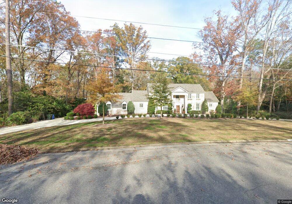
1208 Brookside Dr NW Wilson, NC 27896
Estimated Value: $519,000 - $928,675
4
Beds
6
Baths
3,655
Sq Ft
$191/Sq Ft
Est. Value
About This Home
This home is located at 1208 Brookside Dr NW, Wilson, NC 27896 and is currently estimated at $699,419, approximately $191 per square foot. 1208 Brookside Dr NW is a home located in Wilson County with nearby schools including James Hunt High School, Vinson-Bynum Elementary School, and Forest Hills Middle School.
Ownership History
Date
Name
Owned For
Owner Type
Purchase Details
Closed on
Jul 25, 2006
Sold by
Smith Geraldine M and Orcutt Pamela S
Bought by
Fulford Ted A and Fulford Suzette M
Current Estimated Value
Home Financials for this Owner
Home Financials are based on the most recent Mortgage that was taken out on this home.
Original Mortgage
$150,000
Outstanding Balance
$88,014
Interest Rate
6.44%
Mortgage Type
Adjustable Rate Mortgage/ARM
Estimated Equity
$611,405
Create a Home Valuation Report for This Property
The Home Valuation Report is an in-depth analysis detailing your home's value as well as a comparison with similar homes in the area
Home Values in the Area
Average Home Value in this Area
Purchase History
We collect this data history from publicly available records. To have your information removed, we recommend requesting removal directly through your county’s website.
| Date | Buyer | Sale Price | Title Company |
|---|---|---|---|
| Fulford Ted A | $255,000 | -- |
Source: Public Records
Mortgage History
We collect this data history from publicly available records. To have your information removed, we recommend requesting removal directly through your county’s website.
| Date | Status | Borrower | Loan Amount |
|---|---|---|---|
| Open | Fulford Ted A | $150,000 |
Source: Public Records
Tax History
| Year | Tax Paid | Tax Assessment Tax Assessment Total Assessment is a certain percentage of the fair market value that is determined by local assessors to be the total taxable value of land and additions on the property. | Land | Improvement |
|---|---|---|---|---|
| 2025 | $2,642 | $444,015 | $90,000 | $354,015 |
| 2024 | $2,642 | $444,015 | $90,000 | $354,015 |
| 2023 | $3,663 | $280,692 | $90,000 | $190,692 |
| 2022 | $0 | $280,692 | $90,000 | $190,692 |
| 2021 | $3,663 | $280,692 | $90,000 | $190,692 |
| 2020 | $3,663 | $280,692 | $90,000 | $190,692 |
| 2019 | $3,451 | $280,692 | $90,000 | $190,692 |
| 2018 | $0 | $280,692 | $90,000 | $190,692 |
| 2017 | $3,607 | $280,692 | $90,000 | $190,692 |
| 2016 | $3,607 | $280,692 | $90,000 | $190,692 |
| 2014 | $3,185 | $255,863 | $75,000 | $180,863 |
Source: Public Records
Map
Nearby Homes
- 1701 Westbrook Dr NW
- 1702 Chamberlain Dr NW
- 1709 Westbrook Dr NW
- 1808 Wildwood Ct NW
- 1711 Waterford Dr NW
- 1112 Lakeside Dr NW
- 1110 Lakeside Dr NW
- 1800 Westbrook Dr NW
- 2204 Darien Place NW
- 1015 Cardinal Dr NW
- 1109 Robin Hill Rd NW
- 2509 Ward Blvd
- 909 Parkside Dr NW
- 902 Rollingwood Dr NW
- 1001 Brookside Dr NW
- 1109 Treemont Rd NW
- 1402 Cherry Ln NW
- 0 Forest Hills Rd NW
- 502 Lafayette Dr NW
- 1814 Hermitage Rd NW
- 1210 Brookside Dr NW
- 1202 Brookside Dr NW
- 903 Cardinal Dr NW
- 1212 Brookside Dr NW
- 1205 Brookside Dr NW
- 905 Cardinal Dr NW
- 1203 Brookside Dr NW
- 1207 Brookside Dr NW
- 901 Cardinal Dr NW
- 907 Cardinal Dr NW
- 823 Cardinal Dr NW
- 1201 Brookside Dr NW
- 1200 Brookside Dr NW
- 1209 Brookside Dr NW
- 911 Cardinal Dr NW
- 1214 Brookside Dr NW
- 1202 Windemere Place NW
- 1121 Windemere Dr NW
- 913 Cardinal Dr NW
- 1213 Brookside Dr NW
Your Personal Tour Guide
Ask me questions while you tour the home.