C
Seller's Agent in 2025
Comp02 MLSOK
MLSOK Comparables Only
18 Total Sales

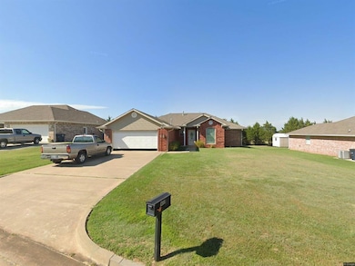
Property sold off market
| Date | Type | Sale Price | Title Company |
|---|---|---|---|
| Warranty Deed | $205,000 | Chicago Title | |
| Joint Tenancy Deed | $150,500 | None Available | |
| Warranty Deed | $138,000 | -- | |
| Warranty Deed | $91,500 | -- |
| Date | Status | Loan Amount | Loan Type |
|---|---|---|---|
| Previous Owner | $150,500 | Purchase Money Mortgage |
| Date | Event | Price | List to Sale | Price per Sq Ft |
|---|---|---|---|---|
| 10/30/2025 10/30/25 | Sold | $205,000 | 0.0% | $127 / Sq Ft |
| 10/29/2025 10/29/25 | Pending | -- | -- | -- |
| 10/20/2025 10/20/25 | For Sale | $205,000 | -- | $127 / Sq Ft |
| Year | Tax Paid | Tax Assessment Tax Assessment Total Assessment is a certain percentage of the fair market value that is determined by local assessors to be the total taxable value of land and additions on the property. | Land | Improvement |
|---|---|---|---|---|
| 2024 | $1,848 | $21,057 | $2,340 | $18,717 |
| 2023 | $1,848 | $20,444 | $2,340 | $18,104 |
| 2022 | $1,813 | $20,444 | $2,340 | $18,104 |
| 2021 | $1,829 | $20,444 | $2,340 | $18,104 |
| 2020 | $1,843 | $20,619 | $2,340 | $18,279 |
| 2019 | $1,880 | $20,795 | $2,340 | $18,455 |
| 2018 | $1,884 | $20,722 | $2,332 | $18,390 |
| 2017 | $1,812 | $20,119 | $2,123 | $17,996 |
| 2016 | $1,775 | $19,533 | $2,042 | $17,491 |
| 2015 | $1,519 | $18,964 | $1,995 | $16,969 |
| 2014 | $1,472 | $18,411 | $1,947 | $16,464 |
C
Seller's Agent in 2025
Comp02 MLSOK
MLSOK Comparables Only
18 Total Sales

Buyer's Agent in 2025
Nikki McCraw
West and Main Homes
(405) 201-4548
31 Total Sales
Source: MLSOK
MLS Number: 1198008
APN: 339500001004000000
Disclaimer: Certain information contained herein is derived from information provided by parties other than Homes.com. All information provided is deemed reliable, but is not guaranteed to be accurate and should be independently verified.
![]() IDX information is provided exclusively for personal, non-commercial use, and may not be used for any purpose other than to identify prospective properties consumers may be interested in purchasing.
IDX information is provided exclusively for personal, non-commercial use, and may not be used for any purpose other than to identify prospective properties consumers may be interested in purchasing.
Information is deemed reliable but not guaranteed.
This information is not verified for authenticity or accuracy, is not guaranteed and may not reflect all real estate activity in the market.
Copyright 2025 MLSOK, Inc. All rights reserved.