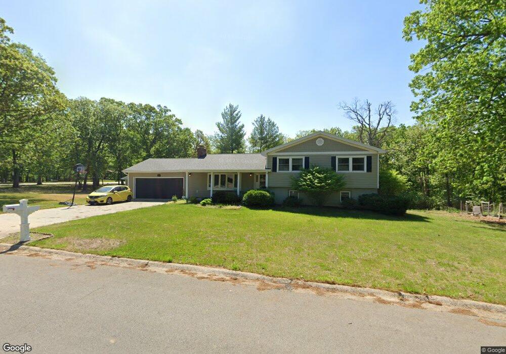
1208 Conestoga Trace Moberly, MO 65270
Estimated Value: $190,000 - $328,000
4
Beds
3
Baths
2,379
Sq Ft
$115/Sq Ft
Est. Value
About This Home
This home is located at 1208 Conestoga Trace, Moberly, MO 65270 and is currently estimated at $272,469, approximately $114 per square foot. 1208 Conestoga Trace is a home located in Randolph County with nearby schools including Moberly Senior High School, St. Pius X. Catholic School, and Maranatha Seventh-day Adventist School.
Ownership History
Date
Name
Owned For
Owner Type
Purchase Details
Closed on
Sep 28, 2020
Sold by
Carlson Isaac J and Carlson Christine A
Bought by
Johnson Claudia I and Carver Brandon J
Current Estimated Value
Home Financials for this Owner
Home Financials are based on the most recent Mortgage that was taken out on this home.
Original Mortgage
$187,000
Outstanding Balance
$166,327
Interest Rate
2.9%
Mortgage Type
New Conventional
Estimated Equity
$106,142
Purchase Details
Closed on
Jul 24, 2009
Sold by
Bouchard Sharon Kay and Forsyth Michael Davis
Bought by
Thomason Linda M and Thomason Billy
Home Financials for this Owner
Home Financials are based on the most recent Mortgage that was taken out on this home.
Original Mortgage
$178,000
Interest Rate
5.44%
Mortgage Type
Future Advance Clause Open End Mortgage
Purchase Details
Closed on
May 21, 2008
Sold by
Forsyth Jack and Forsyth Karen
Bought by
Bouchard Sharon Kay and Forsyth Michael Davis
Create a Home Valuation Report for This Property
The Home Valuation Report is an in-depth analysis detailing your home's value as well as a comparison with similar homes in the area
Home Values in the Area
Average Home Value in this Area
Purchase History
| Date | Buyer | Sale Price | Title Company |
|---|---|---|---|
| Johnson Claudia I | -- | None Available | |
| Thomason Linda M | -- | -- | |
| Bouchard Sharon Kay | -- | -- |
Source: Public Records
Mortgage History
| Date | Status | Borrower | Loan Amount |
|---|---|---|---|
| Open | Johnson Claudia I | $187,000 | |
| Previous Owner | Thomason Linda M | $178,000 |
Source: Public Records
Tax History Compared to Growth
Tax History
| Year | Tax Paid | Tax Assessment Tax Assessment Total Assessment is a certain percentage of the fair market value that is determined by local assessors to be the total taxable value of land and additions on the property. | Land | Improvement |
|---|---|---|---|---|
| 2025 | $2,532 | $38,360 | $7,210 | $31,150 |
| 2024 | $2,532 | $34,770 | $6,271 | $28,499 |
| 2023 | $2,571 | $34,770 | $6,271 | $28,499 |
| 2022 | $2,420 | $33,600 | $6,269 | $27,331 |
| 2021 | $2,410 | $33,600 | $6,269 | $27,331 |
| 2020 | $2,410 | $33,490 | $6,271 | $27,219 |
| 2019 | $2,405 | $33,490 | $6,271 | $27,219 |
| 2018 | $2,383 | $33,290 | $6,270 | $27,020 |
| 2017 | $2,370 | $33,170 | $0 | $0 |
| 2016 | $2,079 | $29,260 | $0 | $0 |
| 2014 | -- | $27,690 | $0 | $0 |
| 2013 | -- | $27,690 | $0 | $0 |
| 2012 | -- | $27,690 | $0 | $0 |
Source: Public Records
Map
Nearby Homes
- 1227 Conestoga Trace
- 713 Homestead Dr
- 1377 Conestoga Trace
- 4 Fair Oaks
- 432 W Longview St
- 417 W Longview St
- 411 Shumate Ave
- 708 Gilman St
- 817 Gilman St
- 1471 Trails End
- 608 Gilman St
- 602 Gilman St
- 1377 Conestoga Trail
- LOT 2 County Rd
- 1000 S Williams St
- 700 S 5th St
- 1216 Shepherds Dr
- 1365 Lantern Pointe Dr
- 407 Epperson St
- 641 Park Ave
- 800 Homestead Dr
- 1224 Conestoga Trace
- 750 Homestead Dr
- 801 Homestead Dr
- 1319 Heritage Place
- 830 Homestead Dr
- 733 Homestead Dr
- 811 Homestead Dr
- 1240 Conestoga Trace
- 1325 Heritage Place
- 1237 Conestoga Trace
- 1302 Heritage Place
- 827 Homestead Dr
- 727 Homestead Dr
- 1318 Heritage Place
- 844 Homestead Dr
- 734 Homestead Dr
- 1331 Heritage Place
- 721 Homestead Dr
- 1350 Heritage Place