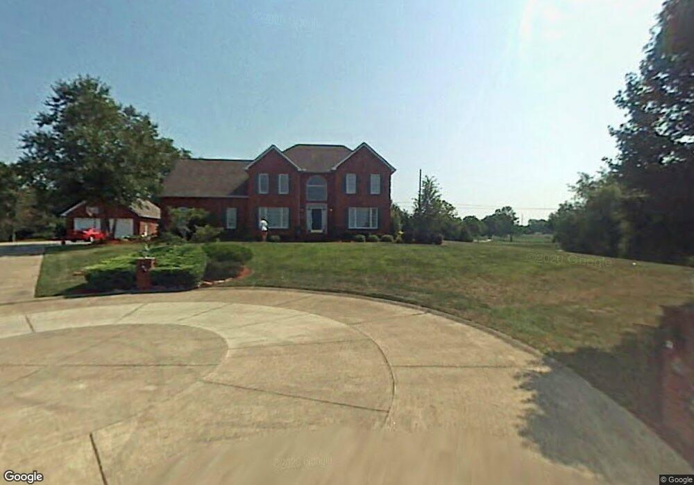
1208 Crown Point Dr Hurricane, WV 25526
Estimated Value: $464,000 - $509,000
5
Beds
4
Baths
3,865
Sq Ft
$127/Sq Ft
Est. Value
About This Home
This home is located at 1208 Crown Point Dr, Hurricane, WV 25526 and is currently estimated at $491,353, approximately $127 per square foot. 1208 Crown Point Dr is a home located in Putnam County with nearby schools including Calvary Baptist Academy.
Ownership History
Date
Name
Owned For
Owner Type
Purchase Details
Closed on
May 1, 2025
Sold by
Cline Mark S and Cline Nancy M
Bought by
Allen Timothy W and Allen Jodi E
Current Estimated Value
Home Financials for this Owner
Home Financials are based on the most recent Mortgage that was taken out on this home.
Original Mortgage
$445,500
Outstanding Balance
$443,913
Interest Rate
6.62%
Mortgage Type
Credit Line Revolving
Estimated Equity
$47,440
Create a Home Valuation Report for This Property
The Home Valuation Report is an in-depth analysis detailing your home's value as well as a comparison with similar homes in the area
Home Values in the Area
Average Home Value in this Area
Purchase History
| Date | Buyer | Sale Price | Title Company |
|---|---|---|---|
| Allen Timothy W | $495,000 | None Listed On Document | |
| Allen Timothy W | $495,000 | None Listed On Document |
Source: Public Records
Mortgage History
| Date | Status | Borrower | Loan Amount |
|---|---|---|---|
| Open | Allen Timothy W | $445,500 | |
| Closed | Allen Timothy W | $445,500 |
Source: Public Records
Tax History Compared to Growth
Tax History
| Year | Tax Paid | Tax Assessment Tax Assessment Total Assessment is a certain percentage of the fair market value that is determined by local assessors to be the total taxable value of land and additions on the property. | Land | Improvement |
|---|---|---|---|---|
| 2024 | $5,000 | $229,380 | $28,920 | $200,460 |
| 2023 | $4,127 | $211,800 | $20,640 | $191,160 |
| 2022 | $3,816 | $208,920 | $20,640 | $188,280 |
| 2021 | $4,038 | $222,420 | $20,640 | $201,780 |
| 2020 | $3,992 | $219,780 | $20,640 | $199,140 |
| 2019 | $4,020 | $212,040 | $24,780 | $187,260 |
| 2018 | $4,091 | $213,180 | $30,660 | $182,520 |
| 2017 | $3,922 | $211,200 | $21,720 | $189,480 |
| 2016 | $3,762 | $200,220 | $21,720 | $178,500 |
| 2015 | $3,878 | $183,480 | $26,580 | $156,900 |
| 2014 | $3,878 | $199,980 | $26,100 | $173,880 |
Source: Public Records
Map
Nearby Homes
- 312 Lower Overlook Dr
- 110 John St
- 106 Vista Ln
- 112 Mulberry Dr
- 120 Sterling Dr
- 12 Meadow Brook
- 12 Meadow Brook Cir
- 8 Ellis Dr
- 401 Parkview Dr
- 1 Royal Oak Ct
- 539 Edgewood Rd
- 601 Ridgemont Rd
- 3 S Brook Dr
- 3570 Teays Valley Rd
- 83 Gavin Ln
- 3715 Cambridge Dr
- 109 Caroline Cir
- 1051 Crestmont Rd
- 3806 Kathy Dr
- 4052 Farmington Dr
- 1206 Crown Point Dr
- 1207 Crown Point Dr
- 1021 Moss Creek Dr
- 1204 Crown Point Dr
- 1023 Moss Creek Dr
- 1019 Moss Creek Dr
- 1203 Crown Point Dr
- 1202 Crown Point Dr
- 1017 Moss Creek Dr
- 1025 Moss Creek Dr
- 1201 Crown Point Dr
- 1014 Moss Creek Dr
- 1016 Moss Creek Dr
- 1211 Forrest Dr
- 1015 Moss Creek Dr
- 1209 Forrest Dr
- 1201 Hickory Mills Dr
- 1202 Hickory Mills Dr
- 1207 Forrest Dr
- 1012 Moss Creek Dr