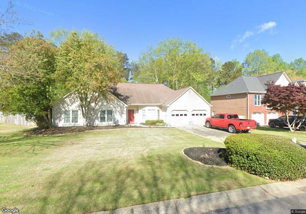
1208 Embassy Ct Unit 2 Powder Springs, GA 30127
West Cobb NeighborhoodEstimated Value: $410,000 - $496,000
3
Beds
3
Baths
2,004
Sq Ft
$227/Sq Ft
Est. Value
About This Home
This home is located at 1208 Embassy Ct Unit 2, Powder Springs, GA 30127 and is currently estimated at $455,612, approximately $227 per square foot. 1208 Embassy Ct Unit 2 is a home located in Cobb County with nearby schools including Kemp Elementary School, Lovinggood Middle School, and Hillgrove High School.
Ownership History
Date
Name
Owned For
Owner Type
Purchase Details
Closed on
Sep 5, 2002
Sold by
Hood Jack M and Hood Terry L
Bought by
Clark Remer Y
Current Estimated Value
Home Financials for this Owner
Home Financials are based on the most recent Mortgage that was taken out on this home.
Original Mortgage
$64,500
Interest Rate
6.4%
Mortgage Type
New Conventional
Purchase Details
Closed on
Jun 22, 1994
Sold by
Marvin Waldrip Realty
Bought by
Hood Terry L Jack M
Home Financials for this Owner
Home Financials are based on the most recent Mortgage that was taken out on this home.
Original Mortgage
$135,083
Interest Rate
8.5%
Mortgage Type
VA
Create a Home Valuation Report for This Property
The Home Valuation Report is an in-depth analysis detailing your home's value as well as a comparison with similar homes in the area
Home Values in the Area
Average Home Value in this Area
Purchase History
| Date | Buyer | Sale Price | Title Company |
|---|---|---|---|
| Clark Remer Y | $172,500 | -- | |
| Hood Terry L Jack M | $132,500 | -- |
Source: Public Records
Mortgage History
| Date | Status | Borrower | Loan Amount |
|---|---|---|---|
| Previous Owner | Clark Remer Y | $64,500 | |
| Previous Owner | Hood Terry L Jack M | $135,083 |
Source: Public Records
Tax History Compared to Growth
Tax History
| Year | Tax Paid | Tax Assessment Tax Assessment Total Assessment is a certain percentage of the fair market value that is determined by local assessors to be the total taxable value of land and additions on the property. | Land | Improvement |
|---|---|---|---|---|
| 2025 | $974 | $178,408 | $36,000 | $142,408 |
| 2024 | $912 | $156,400 | $16,000 | $140,400 |
| 2023 | $706 | $156,400 | $16,000 | $140,400 |
| 2022 | $851 | $135,952 | $12,800 | $123,152 |
| 2021 | $751 | $102,624 | $12,800 | $89,824 |
| 2020 | $751 | $102,624 | $12,800 | $89,824 |
| 2019 | $699 | $85,264 | $12,800 | $72,464 |
| 2018 | $699 | $85,264 | $12,800 | $72,464 |
| 2017 | $604 | $80,520 | $12,800 | $67,720 |
| 2016 | $1,709 | $70,112 | $14,400 | $55,712 |
| 2015 | $1,751 | $70,112 | $14,400 | $55,712 |
| 2014 | $1,467 | $58,224 | $0 | $0 |
Source: Public Records
Map
Nearby Homes
- 1072 Sweet Mia Ln
- 1073 Sweet Mia Ln
- 1079 Angel Ln
- 1077 Sweet Mia Ln
- 4408 Shiloh Trail
- 1150 Sweet Mia Ln
- 4562 Willow Oak Trail Unit 3
- 700 Broadlands Ln Unit 1
- 777 Chanson Dr SW
- 1175 Bowerie Chase
- 506 Balleycastle Point
- 4927 Red Cliff Ct
- 990 Casteel Rd
- 633 Wynnewood Ct SW
- 1200 Fenmore Hall Unit I
- 0 Lost Mountain Rd Unit 7653787
- 0 Lost Mountain Rd Unit 10610707
- 3840 McEachern Farm Dr
- 1210 Embassy Ct Unit 2
- 1206 Embassy Ct
- 1207 Embassy Ct Unit 2
- 1209 Embassy Ct Unit 2
- 1205 Embassy Ct
- 1212 Embassy Ct
- 1204 Embassy Ct
- 1203 Embassy Ct Unit 2
- 1214 Embassy Ct
- 1211 Embassy Ct
- 1202 Embassy Ct
- 0 Embassy Ct Unit 7456778
- 0 Embassy Ct Unit 7040799
- 0 Embassy Ct Unit 3190843
- 0 Embassy Ct Unit 8151058
- 0 Embassy Ct Unit 7625462
- 0 Embassy Ct
- 1201 Embassy Ct
- 4220 Honey Creek Way Unit 2
- 1200 Embassy Ct