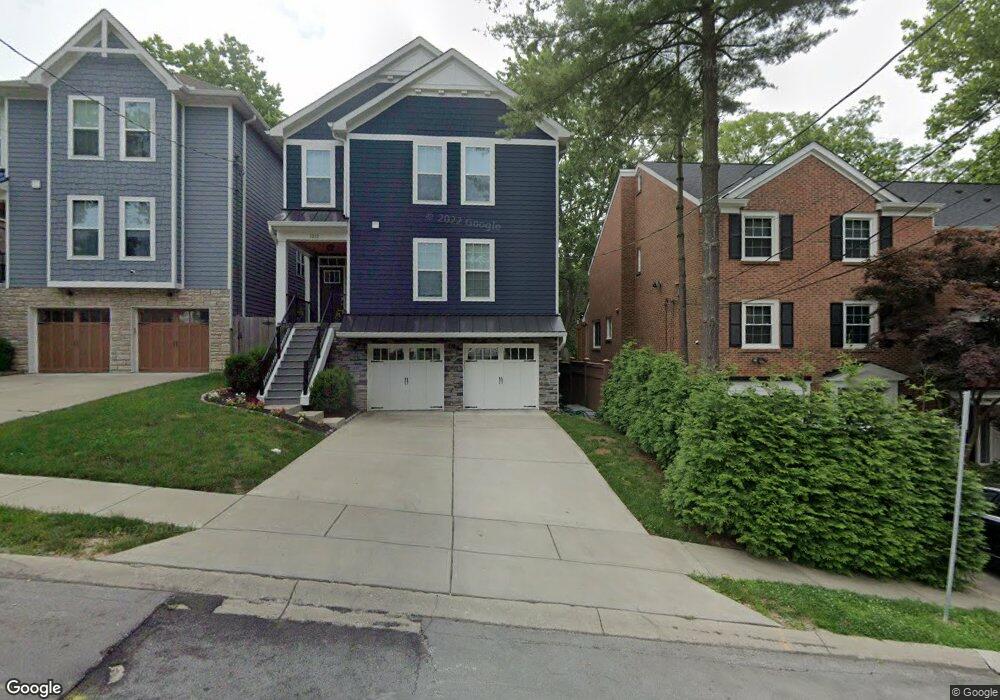
1208 Isis Ave Cincinnati, OH 45208
Mount Lookout NeighborhoodEstimated Value: $485,000 - $757,000
3
Beds
2
Baths
1,599
Sq Ft
$370/Sq Ft
Est. Value
About This Home
This home is located at 1208 Isis Ave, Cincinnati, OH 45208 and is currently estimated at $591,785, approximately $370 per square foot. 1208 Isis Ave is a home located in Hamilton County with nearby schools including Kilgour Elementary School, Clark Montessori High School, and Shroder High School.
Ownership History
Date
Name
Owned For
Owner Type
Purchase Details
Closed on
Aug 13, 2018
Sold by
Taylor Bruce C
Bought by
Taylor Bruce C and Bruce C Taylor Revocable Trust
Current Estimated Value
Purchase Details
Closed on
Mar 7, 1994
Sold by
Kucharski Corinne M
Bought by
Taylor Bruce Calvin
Home Financials for this Owner
Home Financials are based on the most recent Mortgage that was taken out on this home.
Original Mortgage
$195,300
Interest Rate
8.5%
Create a Home Valuation Report for This Property
The Home Valuation Report is an in-depth analysis detailing your home's value as well as a comparison with similar homes in the area
Home Values in the Area
Average Home Value in this Area
Purchase History
| Date | Buyer | Sale Price | Title Company |
|---|---|---|---|
| Taylor Bruce C | -- | None Available | |
| Taylor Bruce Calvin | -- | -- |
Source: Public Records
Mortgage History
| Date | Status | Borrower | Loan Amount |
|---|---|---|---|
| Previous Owner | Taylor Bruce Calvin | $195,300 |
Source: Public Records
Tax History
| Year | Tax Paid | Tax Assessment Tax Assessment Total Assessment is a certain percentage of the fair market value that is determined by local assessors to be the total taxable value of land and additions on the property. | Land | Improvement |
|---|---|---|---|---|
| 2025 | $8,653 | $140,655 | $45,913 | $94,742 |
| 2024 | $8,390 | $140,655 | $45,913 | $94,742 |
| 2023 | $8,579 | $140,655 | $45,913 | $94,742 |
| 2022 | $7,965 | $117,118 | $40,520 | $76,598 |
| 2021 | $7,668 | $117,118 | $40,520 | $76,598 |
| 2020 | $7,893 | $117,118 | $40,520 | $76,598 |
| 2019 | $7,413 | $100,101 | $34,633 | $65,468 |
| 2018 | $7,425 | $100,101 | $34,633 | $65,468 |
| 2017 | $8,090 | $114,920 | $34,633 | $80,287 |
| 2016 | $7,050 | $98,679 | $32,571 | $66,108 |
| 2015 | $6,359 | $98,679 | $32,571 | $66,108 |
| 2014 | $6,404 | $98,679 | $32,571 | $66,108 |
| 2013 | $5,872 | $88,900 | $29,344 | $59,556 |
Source: Public Records
Map
Nearby Homes
- 1225 Corbett St
- 1344 Delta Ave
- 1338 Suncrest Dr
- 1318 Hayward Ct
- 1231 Grace Ave
- 1346 Herlin Place
- 3300 Linwood Ave
- 3220 Linwood Ave
- 1352 Custer Ave
- 3110 Kinmont St
- 3008 Erie Ave
- 3007 Paxton Knoll Ln
- 3525 Herschel View Place
- 3255 Linwood Ave
- 3561 Bayard Dr
- 3065 Alpine Terrace
- 3439 Pape Ave
- 764 Delta Ave
- 3613 Herschel Ave
- 3605 Russell Ave
- 1212 Isis Ave
- 1206 Isis Ave
- 1209 Hidden Wood Place
- 1216 Isis Ave
- 1222 Isis Ave
- 1207 Hidden Wood Place
- 1232 Isis Ave
- 1211 Hidden Wood Place
- 1211 Isis Ave
- 1211 Isis Ave Unit 2
- 1207 Isis Ave
- 1207 Isis Ave Unit A
- 1207 Isis Ave Unit I
- 1207 Isis Ave Unit B
- 1 Isis Ave
- 1213 Hidden Wood Place
- 1235 Isis Ave
- 1205 Hidden Wood Place
- 1215 Isis Ave
- 1208 Hidden Wood Place
Your Personal Tour Guide
Ask me questions while you tour the home.