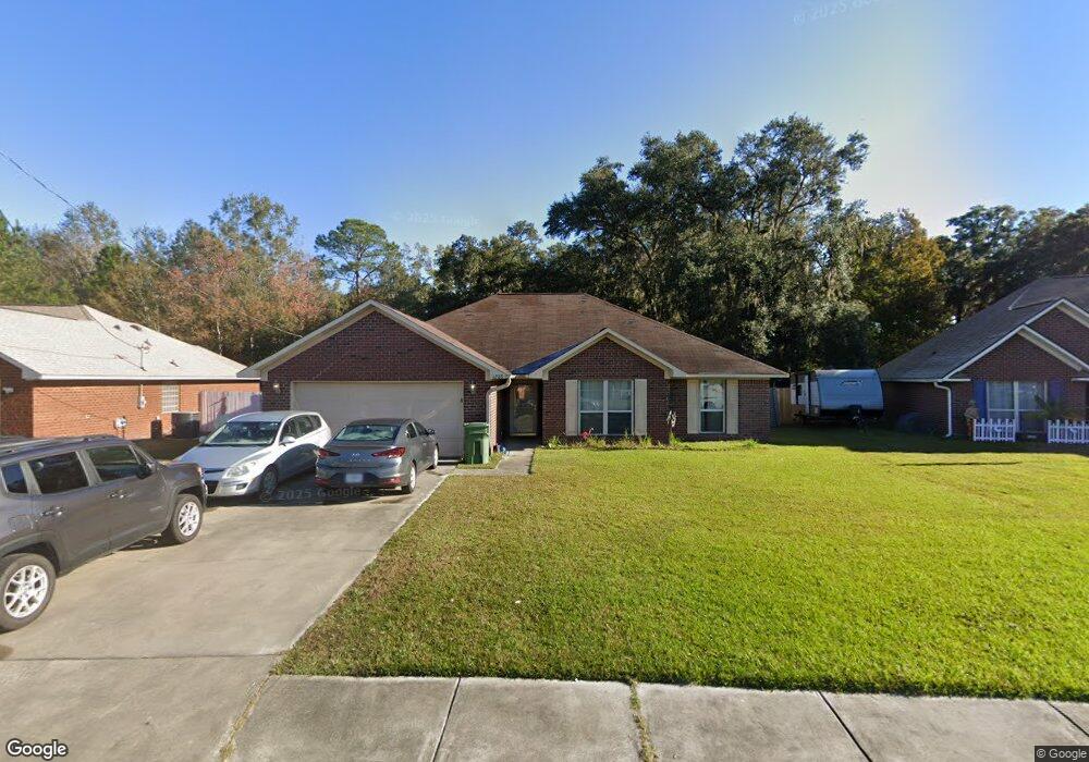
1208 Langston Ln Hinesville, GA 31313
Estimated Value: $222,000 - $262,000
3
Beds
2
Baths
1,931
Sq Ft
$126/Sq Ft
Est. Value
About This Home
This home is located at 1208 Langston Ln, Hinesville, GA 31313 and is currently estimated at $244,000, approximately $126 per square foot. 1208 Langston Ln is a home located in Liberty County with nearby schools including Waldo Pafford Elementary School, Snelson-Golden Middle School, and Bradwell Institute.
Ownership History
Date
Name
Owned For
Owner Type
Purchase Details
Closed on
Jan 16, 2019
Sold by
Bryant Anthony
Bought by
1015 Bacon Road Llc
Current Estimated Value
Purchase Details
Closed on
Jan 8, 2019
Sold by
Secretary Of Veteran Affairs
Bought by
Bryant Anthony
Purchase Details
Closed on
Jul 3, 2018
Sold by
Freedom Mtg Corp
Bought by
Secretary Of Veterans Affairs
Purchase Details
Closed on
Oct 21, 2005
Sold by
Dryden Enterprises Inc
Bought by
Swartz Robert Curtis
Home Financials for this Owner
Home Financials are based on the most recent Mortgage that was taken out on this home.
Original Mortgage
$156,597
Interest Rate
5.76%
Mortgage Type
VA
Create a Home Valuation Report for This Property
The Home Valuation Report is an in-depth analysis detailing your home's value as well as a comparison with similar homes in the area
Home Values in the Area
Average Home Value in this Area
Purchase History
| Date | Buyer | Sale Price | Title Company |
|---|---|---|---|
| 1015 Bacon Road Llc | $110,900 | -- | |
| Bryant Anthony | $110,900 | -- | |
| Secretary Of Veterans Affairs | $117,670 | -- | |
| Freedom Mtg Corp | $117,670 | -- | |
| Swartz Robert Curtis | $153,302 | -- |
Source: Public Records
Mortgage History
| Date | Status | Borrower | Loan Amount |
|---|---|---|---|
| Previous Owner | Swartz Robert Curtis | $156,597 |
Source: Public Records
Tax History Compared to Growth
Tax History
| Year | Tax Paid | Tax Assessment Tax Assessment Total Assessment is a certain percentage of the fair market value that is determined by local assessors to be the total taxable value of land and additions on the property. | Land | Improvement |
|---|---|---|---|---|
| 2024 | $3,947 | $80,390 | $11,059 | $69,331 |
| 2023 | $3,947 | $80,390 | $12,000 | $68,390 |
| 2022 | $2,071 | $44,360 | $6,276 | $38,084 |
| 2021 | $2,109 | $44,360 | $6,276 | $38,084 |
| 2020 | $1,812 | $50,394 | $7,200 | $43,194 |
| 2019 | $2,420 | $50,880 | $7,200 | $43,680 |
| 2018 | $2,451 | $55,695 | $7,200 | $48,495 |
| 2017 | $1,851 | $56,222 | $7,200 | $49,022 |
| 2016 | $2,387 | $56,749 | $7,200 | $49,549 |
| 2015 | $2,801 | $62,464 | $10,000 | $52,464 |
| 2014 | $2,801 | $65,306 | $10,000 | $55,306 |
| 2013 | -- | $68,185 | $10,000 | $58,185 |
Source: Public Records
Map
Nearby Homes
- 963 Yale Ct
- 1226 Langston Ln
- 1112 Cornett Ct
- 950 Elma G Miles Pkwy
- 951 Elma G Miles Pkwy
- 1.05 AC Elma G Miles Pkwy
- 823 Elma G Miles Pkwy
- 1.09 AC Elma G Miles Pkwy
- 14.96 Ac Ellie Ln
- .58 AC Elma G Miles Pkwy
- 144 Alcott Cir
- 0 Elma G Miles Pkwy Unit 324139
- 1072 Ricade Dr
- 970 Whippoorwill Way
- 114 Brasher Dr
- 1100 Pineland Ave Unit 2D
- 396 Alcott Cir
- 1103 Ricade Dr
- 1091 Kelly Dr
- 1106 Ricade Dr
- 1210 Langston Ln
- 1206 Langston Ln
- 1204 Langston Ln
- 1212 Langston Ln
- 1205 Langston Ln
- 1202 Langston Ln
- 1207 Langston Ln
- 1209 Langston Ln
- 1214 Langston Ln
- 51 Pond Dr
- 1203 Langston Ln
- 1201 Langston Ln
- 1211 Langston Ln
- 1216 Langston Ln
- 1200 Langston Ln
- 995 Live Oak Dr
- 1213 Langston Ln
- 1218 Langston Ln
- 1005 Canton Ct
- 916 Amanda Ln