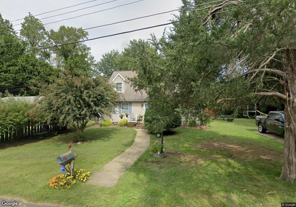
1208 Locust Ln Edgewater, MD 21037
Estimated Value: $490,973 - $637,000
Studio
2
Baths
1,692
Sq Ft
$337/Sq Ft
Est. Value
About This Home
This home is located at 1208 Locust Ln, Edgewater, MD 21037 and is currently estimated at $570,743, approximately $337 per square foot. 1208 Locust Ln is a home located in Anne Arundel County with nearby schools including Mayo Elementary School, Central Middle School, and South River High School.
Ownership History
Date
Name
Owned For
Owner Type
Purchase Details
Closed on
Jun 23, 2015
Sold by
Dibenedetto Jennifer and Perszanowski Jennifer
Bought by
Perzanowski Stephen J and Perzanowski Mary
Current Estimated Value
Home Financials for this Owner
Home Financials are based on the most recent Mortgage that was taken out on this home.
Original Mortgage
$125,000
Interest Rate
3.87%
Mortgage Type
New Conventional
Purchase Details
Closed on
Dec 17, 1997
Sold by
Perzanowski Anna
Bought by
Perzanowski Jennifer
Create a Home Valuation Report for This Property
The Home Valuation Report is an in-depth analysis detailing your home's value as well as a comparison with similar homes in the area
Home Values in the Area
Average Home Value in this Area
Purchase History
| Date | Buyer | Sale Price | Title Company |
|---|---|---|---|
| Perzanowski Stephen J | $250,000 | Eagle Title Llc | |
| Perzanowski Jennifer | -- | -- |
Source: Public Records
Mortgage History
| Date | Status | Borrower | Loan Amount |
|---|---|---|---|
| Closed | Perzanowski Stephen J | $125,000 |
Source: Public Records
Tax History
| Year | Tax Paid | Tax Assessment Tax Assessment Total Assessment is a certain percentage of the fair market value that is determined by local assessors to be the total taxable value of land and additions on the property. | Land | Improvement |
|---|---|---|---|---|
| 2025 | $4,569 | $387,633 | -- | -- |
| 2024 | $4,569 | $371,367 | $0 | $0 |
| 2023 | $4,351 | $355,100 | $206,200 | $148,900 |
| 2022 | $4,112 | $352,300 | $0 | $0 |
| 2020 | $1,846 | $346,700 | $206,200 | $140,500 |
| 2019 | $1,217 | $330,033 | $0 | $0 |
| 2018 | $3,178 | $313,367 | $0 | $0 |
| 2017 | $3,406 | $296,700 | $0 | $0 |
| 2016 | -- | $282,967 | $0 | $0 |
| 2015 | -- | $269,233 | $0 | $0 |
| 2014 | -- | $255,500 | $0 | $0 |
Source: Public Records
Map
Nearby Homes
- 1443 Rehling Dr
- 3725 Ramsey Dr
- 3727 Ramsey Dr
- 3744 Parke Dr
- 1403 (Lot 70) Old Ct
- Lot 71 Old Ct
- 1407 (Lot 72) Old Ct
- 4005 Dark Horse Way
- 1110 Murray Dr
- 3728 Bay Dr
- 1218 Pine Ave
- 4119 Waterview Dr
- 1546 Ridgely Dr
- 1138 Mayo Rd
- 1533 Wakefield Rd
- 1055 Old Turkey Point Rd
- 0 Mayo Rd Unit MDAA2113152
- 0 Old Turkey Point Rd
- 3736 Beach Drive Blvd
- 3718 4th Ave
- 1206 Locust Ln
- 1204 Locust Ln
- 4010 Honeysuckle Dr
- 1207 Locust Ln
- 1205 Locust Ln
- 3910 Shoreham Beach Rd
- 3920 Shoreham Beach Rd
- 1200 Locust Ln
- 1201 Locust Ln
- 1391 Nancy St
- 1214 Cedar Ln
- 1216 Cedar Ln
- 1212 Cedar Ln
- 1218 Cedar Ln
- 1409 Rehling Dr
- 1408 Rehling Dr
- 4020 Honeysuckle Dr
- 1210 Cedar Ln
- 4014 Ramsey Dr
- 3924 Shoreham Beach Rd
Your Personal Tour Guide
Ask me questions while you tour the home.