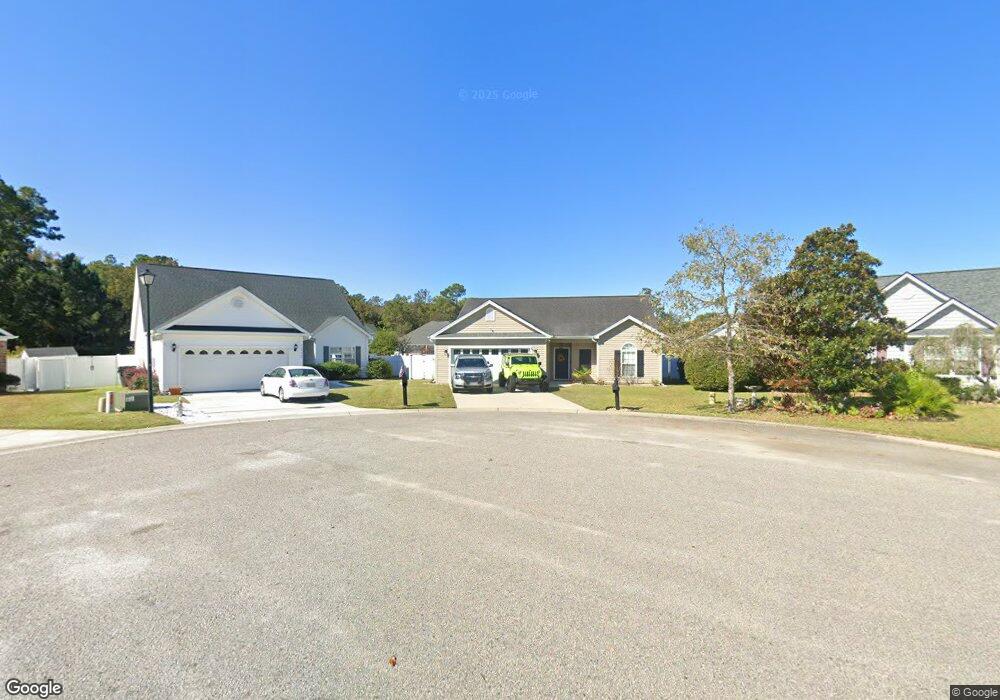
1208 Peyton Ct Unit LAWSONS LANDING Myrtle Beach, SC 29588
Estimated Value: $295,000 - $338,000
3
Beds
2
Baths
1,989
Sq Ft
$159/Sq Ft
Est. Value
About This Home
This home is located at 1208 Peyton Ct Unit LAWSONS LANDING, Myrtle Beach, SC 29588 and is currently estimated at $316,809, approximately $159 per square foot. 1208 Peyton Ct Unit LAWSONS LANDING is a home located in Horry County with nearby schools including Socastee Elementary School, Forestbrook Middle School, and Socastee High School.
Ownership History
Date
Name
Owned For
Owner Type
Purchase Details
Closed on
May 31, 2016
Sold by
Allen Andrew B
Bought by
Hans Aaron M and Hans Kelly K
Current Estimated Value
Purchase Details
Closed on
Jan 26, 2009
Sold by
Master In Equity Horry County
Bought by
Lasalle Bank Na
Purchase Details
Closed on
Mar 24, 2004
Sold by
Independent Builders Development Inc
Bought by
Hughes Pete and Hughes Lesia L
Home Financials for this Owner
Home Financials are based on the most recent Mortgage that was taken out on this home.
Original Mortgage
$144,092
Interest Rate
5.55%
Mortgage Type
Construction
Create a Home Valuation Report for This Property
The Home Valuation Report is an in-depth analysis detailing your home's value as well as a comparison with similar homes in the area
Home Values in the Area
Average Home Value in this Area
Purchase History
| Date | Buyer | Sale Price | Title Company |
|---|---|---|---|
| Hans Aaron M | $148,000 | -- | |
| Lasalle Bank Na | $2,500 | -- | |
| Hughes Pete | $32,000 | -- |
Source: Public Records
Mortgage History
| Date | Status | Borrower | Loan Amount |
|---|---|---|---|
| Previous Owner | Hughes Pete | $144,092 |
Source: Public Records
Tax History Compared to Growth
Tax History
| Year | Tax Paid | Tax Assessment Tax Assessment Total Assessment is a certain percentage of the fair market value that is determined by local assessors to be the total taxable value of land and additions on the property. | Land | Improvement |
|---|---|---|---|---|
| 2024 | -- | $18,346 | $3,900 | $14,446 |
| 2023 | $0 | $6,710 | $1,439 | $5,271 |
| 2021 | $535 | $12,541 | $2,281 | $10,260 |
| 2020 | $628 | $12,541 | $2,281 | $10,260 |
| 2019 | $628 | $12,541 | $2,281 | $10,260 |
| 2018 | $0 | $8,752 | $1,876 | $6,876 |
| 2017 | $0 | $8,752 | $1,876 | $6,876 |
| 2016 | $0 | $8,752 | $1,876 | $6,876 |
| 2015 | -- | $8,753 | $1,877 | $6,876 |
| 2014 | $521 | $8,753 | $1,877 | $6,876 |
Source: Public Records
Map
Nearby Homes
- 1404 Reid Ct
- 1108 Ella Ct
- 1412 Reid Ct
- 244 Colby Ct
- TBD W Oak Circle Dr
- 188 Governors Loop
- 613 Old Fox Ct
- 209 Foxpath Loop
- 800 Geddings Dr
- 305 Foxpath Loop
- 313 Foxpath Loop
- 209 Stonebrook Dr
- 5724 Dogwood Cir
- 1017 Shem Creek Cir Unit Bridge Creek
- 3697 Chapel Ln
- 104 Meredith Ct Unit Lot 104
- 66 Smith Blvd
- 619 McGee Dr
- 527 Folly Estates Dr Unit Folly Estate
- 353 Worthington Cir
- 1208 Peyton Ct
- 1200 Peyton Ct
- 1212 Peyton Ct
- 1305 Lars Ct Unit Lawsons Landing
- 1305 Lars Ct
- 123 Payton Place
- 1301 Lars Ct
- 1312 Lars Ct
- 500 Oak Circle Dr Unit B-4
- 500 Oak Circle Dr Unit Westfield
- 500 Oak Circle Dr
- 500 Oak Circle Dr Unit Westfield Condos Soc
- 500 Oak Circle Dr Unit B-8
- 500 Oak Circle Dr Unit B-7
- 500 Oak Circle Dr Unit B2
- 1213 Peyton Ct
- 1201 Peyton Ct
- 1101 Ella Ct
- 1205 Peyton Ct
- 263 Colby Ct