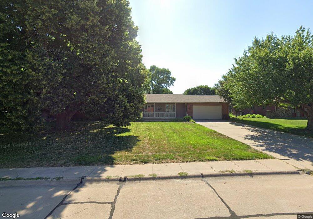
1208 Sheridan Dr Hastings, NE 68901
Estimated Value: $319,000 - $340,000
3
Beds
3
Baths
1,944
Sq Ft
$170/Sq Ft
Est. Value
About This Home
This home is located at 1208 Sheridan Dr, Hastings, NE 68901 and is currently estimated at $330,793, approximately $170 per square foot. 1208 Sheridan Dr is a home located in Adams County with nearby schools including Hastings Senior High School, St. Michael's Preschool & Elementary School, and Zion Lutheran School.
Ownership History
Date
Name
Owned For
Owner Type
Purchase Details
Closed on
Jul 12, 2018
Sold by
Daniels Roy E and Daniels Sharon L
Bought by
Huey Jon and Huey Nan E
Current Estimated Value
Home Financials for this Owner
Home Financials are based on the most recent Mortgage that was taken out on this home.
Original Mortgage
$180,800
Outstanding Balance
$105,140
Interest Rate
4.6%
Mortgage Type
Purchase Money Mortgage
Estimated Equity
$225,653
Purchase Details
Closed on
Mar 9, 2012
Sold by
Griess Olive M
Bought by
Daniels Roy E and Daniels Sharron L
Home Financials for this Owner
Home Financials are based on the most recent Mortgage that was taken out on this home.
Original Mortgage
$220,000
Interest Rate
3.91%
Mortgage Type
VA
Purchase Details
Closed on
Jul 22, 2010
Sold by
Griess Olive M and Harmon Olive M
Bought by
Griess Olive M and Olive M Griess Revocable Trust
Purchase Details
Closed on
Nov 3, 2005
Sold by
Riley Laury L
Bought by
Griess Demas L and Demas L Griess Revocable Trust
Create a Home Valuation Report for This Property
The Home Valuation Report is an in-depth analysis detailing your home's value as well as a comparison with similar homes in the area
Home Values in the Area
Average Home Value in this Area
Purchase History
| Date | Buyer | Sale Price | Title Company |
|---|---|---|---|
| Huey Jon | $226,000 | -- | |
| Daniels Roy E | $220,000 | None Available | |
| Griess Olive M | -- | None Available | |
| Griess Demas L | $135,000 | None Available |
Source: Public Records
Mortgage History
| Date | Status | Borrower | Loan Amount |
|---|---|---|---|
| Open | Huey Jon | $180,800 | |
| Previous Owner | Daniels Roy E | $220,000 |
Source: Public Records
Tax History Compared to Growth
Tax History
| Year | Tax Paid | Tax Assessment Tax Assessment Total Assessment is a certain percentage of the fair market value that is determined by local assessors to be the total taxable value of land and additions on the property. | Land | Improvement |
|---|---|---|---|---|
| 2024 | $4,759 | $293,968 | $38,425 | $255,543 |
| 2023 | $5,305 | $257,111 | $38,425 | $218,686 |
| 2022 | $6,224 | $276,329 | $38,425 | $237,904 |
| 2021 | $5,830 | $265,840 | $43,500 | $222,340 |
| 2020 | $5,732 | $265,840 | $43,500 | $222,340 |
| 2019 | $5,320 | $249,370 | $43,500 | $205,870 |
| 2018 | $5,099 | $237,770 | $31,900 | $205,870 |
| 2017 | $5,095 | $237,770 | $0 | $0 |
| 2016 | $4,698 | $219,055 | $31,900 | $187,155 |
| 2011 | -- | $199,795 | $29,000 | $170,795 |
Source: Public Records
Map
Nearby Homes
- 1225 Heritage Dr
- 1513 Crane Ave
- 1505 Crane Ave
- 1201 Pershing Rd
- 1911 W 11th St
- 1331 Crane Ave
- 1330 Heritage Dr
- 1401 Heritage Dr
- 1223 Westwood Terrace
- 1402 Arapahoe Ave
- 1314 N Laird Ave
- 1814 Boyce St
- 2330 W 11th St
- 904 N Washington Ave
- 1108 N Baltimore Ave
- 736 N Barnes Ave
- 2501 W 10th St
- 2416 W 9th St
- 1334 W 12th St
- 711 Crane Ave
- 1212 Sheridan Dr
- 1204 Sheridan Dr
- 1213 Heritage Dr
- 1205 Heritage Dr
- 1219 Heritage Dr
- 1218 Sheridan Dr
- 2517 Sheridan Dr
- 1221 Sheridan Dr
- 1224 Sheridan Dr
- 1135 Westlawn Ave
- 1212 Heritage Dr
- 1138 Westlawn Ave
- 1927 W 12th St
- 1204 Heritage Dr
- 1220 Heritage Dr
- 1230 Sheridan Dr
- 1935 W 12th St
- 1229 Heritage Dr
- 1230 Crane Ave
- 1236 Sheridan Dr