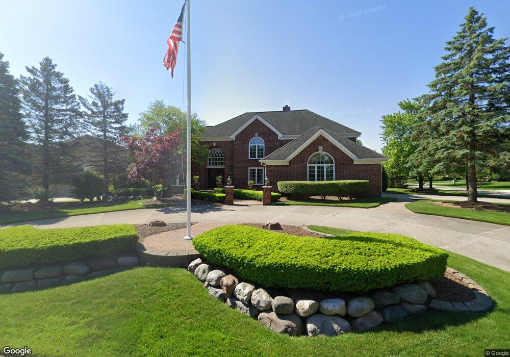
12081 Fox Ridge Dr Plymouth, MI 48170
Estimated Value: $766,838 - $883,000
--
Bed
2
Baths
4,159
Sq Ft
$202/Sq Ft
Est. Value
About This Home
This home is located at 12081 Fox Ridge Dr, Plymouth, MI 48170 and is currently estimated at $839,710, approximately $201 per square foot. 12081 Fox Ridge Dr is a home located in Wayne County with nearby schools including Canton High School, Isbister Elementary School, and Salem High School.
Ownership History
Date
Name
Owned For
Owner Type
Purchase Details
Closed on
Sep 1, 1994
Sold by
Dimaria & Assoc Inc
Bought by
Sunderman Daniel D and Sunderman Jeanne M
Current Estimated Value
Home Financials for this Owner
Home Financials are based on the most recent Mortgage that was taken out on this home.
Original Mortgage
$260,000
Interest Rate
6.75%
Mortgage Type
New Conventional
Purchase Details
Closed on
Jul 18, 1994
Sold by
Deer Park Corp
Bought by
Dimaria & Assoc Inc
Home Financials for this Owner
Home Financials are based on the most recent Mortgage that was taken out on this home.
Original Mortgage
$260,000
Interest Rate
6.75%
Mortgage Type
New Conventional
Create a Home Valuation Report for This Property
The Home Valuation Report is an in-depth analysis detailing your home's value as well as a comparison with similar homes in the area
Home Values in the Area
Average Home Value in this Area
Purchase History
| Date | Buyer | Sale Price | Title Company |
|---|---|---|---|
| Sunderman Daniel D | $350,000 | -- | |
| Dimaria & Assoc Inc | $75,000 | -- |
Source: Public Records
Mortgage History
| Date | Status | Borrower | Loan Amount |
|---|---|---|---|
| Closed | Sunderman Daniel D | $260,000 |
Source: Public Records
Tax History Compared to Growth
Tax History
| Year | Tax Paid | Tax Assessment Tax Assessment Total Assessment is a certain percentage of the fair market value that is determined by local assessors to be the total taxable value of land and additions on the property. | Land | Improvement |
|---|---|---|---|---|
| 2025 | $6,586 | $400,900 | $0 | $0 |
| 2024 | $6,586 | $346,000 | $0 | $0 |
| 2023 | $6,275 | $328,500 | $0 | $0 |
| 2022 | $8,576 | $300,500 | $0 | $0 |
| 2021 | $8,328 | $298,700 | $0 | $0 |
| 2019 | $8,086 | $269,650 | $0 | $0 |
| 2018 | $5,370 | $266,960 | $0 | $0 |
| 2017 | $4,217 | $50,100 | $0 | $0 |
| 2016 | $7,025 | $261,100 | $0 | $0 |
| 2015 | $22,483 | $258,830 | $0 | $0 |
| 2013 | $21,781 | $244,060 | $0 | $0 |
| 2012 | -- | $228,870 | $50,110 | $178,760 |
Source: Public Records
Map
Nearby Homes
- 49238 Plum Tree Dr
- 48100 Powell Rd
- 11809 Amherst Ct
- 48441 N Territorial Rd
- 47443 Verona Ct
- 0 E Ann Arbor Trail Unit 20251048195
- 49451 Plymouth Way Unit 26
- 49667 Draper Cir Unit 74
- 9875 Ann Arbor Trail
- 48434 Hill Top Dr E
- B1 Tall Timber Unit B1
- 9377 Pineview Dr
- 9350 Colony Farms Ct
- 12812 Drury Ln
- 9079 Woodgrove Dr
- 46777 Bettyhill
- 50501 Elmwood Ct Unit 11
- 50520 Elmwood Ct
- 9421 Mapletree Dr
- 13881 Emrick Dr
- 12065 Fox Ridge Dr
- 12106 Deer Creek Run
- 12151 Deer Creek Run
- 11999 Fox Ridge Dr
- 12213 Deer Creek Run
- 12107 Deer Creek Run
- 12062 Deer Creek Run
- 12064 Fox Ridge Dr
- 11975 Fox Ridge Dr
- 12217 Deer Creek Run
- 12063 Deer Creek Run
- 12238 Deer Creek Cir
- 12042 Fox Ridge Dr
- 12018 Deer Creek Run
- 11955 Fox Ridge Dr
- 12019 Deer Creek Run
- 48949 Buck Run Dr
- 11998 Fox Ridge Dr
- 12327 Deer Creek Cir
- 12020 Fox Ridge Dr