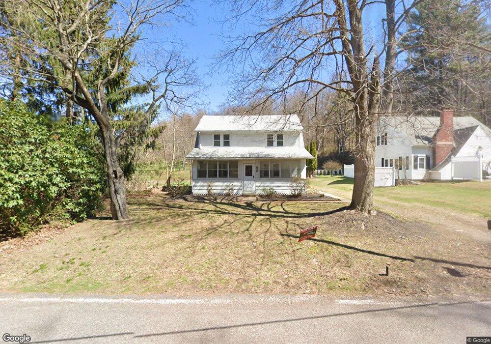
12086 Creek Rd Clarks Summit, PA 18411
Estimated Value: $189,000 - $226,000
3
Beds
1
Bath
1,500
Sq Ft
$138/Sq Ft
Est. Value
About This Home
This home is located at 12086 Creek Rd, Clarks Summit, PA 18411 and is currently estimated at $207,471, approximately $138 per square foot. 12086 Creek Rd is a home located in Lackawanna County with nearby schools including Abington Heights High School.
Ownership History
Date
Name
Owned For
Owner Type
Purchase Details
Closed on
May 13, 2024
Sold by
Lsf9 Master Participation Trust and Us Bank Trust Na
Bought by
Argust Robert Ray and Kellner Jessica Lee
Current Estimated Value
Home Financials for this Owner
Home Financials are based on the most recent Mortgage that was taken out on this home.
Original Mortgage
$175,655
Interest Rate
6.94%
Mortgage Type
New Conventional
Purchase Details
Closed on
Jan 7, 2008
Sold by
Ames Florence
Bought by
Ames Brett
Create a Home Valuation Report for This Property
The Home Valuation Report is an in-depth analysis detailing your home's value as well as a comparison with similar homes in the area
Home Values in the Area
Average Home Value in this Area
Purchase History
| Date | Buyer | Sale Price | Title Company |
|---|---|---|---|
| Argust Robert Ray | $184,900 | First American Mortgage Soluti | |
| Ames Brett | -- | None Available |
Source: Public Records
Mortgage History
| Date | Status | Borrower | Loan Amount |
|---|---|---|---|
| Previous Owner | Argust Robert Ray | $175,655 |
Source: Public Records
Tax History Compared to Growth
Tax History
| Year | Tax Paid | Tax Assessment Tax Assessment Total Assessment is a certain percentage of the fair market value that is determined by local assessors to be the total taxable value of land and additions on the property. | Land | Improvement |
|---|---|---|---|---|
| 2025 | $1,001 | $4,200 | $1,200 | $3,000 |
| 2024 | $832 | $4,200 | $1,200 | $3,000 |
| 2023 | $832 | $4,200 | $1,200 | $3,000 |
| 2022 | $810 | $4,200 | $1,200 | $3,000 |
| 2021 | $810 | $4,200 | $1,200 | $3,000 |
| 2020 | $810 | $4,200 | $1,200 | $3,000 |
| 2019 | $783 | $4,200 | $1,200 | $3,000 |
| 2018 | $775 | $4,200 | $1,200 | $3,000 |
| 2017 | $771 | $4,200 | $1,200 | $3,000 |
| 2016 | $380 | $4,200 | $1,200 | $3,000 |
| 2015 | -- | $4,200 | $1,200 | $3,000 |
| 2014 | -- | $4,200 | $1,200 | $3,000 |
Source: Public Records
Map
Nearby Homes
- 10 Bald Mt Rd
- 2441 Milwaukee Rd
- 1932 Newton Ransom Blvd
- 2694 Ransom Rd
- 0 Milwaukee Rd Unit GSBSC254290
- 2225 Cherry Hill Rd
- 0 Spring & Red Oak Dr Unit GSBSC1753
- 2352 Newton Ransom Blvd
- 2356 Newton Ransom Blvd
- 3018 Main St
- 3061 Main St
- 1213 1215 Lori Ln
- 1150 Franklin St
- 0 William St Unit GSBSC253642
- 1736 Falls Rd
- 800 W Oak St
- 2923 Frink St
- 0 Roanoke Ln Unit GSBSC254856
- 0 Crisp Ave and Division St Unit 22-3646
- 314 Terrace Ave