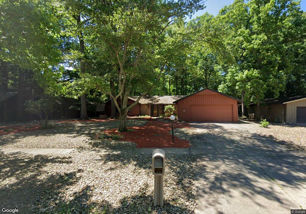
12088 The Bluff Strongsville, OH 44136
Estimated Value: $363,000 - $442,000
3
Beds
2
Baths
2,160
Sq Ft
$183/Sq Ft
Est. Value
About This Home
This home is located at 12088 The Bluff, Strongsville, OH 44136 and is currently estimated at $394,586, approximately $182 per square foot. 12088 The Bluff is a home located in Cuyahoga County with nearby schools including Strongsville High School, Sts Joseph & John Interparochial School, and Royal Redeemer Lutheran School.
Ownership History
Date
Name
Owned For
Owner Type
Purchase Details
Closed on
Oct 24, 2019
Sold by
Selim Mostafa A and Mostafa Ahmed Selim Trust
Bought by
Selim Mostafa Ahmed and Selim Dawn
Current Estimated Value
Purchase Details
Closed on
Oct 1, 2002
Sold by
Selim Mostafa A and Selim Dawn
Bought by
Selim Mostafa A
Purchase Details
Closed on
Apr 25, 1979
Sold by
Selim Mostafa A and Selim Dawn
Bought by
Mostafa A Selim
Purchase Details
Closed on
Jan 1, 1975
Bought by
Selim Mostafa A and Selim Dawn
Create a Home Valuation Report for This Property
The Home Valuation Report is an in-depth analysis detailing your home's value as well as a comparison with similar homes in the area
Home Values in the Area
Average Home Value in this Area
Purchase History
| Date | Buyer | Sale Price | Title Company |
|---|---|---|---|
| Selim Mostafa Ahmed | -- | None Available | |
| Selim Mostafa A | -- | -- | |
| Mostafa A Selim | -- | -- | |
| Selim Mostafa A | -- | -- |
Source: Public Records
Tax History Compared to Growth
Tax History
| Year | Tax Paid | Tax Assessment Tax Assessment Total Assessment is a certain percentage of the fair market value that is determined by local assessors to be the total taxable value of land and additions on the property. | Land | Improvement |
|---|---|---|---|---|
| 2024 | $5,067 | $105,420 | $22,610 | $82,810 |
| 2023 | $5,338 | $83,450 | $23,280 | $60,170 |
| 2022 | $5,300 | $83,440 | $23,280 | $60,170 |
| 2021 | $5,263 | $83,440 | $23,280 | $60,170 |
| 2020 | $4,876 | $68,390 | $19,080 | $49,320 |
| 2019 | $4,736 | $195,400 | $54,500 | $140,900 |
| 2018 | $2,154 | $68,390 | $19,080 | $49,320 |
| 2017 | $4,465 | $65,630 | $15,930 | $49,700 |
| 2016 | $4,430 | $65,630 | $15,930 | $49,700 |
| 2015 | $4,362 | $65,630 | $15,930 | $49,700 |
| 2014 | $4,362 | $63,700 | $15,470 | $48,230 |
Source: Public Records
Map
Nearby Homes
- 12101 The Bluffs
- 17945 Cliffside Dr
- 11650 River Moss Rd
- 17809 Cliffside Dr Unit 4926
- 18336 Falling Water Rd
- 18248 Meadow Ln
- 16519 Albion Rd
- 17281 Akita Ct Unit 4506
- 17289 Akita Ct Unit 4508
- 13513 Suncrest Ct
- 11499 Pearl Rd Unit A106
- 11479 Pearl Rd Unit A101
- 10369 Council Bluff
- 11432 Pearl Rd
- 10471 Royal Oak Dr Unit 38-A
- 10560 Stapleton Dr
- 15485 Albion Rd
- 19240 Briarwood Ln
- 9945 Twelve Oaks Cir
- 13099 Olympus Way
- 12048 The Bluff
- 12130 The Bluff
- 12006 The Bluff
- 12184 The Bluff
- 12101 The Bluff
- 12057 The Bluff
- 12057 The Bluffs
- 12145 The Bluff
- 11966 The Bluff
- 12017 The Bluff
- 11966 The Bluffs
- 12224 The Bluff
- 11979 The Bluff
- 11928 The Bluffs
- 11928 The Bluff
- 12221 The Bluff
- 12264 The Bluff
- 11939 The Bluff
- 12265 The Bluff
- 12233 Moss Point Rd