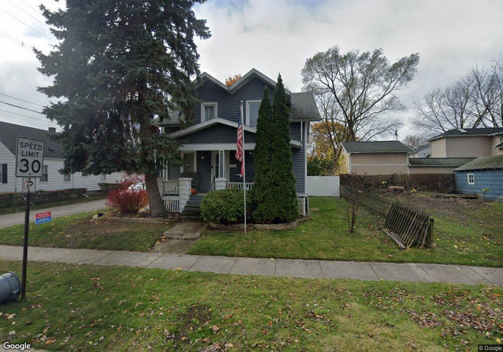
1209 13th St Port Huron, MI 48060
Estimated Value: $126,000 - $158,000
3
Beds
2
Baths
1,274
Sq Ft
$111/Sq Ft
Est. Value
About This Home
This home is located at 1209 13th St, Port Huron, MI 48060 and is currently estimated at $141,018, approximately $110 per square foot. 1209 13th St is a home located in St. Clair County with nearby schools including Michigamme Elementary School, Central Middle School, and Port Huron High School.
Ownership History
Date
Name
Owned For
Owner Type
Purchase Details
Closed on
Jun 7, 2010
Sold by
Neff Linda S
Bought by
Putze Barry E and Zweng Putze Alician
Current Estimated Value
Purchase Details
Closed on
Oct 5, 2009
Sold by
Stewart Daniel T and Stewart Nancy C
Bought by
Green Josephine M
Purchase Details
Closed on
Aug 13, 2009
Sold by
Green Josephine M
Bought by
Neff Linda S
Create a Home Valuation Report for This Property
The Home Valuation Report is an in-depth analysis detailing your home's value as well as a comparison with similar homes in the area
Home Values in the Area
Average Home Value in this Area
Purchase History
| Date | Buyer | Sale Price | Title Company |
|---|---|---|---|
| Putze Barry E | -- | Maritime Title Agency Llc | |
| Green Josephine M | -- | None Available | |
| Neff Linda S | -- | None Available |
Source: Public Records
Tax History Compared to Growth
Tax History
| Year | Tax Paid | Tax Assessment Tax Assessment Total Assessment is a certain percentage of the fair market value that is determined by local assessors to be the total taxable value of land and additions on the property. | Land | Improvement |
|---|---|---|---|---|
| 2025 | $1,397 | $54,900 | $0 | $0 |
| 2024 | $1,143 | $52,000 | $0 | $0 |
| 2023 | $1,080 | $45,900 | $0 | $0 |
| 2022 | $1,080 | $39,600 | $0 | $0 |
| 2021 | $1,025 | $35,400 | $0 | $0 |
| 2020 | $1,037 | $30,900 | $30,900 | $0 |
| 2019 | $1,019 | $23,100 | $0 | $0 |
| 2018 | $996 | $23,100 | $0 | $0 |
| 2017 | $891 | $22,300 | $0 | $0 |
| 2016 | $753 | $22,300 | $0 | $0 |
| 2015 | $739 | $21,700 | $21,700 | $0 |
| 2014 | $739 | $20,600 | $20,600 | $0 |
| 2013 | -- | $20,900 | $0 | $0 |
Source: Public Records
Map
Nearby Homes