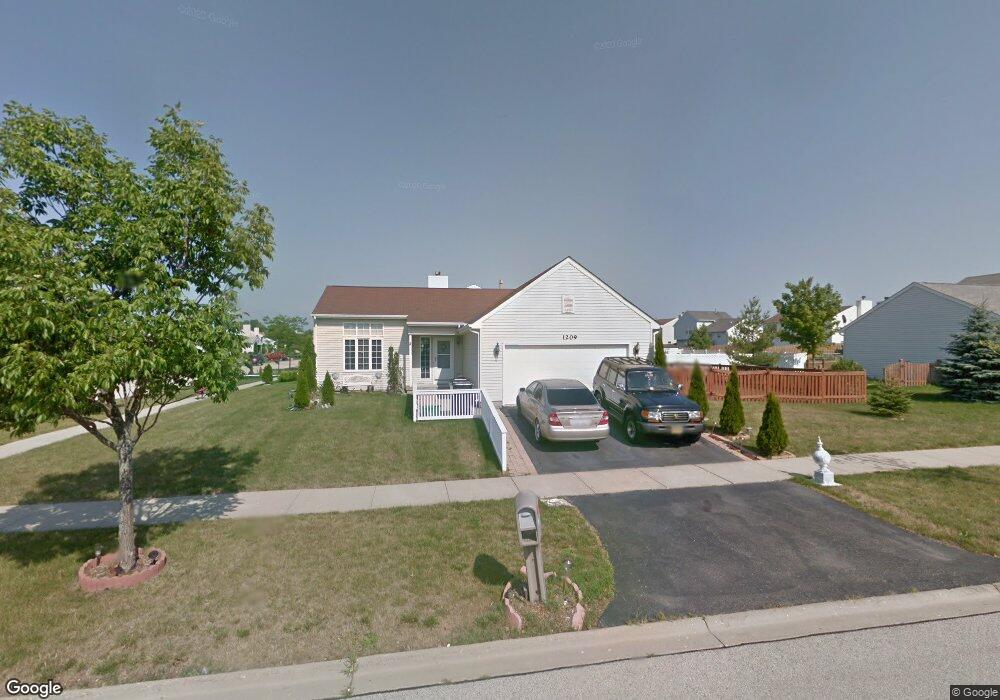
1209 Cardinal Dr Zion, IL 60099
West Zion NeighborhoodEstimated Value: $295,000 - $332,000
3
Beds
3
Baths
1,376
Sq Ft
$229/Sq Ft
Est. Value
About This Home
This home is located at 1209 Cardinal Dr, Zion, IL 60099 and is currently estimated at $315,759, approximately $229 per square foot. 1209 Cardinal Dr is a home located in Lake County with nearby schools including Newport Elementary School, Beach Park Middle School, and Zion-Benton Township High School.
Ownership History
Date
Name
Owned For
Owner Type
Purchase Details
Closed on
Apr 18, 2006
Sold by
Ersland Anthony J and Ersland Carolyn A
Bought by
Marcelin Claude M and Marcelin Jacqueline
Current Estimated Value
Home Financials for this Owner
Home Financials are based on the most recent Mortgage that was taken out on this home.
Original Mortgage
$225,751
Outstanding Balance
$131,075
Interest Rate
6.54%
Mortgage Type
VA
Estimated Equity
$184,684
Purchase Details
Closed on
Oct 22, 2002
Sold by
Berry David E and Berry Eva L
Bought by
Ersland Anthony J and Ersland Carolyn A
Home Financials for this Owner
Home Financials are based on the most recent Mortgage that was taken out on this home.
Original Mortgage
$177,650
Interest Rate
6.13%
Purchase Details
Closed on
Oct 4, 1999
Sold by
Bank Of Waukegan
Bought by
Berry David E and Berry Eva L
Create a Home Valuation Report for This Property
The Home Valuation Report is an in-depth analysis detailing your home's value as well as a comparison with similar homes in the area
Home Values in the Area
Average Home Value in this Area
Purchase History
| Date | Buyer | Sale Price | Title Company |
|---|---|---|---|
| Marcelin Claude M | $221,000 | None Available | |
| Ersland Anthony J | $187,000 | St | |
| Berry David E | $151,000 | -- |
Source: Public Records
Mortgage History
| Date | Status | Borrower | Loan Amount |
|---|---|---|---|
| Open | Marcelin Claude M | $225,751 | |
| Previous Owner | Ersland Anthony J | $177,650 |
Source: Public Records
Tax History Compared to Growth
Tax History
| Year | Tax Paid | Tax Assessment Tax Assessment Total Assessment is a certain percentage of the fair market value that is determined by local assessors to be the total taxable value of land and additions on the property. | Land | Improvement |
|---|---|---|---|---|
| 2024 | $7,686 | $76,451 | $9,912 | $66,539 |
| 2023 | $7,465 | $68,162 | $8,837 | $59,325 |
| 2022 | $7,465 | $63,210 | $7,249 | $55,961 |
| 2021 | $7,050 | $59,095 | $6,800 | $52,295 |
| 2020 | $7,050 | $55,582 | $6,396 | $49,186 |
| 2019 | $6,847 | $51,776 | $5,958 | $45,818 |
| 2018 | $6,149 | $46,361 | $5,420 | $40,941 |
| 2017 | $6,022 | $43,007 | $5,028 | $37,979 |
| 2016 | $5,560 | $39,040 | $4,564 | $34,476 |
| 2015 | $5,311 | $35,423 | $4,141 | $31,282 |
| 2014 | $5,163 | $35,287 | $3,976 | $31,311 |
| 2012 | $5,614 | $37,579 | $4,234 | $33,345 |
Source: Public Records
Map
Nearby Homes
- 1302 Lorelei Dr
- 1304 Lorelei Dr
- 908 Countrywood Dr
- 1417 Westside Trail
- 4014 Ridge Rd
- 3717 Willow Crest Dr
- 0 9th St
- 3707 Willow Crest Dr
- 4539 Illinois 173
- 4533 Illinois 173
- 1304 Pelican Ct
- 41320 N Green Bay Rd
- 1916 Sunshine Ct
- 2010 Sunset Ct
- 1531 Southport Ct
- 1521 Southport Ct
- 1405 Lewis Ave
- 42334 N Heritage Lot 7 Trail
- 43389 N Oakcrest Ln
- 43411 Lynn Dale Dr
- 4219 Quail St
- 1211 Cardinal Dr
- 4217 Quail St
- 1205 Cardinal Dr
- 1238 Pheasant Run
- 1213 Cardinal Dr
- 4218 Quail St
- 4215 Quail St
- 1236 Pheasant Run
- 4216 Quail St
- 1234 Pheasant Run
- 1203 Cardinal Dr
- 4214 Quail St
- 4213 Quail St
- 1232 Pheasant Run
- 4212 Quail St
- 4211 Quail St
- 4217 Jay Dr
- 4219 Jay Dr
- 1201 Cardinal Dr