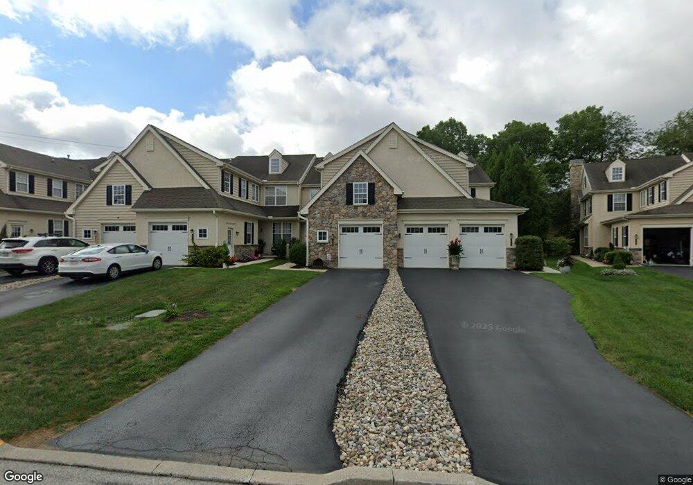
1209 Derry Ln Unit 5 West Chester, PA 19380
Estimated Value: $602,000 - $702,000
3
Beds
3
Baths
2,256
Sq Ft
$287/Sq Ft
Est. Value
About This Home
This home is located at 1209 Derry Ln Unit 5, West Chester, PA 19380 and is currently estimated at $646,516, approximately $286 per square foot. 1209 Derry Ln Unit 5 is a home located in Chester County with nearby schools including Exton Elementary School, J.R. Fugett Middle School, and West Chester East High School.
Ownership History
Date
Name
Owned For
Owner Type
Purchase Details
Closed on
Aug 2, 2013
Sold by
Sullivan Elizabeth I
Bought by
Rodia Joseph and Rodia Michelle
Current Estimated Value
Home Financials for this Owner
Home Financials are based on the most recent Mortgage that was taken out on this home.
Original Mortgage
$300,000
Outstanding Balance
$223,188
Interest Rate
4.4%
Mortgage Type
New Conventional
Estimated Equity
$423,328
Purchase Details
Closed on
Jul 18, 2012
Sold by
Dhlp Shadeland Woods Lp
Bought by
First Landing Inc
Purchase Details
Closed on
Jul 16, 2009
Sold by
Dhlp Shadeland Woods Lp
Bought by
Sullivan Elizabeth I
Home Financials for this Owner
Home Financials are based on the most recent Mortgage that was taken out on this home.
Original Mortgage
$367,190
Interest Rate
5.31%
Mortgage Type
FHA
Create a Home Valuation Report for This Property
The Home Valuation Report is an in-depth analysis detailing your home's value as well as a comparison with similar homes in the area
Home Values in the Area
Average Home Value in this Area
Purchase History
| Date | Buyer | Sale Price | Title Company |
|---|---|---|---|
| Rodia Joseph | $355,500 | None Available | |
| First Landing Inc | -- | None Available | |
| Sullivan Elizabeth I | $375,000 | None Available |
Source: Public Records
Mortgage History
| Date | Status | Borrower | Loan Amount |
|---|---|---|---|
| Open | Rodia Joseph | $300,000 | |
| Previous Owner | Sullivan Elizabeth I | $367,190 |
Source: Public Records
Tax History Compared to Growth
Tax History
| Year | Tax Paid | Tax Assessment Tax Assessment Total Assessment is a certain percentage of the fair market value that is determined by local assessors to be the total taxable value of land and additions on the property. | Land | Improvement |
|---|---|---|---|---|
| 2025 | $6,406 | $220,990 | $24,470 | $196,520 |
| 2024 | $6,406 | $220,990 | $24,470 | $196,520 |
| 2023 | $6,406 | $220,990 | $24,470 | $196,520 |
| 2022 | $6,323 | $220,990 | $24,470 | $196,520 |
| 2021 | $6,235 | $220,990 | $24,470 | $196,520 |
| 2020 | $6,195 | $220,990 | $24,470 | $196,520 |
| 2019 | $6,108 | $220,990 | $24,470 | $196,520 |
| 2018 | $5,978 | $220,990 | $24,470 | $196,520 |
| 2017 | $5,696 | $215,200 | $24,470 | $190,730 |
| 2016 | $4,804 | $215,200 | $24,470 | $190,730 |
| 2015 | $4,804 | $215,200 | $24,470 | $190,730 |
| 2014 | $4,804 | $215,200 | $24,470 | $190,730 |
Source: Public Records
Map
Nearby Homes
- 1205 Killington Cir
- 1206 Longford Rd Unit 51
- 1203 Morstein Rd
- 1340 Ship Rd
- 1203 Karen Ln
- 706 King Rd
- Kipling Plan at The Woodlands at Brandywine
- Nottingham Plan at The Woodlands at Brandywine
- Hawthorne Plan at The Woodlands at Brandywine
- Savannah Plan at The Woodlands at Brandywine
- Magnolia Plan at The Woodlands at Brandywine
- Woodford Plan at The Woodlands at Brandywine
- Augusta Plan at The Woodlands at Brandywine
- Devonshire Plan at The Woodlands at Brandywine
- Ethan Plan at The Woodlands at Brandywine
- Covington Plan at The Woodlands at Brandywine
- 300 Kirkland Ave Unit DEVONSHIRE
- 300 Kirkland Ave Unit HAWTHORNE
- 300 Kirkland Ave Unit SAVANNAH
- 300 Kirkland Ave Unit AUGUSTA
- 1209 Derry Ln
- 1207 Derry Ln Unit 4
- 1207 Derry Ln
- 1211 Derry Ln
- 1205 Derry Ln
- 1203 Derry Ln
- 1213 Derry Ln
- 1215 Derry Ln Unit 8
- 1215 Derry Ln
- 0 Derry Ln Unit 1007299618
- 0 Derry Ln Unit 1006675150
- 0 Derry Ln Unit 5310875
- 0 Derry Ln Unit 5310907
- 0 Derry Ln Unit 5361585
- 0 Derry Ln Unit 5361562
- 0 Derry Ln Unit 5361558
- 0 Derry Ln Unit 5533414
- 0 Derry Ln Unit 5533409
- 0 Derry Ln Unit 5533410
- 0 Derry Ln Unit 5619819