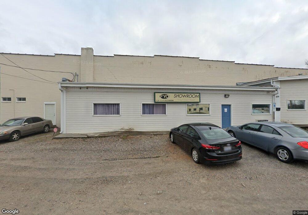
1209 E Andrews Ave Henderson, NC 27536
Studio
--
Bath
50,000
Sq Ft
73,616
Sq Ft Lot
About This Home
This home is located at 1209 E Andrews Ave, Henderson, NC 27536. 1209 E Andrews Ave is a home located in Vance County with nearby schools including Pinkston Street Elementary School, Vance County High School, and Vance County Learning Center.
Ownership History
Date
Name
Owned For
Owner Type
Purchase Details
Closed on
Jul 23, 2020
Sold by
Ww Properties & Rentals Llc
Bought by
Richter Charles R and Richter Julie L
Home Financials for this Owner
Home Financials are based on the most recent Mortgage that was taken out on this home.
Original Mortgage
$296,000
Outstanding Balance
$262,960
Interest Rate
3.2%
Mortgage Type
Construction
Purchase Details
Closed on
Jan 26, 2006
Sold by
Fowler Lois R and Warehouse Liberty
Bought by
W W Properties & Rentals Llc
Create a Home Valuation Report for This Property
The Home Valuation Report is an in-depth analysis detailing your home's value as well as a comparison with similar homes in the area
Purchase History
| Date | Buyer | Sale Price | Title Company |
|---|---|---|---|
| Richter Charles R | $330,000 | None Available | |
| W W Properties & Rentals Llc | $74,000 | -- |
Source: Public Records
Mortgage History
| Date | Status | Borrower | Loan Amount |
|---|---|---|---|
| Open | Richter Charles R | $296,000 |
Source: Public Records
Tax History
| Year | Tax Paid | Tax Assessment Tax Assessment Total Assessment is a certain percentage of the fair market value that is determined by local assessors to be the total taxable value of land and additions on the property. | Land | Improvement |
|---|---|---|---|---|
| 2025 | $12,694 | $931,386 | $81,120 | $850,266 |
| 2024 | $12,694 | $931,386 | $81,120 | $850,266 |
| 2023 | $4,624 | $281,978 | $76,050 | $205,928 |
| 2022 | $4,517 | $281,978 | $76,050 | $205,928 |
| 2021 | $4,517 | $281,978 | $76,050 | $205,928 |
| 2020 | $4,517 | $281,978 | $76,050 | $205,928 |
| 2019 | $4,517 | $281,978 | $76,050 | $205,928 |
| 2018 | $4,517 | $281,978 | $76,050 | $205,928 |
| 2017 | $4,517 | $281,978 | $76,050 | $205,928 |
| 2016 | $4,368 | $272,652 | $76,050 | $196,602 |
| 2015 | $1,291 | $91,431 | $91,431 | $0 |
| 2014 | $1,291 | $91,441 | $91,431 | $10 |
Source: Public Records
Map
Nearby Homes
- 00 Cardinal Dr
- 105 S Elizabeth St
- 248 Orville St
- 630 East Ave
- 628 Farrar Ave
- 936 Eaton St
- 210/212 N Shank St
- 417 Sunnyview Rd
- 723 Water St
- 431 Charles St
- 917 Gay St
- 0 Summit Rd Unit 100551033
- 503 Hilliard St
- 605 E Montgomery St
- 735 Alexander Ave
- 651 Marshall St
- 650 Marshall St
- 647 Marshall St
- 648 Marshall St
- 646 Marshall St
- 1212 E Andrews Ave
- 001 Andrews Ave
- 1208 E Andrews Ave
- 1202 E Andrews Ave
- 1016 East Ave
- 0000 S Us 1 Hwy
- 0 S Us 1 Hwy
- 214 N Bullock St
- 212 N Bullock St
- 1130 E Andrews Ave
- 164 N Elizabeth St
- 1127 E Andrews Ave
- 822 East Ave
- 210 N Bullock St
- 217 N Bullock St
- 176 N Elizabeth St
- 1125 E Andrews Ave
- 160 N Elizabeth St
- 215 N Bullock St
- 818 East Ave
Your Personal Tour Guide
Ask me questions while you tour the home.