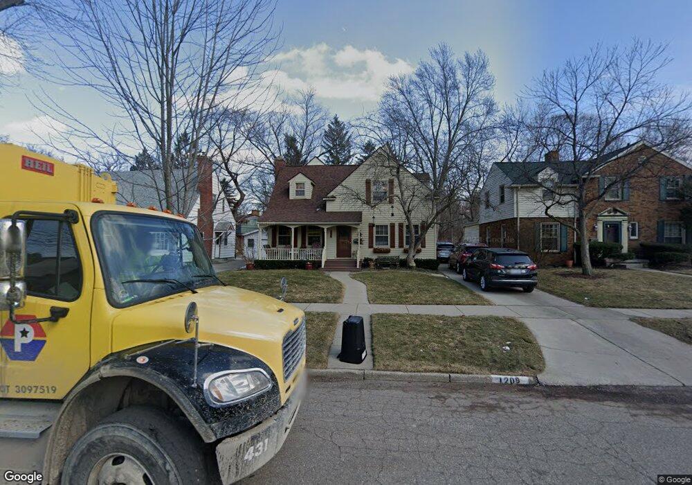
1209 Kensington Ave Flint, MI 48503
College Cultural Neighborhood NeighborhoodEstimated Value: $207,266 - $226,000
4
Beds
3
Baths
2,258
Sq Ft
$95/Sq Ft
Est. Value
About This Home
This home is located at 1209 Kensington Ave, Flint, MI 48503 and is currently estimated at $215,317, approximately $95 per square foot. 1209 Kensington Ave is a home located in Genesee County with nearby schools including Pierce Elementary School, Flint Southwestern Classical Academy, and Flint Cultural Center Academy.
Ownership History
Date
Name
Owned For
Owner Type
Purchase Details
Closed on
Oct 17, 2017
Sold by
Ramsdell Richard K and Ramsdell Betty L
Bought by
Ramsdell Richard K and Ramsdell Betty L
Current Estimated Value
Purchase Details
Closed on
Oct 12, 2017
Sold by
Ramsdell Richard K and Ramsdell Betty L
Bought by
Ramsdell Ruchard K and Ramsdell Betty L
Purchase Details
Closed on
Jun 8, 2011
Sold by
Ramsdell Richard K and Ramsdell Betty L
Bought by
Ramsdell Richard K and Ramsdell Betty L
Create a Home Valuation Report for This Property
The Home Valuation Report is an in-depth analysis detailing your home's value as well as a comparison with similar homes in the area
Home Values in the Area
Average Home Value in this Area
Purchase History
| Date | Buyer | Sale Price | Title Company |
|---|---|---|---|
| Ramsdell Richard K | -- | None Available | |
| Ramsdell Ruchard K | -- | None Available | |
| Ramsdell Richard K | -- | None Available |
Source: Public Records
Tax History Compared to Growth
Tax History
| Year | Tax Paid | Tax Assessment Tax Assessment Total Assessment is a certain percentage of the fair market value that is determined by local assessors to be the total taxable value of land and additions on the property. | Land | Improvement |
|---|---|---|---|---|
| 2025 | $1,822 | $86,900 | $0 | $0 |
| 2024 | $1,622 | $83,100 | $0 | $0 |
| 2023 | $1,576 | $68,500 | $0 | $0 |
| 2022 | $0 | $57,600 | $0 | $0 |
| 2021 | $1,658 | $54,800 | $0 | $0 |
| 2020 | $1,466 | $51,800 | $0 | $0 |
| 2019 | $1,410 | $47,000 | $0 | $0 |
| 2018 | $1,473 | $35,900 | $0 | $0 |
| 2017 | $1,425 | $0 | $0 | $0 |
| 2016 | $1,414 | $0 | $0 | $0 |
| 2015 | -- | $0 | $0 | $0 |
| 2014 | -- | $0 | $0 | $0 |
| 2012 | -- | $31,800 | $0 | $0 |
Source: Public Records
Map
Nearby Homes
- 1510 S Franklin Ave
- 1018 Lafayette St
- 2122 Pierce St
- 2313 Brookside Dr
- 2013 E Court St
- 930 Belmont Ave
- 2319 Calumet St
- 1623 Montclair Ave
- 2202 Windemere Ave
- 2208 Windemere Ave
- 2131 Windemere Ave
- 911 E 7th St
- 841 E 8th St
- 1601 Wayne St
- 605 S Lynch St
- 524 S Lynch St
- 622 Chalmers St
- 1840 Mcphail St
- 1110 Pingree Ave
- 1917 Whittlesey St
- 1205 Kensington Ave
- 1213 Kensington Ave
- 1201 Kensington Ave
- 1217 Kensington Ave
- 1137 Kensington Ave
- 1851 Brookside Dr
- 1210 Kensington Ave
- 1214 Kensington Ave
- 1218 Kensington Ave
- 1138 Kensington Ave
- 1129 Kensington Ave
- 1134 S Franklin Ave
- 1222 Kensington Ave
- 1820 Brookside Dr
- 1130 S Franklin Ave
- 1125 Kensington Ave
- 1309 Blanchard Ave
- 1130 Kensington Ave
- 1305 Blanchard Ave
- 1317 Blanchard Ave