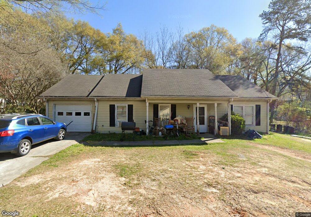
1209 Mathis St Monroe, GA 30655
Estimated Value: $219,000 - $266,000
Studio
--
Bath
1,316
Sq Ft
$189/Sq Ft
Est. Value
About This Home
This home is located at 1209 Mathis St, Monroe, GA 30655 and is currently estimated at $249,053, approximately $189 per square foot. 1209 Mathis St is a home located in Walton County with nearby schools including Atha Road Elementary School, Youth Middle School, and Walnut Grove High School.
Ownership History
Date
Name
Owned For
Owner Type
Purchase Details
Closed on
Jun 16, 2000
Sold by
Phelps Billy J
Bought by
Mccoy Robert D
Current Estimated Value
Home Financials for this Owner
Home Financials are based on the most recent Mortgage that was taken out on this home.
Original Mortgage
$71,250
Outstanding Balance
$24,113
Interest Rate
8.27%
Mortgage Type
FHA
Estimated Equity
$224,940
Create a Home Valuation Report for This Property
The Home Valuation Report is an in-depth analysis detailing your home's value as well as a comparison with similar homes in the area
Home Values in the Area
Average Home Value in this Area
Purchase History
| Date | Buyer | Sale Price | Title Company |
|---|---|---|---|
| Mccoy Robert D | $71,900 | -- |
Source: Public Records
Mortgage History
| Date | Status | Borrower | Loan Amount |
|---|---|---|---|
| Open | Mccoy Robert D | $71,250 |
Source: Public Records
Tax History
| Year | Tax Paid | Tax Assessment Tax Assessment Total Assessment is a certain percentage of the fair market value that is determined by local assessors to be the total taxable value of land and additions on the property. | Land | Improvement |
|---|---|---|---|---|
| 2025 | $2,347 | $89,060 | $14,520 | $74,540 |
| 2024 | $2,251 | $84,460 | $12,000 | $72,460 |
| 2023 | $2,093 | $74,860 | $12,000 | $62,860 |
| 2022 | $1,996 | $64,740 | $12,000 | $52,740 |
| 2021 | $1,554 | $46,140 | $6,400 | $39,740 |
| 2020 | $1,331 | $37,020 | $4,800 | $32,220 |
| 2019 | $1,291 | $31,140 | $4,000 | $27,140 |
| 2018 | $1,146 | $31,140 | $4,000 | $27,140 |
| 2017 | $1,092 | $26,060 | $3,400 | $22,660 |
| 2016 | $834 | $22,244 | $3,400 | $18,844 |
| 2015 | $739 | $19,604 | $3,400 | $16,204 |
| 2014 | $702 | $18,232 | $0 | $0 |
Source: Public Records
Map
Nearby Homes
- 206 Walker Dr
- 212 Walker Dr
- 223 Atha St
- 1230 S Madison Ave
- 808 S Broad St
- 1037 S Madison Ave
- 227 Atha St
- 1435 Creek View Dr
- 1328 S Madison Ave
- 529 Mill Farm Ln
- 525 Mill Farm Ln
- 429 Red Oak Ct
- 416 Shamrock Dr
- 404 Walker Dr
- 500 Mill Farm Ln
- 739 Wheel House Ln Unit B
- 739 Wheel House Ln Unit A
- 736 Wheel House Ln Unit B
- 733 W Creek Cir
- 603 Ash Ln
- 1213 Mathis St
- 1207 Mathis St
- 1207 Mathis St
- 1210 Mathis St
- 200 Douglas St
- 1214 Mathis St Unit 141
- 1214 Mathis St
- 1215 Mathis St
- 203 Douglas St
- 1214 S Broad St
- 109 W Fambrough St
- 107 W Fambrough St
- 107 W Fambrough St
- 204 Douglas St
- 1208 S Broad St
- 1302 S Broad St
- 118 Walker Dr
- 201 W Fambrough St
- 201 W Fambrough St
- 1304 S Broad St Unit B
Your Personal Tour Guide
Ask me questions while you tour the home.