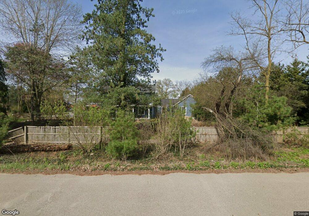
1209 N Zeeb Rd Ann Arbor, MI 48103
Estimated Value: $715,000 - $1,068,000
7
Beds
3
Baths
3,214
Sq Ft
$276/Sq Ft
Est. Value
About This Home
This home is located at 1209 N Zeeb Rd, Ann Arbor, MI 48103 and is currently estimated at $888,645, approximately $276 per square foot. 1209 N Zeeb Rd is a home located in Washtenaw County with nearby schools including Anchor Elementary School, Creekside Intermediate School, and Bates Elementary School.
Ownership History
Date
Name
Owned For
Owner Type
Purchase Details
Closed on
Dec 4, 2000
Sold by
Hutton Mark J
Current Estimated Value
Purchase Details
Closed on
Mar 17, 1997
Sold by
Shapiro Douglas Y
Bought by
Hutton Mark J and Hutton Julianna M
Home Financials for this Owner
Home Financials are based on the most recent Mortgage that was taken out on this home.
Original Mortgage
$300,000
Interest Rate
6.63%
Mortgage Type
New Conventional
Create a Home Valuation Report for This Property
The Home Valuation Report is an in-depth analysis detailing your home's value as well as a comparison with similar homes in the area
Home Values in the Area
Average Home Value in this Area
Purchase History
| Date | Buyer | Sale Price | Title Company |
|---|---|---|---|
| -- | $470,000 | -- | |
| Hutton Mark J | $375,000 | -- |
Source: Public Records
Mortgage History
| Date | Status | Borrower | Loan Amount |
|---|---|---|---|
| Previous Owner | Hutton Mark J | $300,000 |
Source: Public Records
Tax History Compared to Growth
Tax History
| Year | Tax Paid | Tax Assessment Tax Assessment Total Assessment is a certain percentage of the fair market value that is determined by local assessors to be the total taxable value of land and additions on the property. | Land | Improvement |
|---|---|---|---|---|
| 2025 | $3,257 | $407,400 | $0 | $0 |
| 2024 | $2,390 | $371,400 | $0 | $0 |
| 2023 | $2,277 | $297,300 | $0 | $0 |
| 2022 | $7,655 | $277,700 | $0 | $0 |
| 2021 | $7,238 | $272,300 | $0 | $0 |
| 2020 | $7,256 | $274,800 | $0 | $0 |
| 2019 | $6,940 | $256,300 | $256,300 | $0 |
| 2018 | $6,908 | $240,600 | $0 | $0 |
| 2017 | $6,608 | $251,200 | $0 | $0 |
| 2016 | $1,957 | $184,187 | $0 | $0 |
| 2015 | -- | $183,637 | $0 | $0 |
| 2014 | -- | $177,900 | $0 | $0 |
| 2013 | -- | $177,900 | $0 | $0 |
Source: Public Records
Map
Nearby Homes
- 5183 Christine Dr
- 5185 Christine Dr
- 5535 Arbor Chase Dr
- 5610 Arbor Chase Dr
- 286 Silver Oak St
- 139 Luella Ave
- 343 Honey Tree Way Unit 156
- 283 S Zeeb Rd Unit 212
- 274 Silver Oak St
- 5967 Cedar Ridge Dr
- 6167 N Trailwoods Dr
- 6207 N Trailwoods Dr
- 6112 N Trailwoods Dr
- 6151 N Trailwoods Dr
- 413 Blossom Dr
- 4870 Lytham Ln
- 5620 Le Blanc Ave
- The Harrison Plan at Trailwoods of Ann Arbor
- The Columbia Plan at Trailwoods of Ann Arbor
- The Austin Plan at Trailwoods of Ann Arbor
- 295 N Zeeb Rd
- 1135 Wing Dr
- 1115 Harold Cir
- 1105 Harold Cir
- 1095 Harold Cir
- 1130 Wing Dr
- 1335 N Zeeb Rd
- 1124 Harold Cir
- 1112 Harold Cir
- 1075 Harold Cir
- 1100 Harold Cir
- 1120 Wing Dr
- 1086 Harold Cir
- 0 N Zeeb Rd Unit 543240314
- 0 N Zeeb Rd Unit 3240314
- 0 N Zeeb Rd
- 1065 Harold Cir
- 1377 N Zeeb Rd
- 1071 Wing Dr
- 1110 Wing Dr