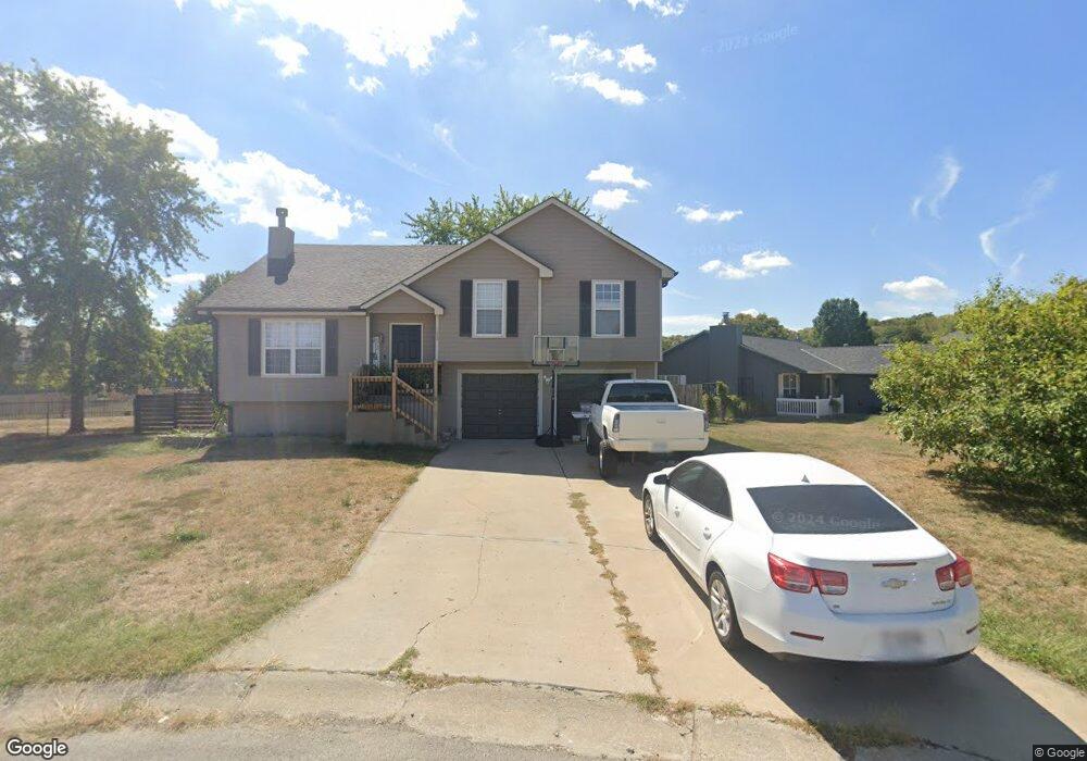
1209 SW Dean Dr Grain Valley, MO 64029
Estimated Value: $292,000 - $313,365
About This Home
This home is located at 1209 SW Dean Dr, Grain Valley, MO 64029 and is currently estimated at $303,091, approximately $243 per square foot. 1209 SW Dean Dr is a home located in Jackson County with nearby schools including Grain Valley High School.
Ownership History
We collect this data history from publicly available records. To have your information removed, we recommend requesting removal directly through your county’s website.
Purchase Details
Home Financials for this Owner
Home Financials are based on the most recent Mortgage that was taken out on this home.Purchase Details
Purchase Details
Purchase Details
Home Financials for this Owner
Home Financials are based on the most recent Mortgage that was taken out on this home.Purchase Details
Home Financials for this Owner
Home Financials are based on the most recent Mortgage that was taken out on this home.Home Values in the Area
Average Home Value in this Area
Purchase History
We collect this data history from publicly available records. To have your information removed, we recommend requesting removal directly through your county’s website.
| Date | Buyer | Sale Price | Title Company |
|---|---|---|---|
| -- | None Available | ||
| -- | Kansas City Title | ||
| -- | Stewart Title Of Kansas City | ||
| -- | Stewart Title | ||
| -- | Stewart Title |
Mortgage History
We collect this data history from publicly available records. To have your information removed, we recommend requesting removal directly through your county’s website.
| Date | Status | Borrower | Loan Amount |
|---|---|---|---|
| Open | $130,571 | ||
| Previous Owner | $118,922 | ||
| Previous Owner | $101,500 |
Tax History
We collect this data history from publicly available records. To have your information removed, we recommend requesting removal directly through your county’s website.
| Year | Tax Paid | Tax Assessment Tax Assessment Total Assessment is a certain percentage of the fair market value that is determined by local assessors to be the total taxable value of land and additions on the property. | Land | Improvement |
|---|---|---|---|---|
| 2025 | $3,500 | $40,204 | $8,010 | $32,194 |
| 2024 | $3,370 | $42,499 | $4,668 | $37,831 |
| 2023 | $3,370 | $42,499 | $5,360 | $37,139 |
| 2022 | $2,756 | $30,400 | $3,844 | $26,556 |
| 2021 | $2,691 | $30,400 | $3,844 | $26,556 |
| 2020 | $2,722 | $30,331 | $3,844 | $26,487 |
| 2019 | $2,667 | $30,331 | $3,844 | $26,487 |
| 2018 | $910,956 | $26,398 | $3,346 | $23,052 |
| 2017 | $2,421 | $26,398 | $3,346 | $23,052 |
| 2016 | $2,421 | $25,736 | $3,211 | $22,525 |
| 2014 | $2,391 | $25,232 | $3,148 | $22,084 |
Map
- 521 S Minter Rd
- 441 SW Laura Ln
- 545 S Minter Rd
- 521 SW Graystone Dr
- 608 SW Lakeview Dr
- 715 S Minter Rd
- 1305 SW Graystone Cir
- 710 SW Brome Dr
- 110 NW Lindsey Ln
- 600 SW Valley Dr
- 1215 NW Ashley Ln
- 6205 Chiles Rd
- 913 SW Abar Dr
- 901 SW Foxtail Dr
- 1105 NW Long Dr
- 701 SW Nelson Dr
- 505 SW Ridgeview Dr
- 503 Broadway St
- 927 NW Long Dr
- 2700 NE Wheatley Dr
- 1211 SW Dean Dr
- 1207 SW Dean Dr
- 1222 SW Duster Ct
- 1205 SW Dean Dr
- 1224 SW Duster Ct
- 1210 SW Dean Dr
- 1208 SW Dean Dr
- 410 SW Hamilton Ln
- 1215 SW Dean Dr
- 1212 SW Dean Dr
- 1204 SW Dean Dr
- 412 SW Hamilton Ln
- 1214 SW Dean Dr
- 1225 SW Duster Ct
- 1206 SW Dean Dr
- 403 SW Joseph Ln
- 1203 SW Dean Dr
- 407 SW Joseph Ln
- 1300 SW Dean Dr
- 1223 SW Duster Ct
Ask me questions while you tour the home.