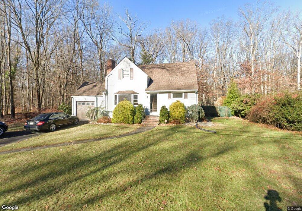
1209 Williamson Rd North Brunswick, NJ 08902
Estimated Value: $365,399 - $601,000
--
Bed
--
Bath
832
Sq Ft
$557/Sq Ft
Est. Value
About This Home
This home is located at 1209 Williamson Rd, North Brunswick, NJ 08902 and is currently estimated at $463,600, approximately $557 per square foot. 1209 Williamson Rd is a home located in Middlesex County with nearby schools including Arthur M. Judd Elementary School, Linwood Middle School, and North Brunswick Twp High School.
Ownership History
Date
Name
Owned For
Owner Type
Purchase Details
Closed on
Jun 16, 2011
Sold by
Maloney Joseph and Maloney Joann
Bought by
Maloney Joann
Current Estimated Value
Home Financials for this Owner
Home Financials are based on the most recent Mortgage that was taken out on this home.
Original Mortgage
$100,000
Outstanding Balance
$6,473
Interest Rate
3.82%
Mortgage Type
New Conventional
Estimated Equity
$457,127
Purchase Details
Closed on
Jun 30, 2000
Sold by
Rethy Joseph
Bought by
Maloney Joseph and Maloney Joann
Home Financials for this Owner
Home Financials are based on the most recent Mortgage that was taken out on this home.
Original Mortgage
$136,000
Interest Rate
8.5%
Create a Home Valuation Report for This Property
The Home Valuation Report is an in-depth analysis detailing your home's value as well as a comparison with similar homes in the area
Home Values in the Area
Average Home Value in this Area
Purchase History
| Date | Buyer | Sale Price | Title Company |
|---|---|---|---|
| Maloney Joann | -- | Fidelity Natl Title Ins Co | |
| Maloney Joseph | $170,000 | -- |
Source: Public Records
Mortgage History
| Date | Status | Borrower | Loan Amount |
|---|---|---|---|
| Open | Maloney Joann | $100,000 | |
| Closed | Maloney Joseph | $136,000 |
Source: Public Records
Tax History Compared to Growth
Tax History
| Year | Tax Paid | Tax Assessment Tax Assessment Total Assessment is a certain percentage of the fair market value that is determined by local assessors to be the total taxable value of land and additions on the property. | Land | Improvement |
|---|---|---|---|---|
| 2025 | $8,256 | $130,300 | $65,400 | $64,900 |
| 2024 | $8,107 | $130,300 | $65,400 | $64,900 |
| 2023 | $8,107 | $130,300 | $65,400 | $64,900 |
| 2022 | $7,831 | $130,300 | $65,400 | $64,900 |
| 2021 | $7,385 | $130,300 | $65,400 | $64,900 |
| 2020 | $7,539 | $130,300 | $65,400 | $64,900 |
| 2019 | $7,385 | $130,300 | $65,400 | $64,900 |
| 2018 | $7,234 | $130,300 | $65,400 | $64,900 |
| 2017 | $7,107 | $130,300 | $65,400 | $64,900 |
| 2016 | $6,958 | $130,300 | $65,400 | $64,900 |
| 2015 | $6,839 | $130,300 | $65,400 | $64,900 |
| 2014 | $6,763 | $130,300 | $65,400 | $64,900 |
Source: Public Records
Map
Nearby Homes
- 422 Franklin Rd
- 386 Franklin Rd
- 1123 N Boyd Pkwy
- 1088 S Boyd Pkwy
- 41 Lynn Ct
- 1290 Barkley Place N
- 303 Constitution Cir
- 334 Constitution Cir
- 276 Constitution Cir
- 2 Silver Hollow
- 32 Lafayette Ct
- 224 Pennsylvania Way
- 149 Pennsylvania Way
- 910 Curtis Place
- 63 Pennsylvania Way
- 89 Pennsylvania Way
- 796 Curie Rd
- 2 Kohlhepp Ave
- 457 Barrymore Place
- 1584 Holly Rd
- 1201 Williamson Rd
- 1195 Williamson Rd
- 1200 Williamson Rd
- 1225 Williamson Rd
- 1185 Williamson Rd
- 1233 Williamson Rd
- 1190 Williamson Rd
- 425 Huff Rd
- 412 Franklin Rd
- 1241 Williamson Rd
- 419 Huff Rd
- 417 Huff Rd
- 410 Independence Blvd
- 402 Franklin Rd
- 1171 Revere Rd
- 413 Huff Rd
- 1249 Williamson Rd
- 1163 Revere Rd
- 424 Huff Rd
- 395 Franklin Rd