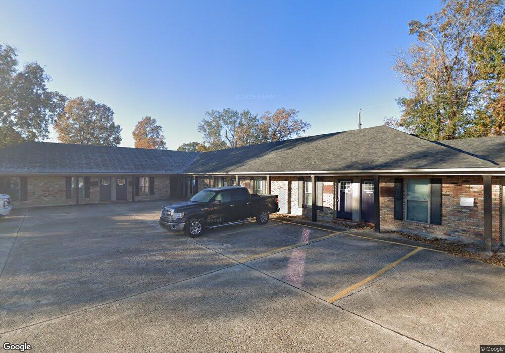
12090 S Harrells Ferry Rd Baton Rouge, LA 70816
Shenandoah NeighborhoodEstimated Value: $702,805
--
Bed
--
Bath
13,115
Sq Ft
$54/Sq Ft
Est. Value
About This Home
This home is located at 12090 S Harrells Ferry Rd, Baton Rouge, LA 70816 and is currently estimated at $702,805, approximately $53 per square foot. 12090 S Harrells Ferry Rd is a home located in East Baton Rouge Parish with nearby schools including Wedgewood Elementary School, Southeast Middle School, and Tara High School.
Ownership History
Date
Name
Owned For
Owner Type
Purchase Details
Closed on
Aug 20, 2015
Sold by
D And S 1 Properties Llc
Bought by
The Highlander Executive Suite
Current Estimated Value
Home Financials for this Owner
Home Financials are based on the most recent Mortgage that was taken out on this home.
Original Mortgage
$400,000
Outstanding Balance
$315,132
Interest Rate
4.08%
Mortgage Type
New Conventional
Estimated Equity
$387,673
Purchase Details
Closed on
Oct 24, 2005
Sold by
East Gate Building
Bought by
D And S 1 Properties
Home Financials for this Owner
Home Financials are based on the most recent Mortgage that was taken out on this home.
Original Mortgage
$500,000
Interest Rate
5.75%
Mortgage Type
Construction
Create a Home Valuation Report for This Property
The Home Valuation Report is an in-depth analysis detailing your home's value as well as a comparison with similar homes in the area
Home Values in the Area
Average Home Value in this Area
Purchase History
| Date | Buyer | Sale Price | Title Company |
|---|---|---|---|
| The Highlander Executive Suite | $500,000 | -- | |
| D And S 1 Properties | $500,000 | -- |
Source: Public Records
Mortgage History
| Date | Status | Borrower | Loan Amount |
|---|---|---|---|
| Open | The Highlander Executive Suite | $400,000 | |
| Previous Owner | D And S 1 Properties | $500,000 |
Source: Public Records
Tax History Compared to Growth
Tax History
| Year | Tax Paid | Tax Assessment Tax Assessment Total Assessment is a certain percentage of the fair market value that is determined by local assessors to be the total taxable value of land and additions on the property. | Land | Improvement |
|---|---|---|---|---|
| 2024 | $9,654 | $82,423 | $10,197 | $72,226 |
| 2023 | $9,654 | $74,930 | $9,270 | $65,660 |
| 2022 | $8,947 | $74,930 | $9,270 | $65,660 |
| 2021 | $8,742 | $74,930 | $9,270 | $65,660 |
| 2020 | $8,851 | $74,930 | $9,270 | $65,660 |
| 2019 | $8,986 | $72,750 | $9,000 | $63,750 |
| 2018 | $8,877 | $72,750 | $9,000 | $63,750 |
| 2017 | $8,877 | $72,750 | $9,000 | $63,750 |
| 2016 | $8,662 | $72,750 | $9,000 | $63,750 |
| 2015 | $8,496 | $71,250 | $7,500 | $63,750 |
| 2014 | $8,466 | $71,250 | $7,500 | $63,750 |
| 2013 | -- | $71,250 | $7,500 | $63,750 |
Source: Public Records
Map
Nearby Homes
- 11976 Baylor Dr
- 12416 Astolat Ave
- 2045 Sherwood Meadow Dr Unit 4
- 12536 Mallory Ave
- 11583 Sewanee Dr
- 11662 Auburn Dr
- 11591 Auburn Dr
- 2655 Citadel Dr
- 0000 Boulevard de Province
- 2614 Citadel Dr
- 3014 Lancelot Dr
- 12023 Elva Dr
- 1793 Boulevard de Province Unit D
- 1781 Boulevard de Province Unit D
- 1769 Boulevard de Province Unit E
- 11620 Old Hammond Hwy
- 1765 Boulevard de Province Unit B
- 1715 Foxton Ct
- 1763 Boulevard de Province Unit C
- 1763 Boulevard de Province Unit D
- 12111 Astolat Ave
- 12121 Astolat Ave
- 2310 Lancelot Dr
- 12131 Astolat Ave
- 2361 Eastgate Dr
- 12141 Astolat Ave
- 2373 Eastgate Dr
- 2320 Lancelot Dr
- 12213 Astolat Ave
- 12023 Baylor Dr
- 12110 Astolat Ave
- 2376 Eastgate Dr
- 12120 Astolat Ave
- 11985 Baylor Dr
- 12223 Astolat Ave
- 12130 Astolat Ave
- 11977 Baylor Dr
- 2411 Eastgate Dr
- 2330 Lancelot Dr
- 12212 Astolat Ave