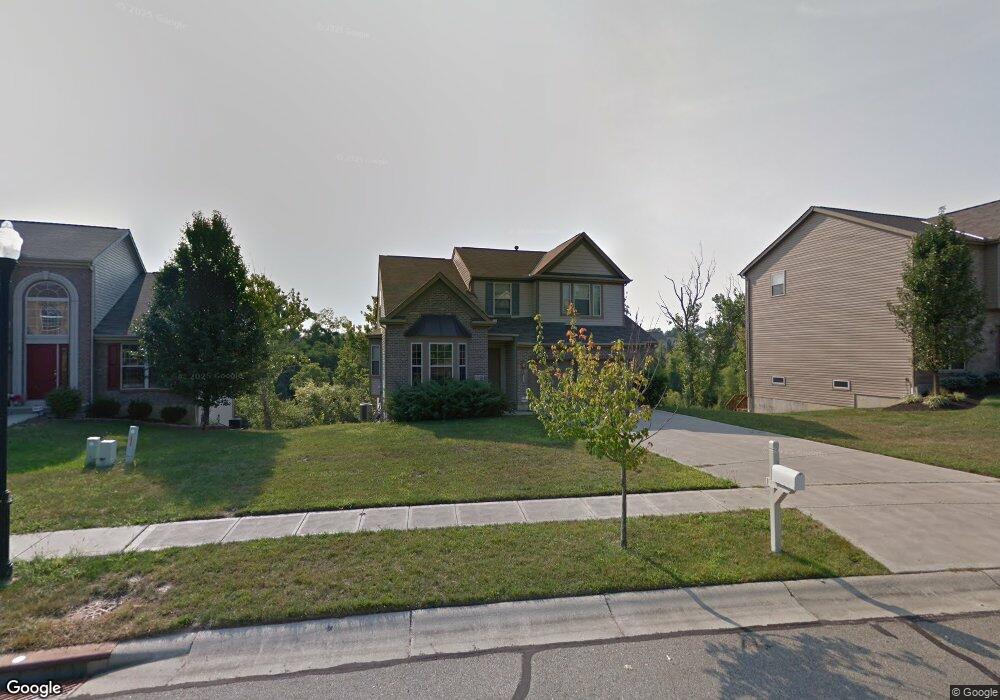
12094 Doe Run Ct Cincinnati, OH 45240
Pleasant Run Farms NeighborhoodEstimated Value: $382,978 - $419,000
4
Beds
3
Baths
2,646
Sq Ft
$151/Sq Ft
Est. Value
About This Home
This home is located at 12094 Doe Run Ct, Cincinnati, OH 45240 and is currently estimated at $399,495, approximately $150 per square foot. 12094 Doe Run Ct is a home located in Hamilton County with nearby schools including Pleasant Run Elementary School, Pleasant Run Middle School, and Northwest High School.
Ownership History
Date
Name
Owned For
Owner Type
Purchase Details
Closed on
Feb 16, 2007
Sold by
M/1 Homes Of Cincinnati Llc
Bought by
Fisher Robin
Current Estimated Value
Home Financials for this Owner
Home Financials are based on the most recent Mortgage that was taken out on this home.
Original Mortgage
$228,365
Interest Rate
6.2%
Mortgage Type
Purchase Money Mortgage
Purchase Details
Closed on
Sep 29, 2003
Sold by
M/I Schottenstein Homes Inc
Bought by
M/I Homes Of Cincinnati Llc
Create a Home Valuation Report for This Property
The Home Valuation Report is an in-depth analysis detailing your home's value as well as a comparison with similar homes in the area
Home Values in the Area
Average Home Value in this Area
Purchase History
| Date | Buyer | Sale Price | Title Company |
|---|---|---|---|
| Fisher Robin | $232,500 | First Title Inc | |
| M/I Homes Of Cincinnati Llc | -- | -- |
Source: Public Records
Mortgage History
| Date | Status | Borrower | Loan Amount |
|---|---|---|---|
| Previous Owner | Fisher Robin | $228,365 |
Source: Public Records
Tax History Compared to Growth
Tax History
| Year | Tax Paid | Tax Assessment Tax Assessment Total Assessment is a certain percentage of the fair market value that is determined by local assessors to be the total taxable value of land and additions on the property. | Land | Improvement |
|---|---|---|---|---|
| 2024 | $6,776 | $111,573 | $17,990 | $93,583 |
| 2023 | $6,434 | $111,573 | $17,990 | $93,583 |
| 2022 | $4,982 | $69,286 | $14,378 | $54,908 |
| 2021 | $4,931 | $69,286 | $14,378 | $54,908 |
| 2020 | $4,993 | $69,286 | $14,378 | $54,908 |
| 2019 | $5,069 | $66,623 | $13,825 | $52,798 |
| 2018 | $4,582 | $66,623 | $13,825 | $52,798 |
| 2017 | $4,351 | $66,623 | $13,825 | $52,798 |
| 2016 | $4,509 | $67,855 | $14,168 | $53,687 |
| 2015 | $4,559 | $67,855 | $14,168 | $53,687 |
| 2014 | $4,568 | $67,855 | $14,168 | $53,687 |
| 2013 | $4,834 | $73,756 | $15,400 | $58,356 |
Source: Public Records
Map
Nearby Homes
- 12017 Brookway Dr
- 12052 Doe Run Ct
- 12120 Regency Run Ct
- 12058 Wincanton Dr
- 27 Carousel Cir
- 2545 Haverknoll Dr
- 1969 Broadhurst Ave
- 2617 Haverknoll Dr
- 1 Pinehurst Ct
- 11888 Kittrun Ct
- 1881 Happy Valley Dr
- 1515 Gelhot Dr
- 11888 Elkwood Dr
- 1605 W Augusta Blvd
- 2681 Haverknoll Dr
- 1535 Gelhot Dr
- 1710 Forester Dr
- 11954 Elmgrove Cir
- 11992 Pippin Rd
- 6209 Muirfield Ct
- 12086 Doe Run Ct
- 12096 Doe Run Ct
- 12078 Doe Run Ct
- 12102 Doe Run Ct
- 12057 Brookway Dr
- 12063 Brookway Dr
- 12072 Doe Run Ct
- 12067 Brookway Dr
- 12110 Doe Run Ct
- 12103 Doe Run Ct
- 12066 Doe Run Ct
- 12089 Doe Run Ct
- 12053 Brookway Dr
- 12111 Doe Run Ct
- 12116 Doe Run Ct
- 12071 Brookway Dr
- 12058 Doe Run Ct
- 12045 Brookway Dr
- 12075 Doe Run Ct
- 12029 Brookway Dr