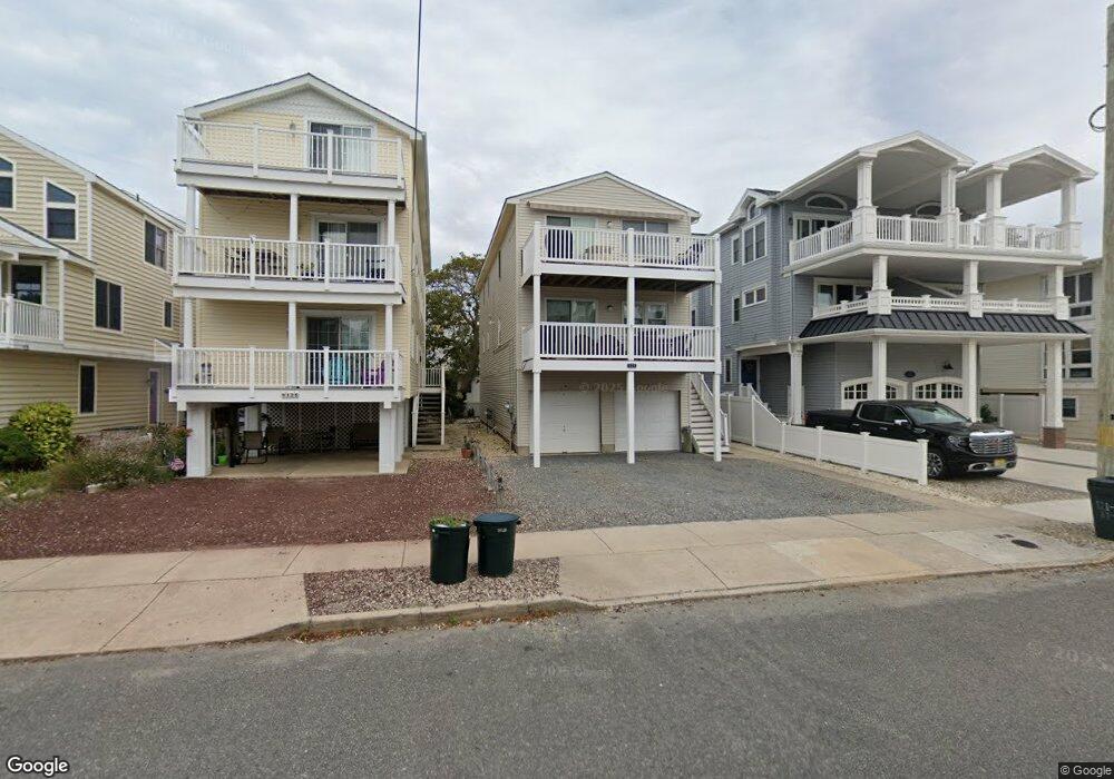
121 87th St Unit 1ST Sea Isle City, NJ 08243
Estimated Value: $742,989 - $1,197,000
--
Bed
--
Bath
1,100
Sq Ft
$907/Sq Ft
Est. Value
About This Home
This home is located at 121 87th St Unit 1ST, Sea Isle City, NJ 08243 and is currently estimated at $997,997, approximately $907 per square foot. 121 87th St Unit 1ST is a home located in Cape May County with nearby schools including Ocean City Primary School, Ocean City Intermediate School, and Ocean City High School.
Ownership History
Date
Name
Owned For
Owner Type
Purchase Details
Closed on
Sep 15, 2022
Sold by
Patricia A Van Fleet Revocable Trust
Bought by
James E Van Fleet Revocable Trust
Current Estimated Value
Purchase Details
Closed on
Jul 13, 2005
Sold by
Vanfleet James E and Van Fleet Patricia A
Bought by
Vanfleet James E and Van Fleet Patricia A
Purchase Details
Closed on
Aug 30, 1991
Sold by
Et Als Ferner J and Et Als Anela A
Bought by
Vanfleet James E and Vanfleet Patricia A
Create a Home Valuation Report for This Property
The Home Valuation Report is an in-depth analysis detailing your home's value as well as a comparison with similar homes in the area
Home Values in the Area
Average Home Value in this Area
Purchase History
| Date | Buyer | Sale Price | Title Company |
|---|---|---|---|
| James E Van Fleet Revocable Trust | -- | -- | |
| James E Van Fleet Revocable Trust | -- | None Listed On Document | |
| Vanfleet James E | -- | -- | |
| Vanfleet James E | -- | -- |
Source: Public Records
Tax History Compared to Growth
Tax History
| Year | Tax Paid | Tax Assessment Tax Assessment Total Assessment is a certain percentage of the fair market value that is determined by local assessors to be the total taxable value of land and additions on the property. | Land | Improvement |
|---|---|---|---|---|
| 2025 | $4,357 | $487,400 | $371,300 | $116,100 |
| 2024 | $4,357 | $487,400 | $371,300 | $116,100 |
| 2023 | $4,153 | $487,400 | $371,300 | $116,100 |
| 2022 | $3,904 | $487,400 | $371,300 | $116,100 |
| 2021 | $3,500 | $487,400 | $371,300 | $116,100 |
| 2020 | $3,578 | $487,400 | $371,300 | $116,100 |
| 2019 | $3,500 | $487,400 | $371,300 | $116,100 |
| 2018 | $3,461 | $487,400 | $371,300 | $116,100 |
| 2017 | $3,387 | $487,400 | $371,300 | $116,100 |
| 2016 | $3,275 | $487,400 | $371,300 | $116,100 |
| 2015 | $3,132 | $531,800 | $362,300 | $169,500 |
| 2014 | $3,106 | $531,800 | $362,300 | $169,500 |
Source: Public Records
Map
Nearby Homes
- 125 87th St Unit REAR
- 8704 Landis Ave Unit North
- 8704 Landis Ave Unit South
- 120 85th St Unit B
- 8600 Landis Ave Unit 204
- 8600 Landis Ave Unit 302
- 8600 Landis Ave Unit 201
- 8600 Landis Ave Unit 202
- 206 87th St Unit East
- 206 87th St Unit West
- 210 87th St Unit East
- 210 87th St Unit West
- 207 88th St
- 221 87th St Unit 202
- 8808 Landis Ave Unit First Floo
- 229 86th St Unit 2N
- 8400 Landis Ave Unit 3
- 9 85th St Unit North Side
- 207 92nd St Unit 2nd Floor
- 210 81st St
- 121 87th St Unit 2ND
- 125 87th St Unit REAR UNIT
- 125 87th St
- 125 87th St
- 119 87th St
- 119 87th St Unit East
- 127 87th St
- 127 87th St
- 115 87th St Unit 2ND
- 115 87th St Unit 1ST
- 118 86th St
- 118 86th St
- 118 86th St Unit South
- 129 87th St
- 122 86th St
- 122 86th St
- 126 86th St
- 126 86th St Unit EAST
- 126 86th St Unit West
- 114 86th St