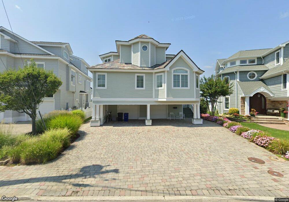
121 Anchor Rd Ocean City, NJ 08226
Estimated Value: $5,188,430 - $6,335,000
--
Bed
--
Bath
5,432
Sq Ft
$1,027/Sq Ft
Est. Value
About This Home
This home is located at 121 Anchor Rd, Ocean City, NJ 08226 and is currently estimated at $5,578,477, approximately $1,026 per square foot. 121 Anchor Rd is a home with nearby schools including Ocean City Primary School, Ocean City Intermediate School, and Ocean City High School.
Ownership History
Date
Name
Owned For
Owner Type
Purchase Details
Closed on
Mar 24, 1993
Sold by
Gentile Albert
Bought by
Atlantic City Electric & Nj Bell
Current Estimated Value
Purchase Details
Closed on
Dec 20, 1991
Sold by
New Jersey Dep
Bought by
Gentile Albert
Purchase Details
Closed on
Mar 1, 1986
Bought by
Gentile Albert
Create a Home Valuation Report for This Property
The Home Valuation Report is an in-depth analysis detailing your home's value as well as a comparison with similar homes in the area
Home Values in the Area
Average Home Value in this Area
Purchase History
| Date | Buyer | Sale Price | Title Company |
|---|---|---|---|
| Atlantic City Electric & Nj Bell | -- | -- | |
| Gentile Albert | $159,900 | -- | |
| Gentile Albert | $190,000 | -- |
Source: Public Records
Tax History Compared to Growth
Tax History
| Year | Tax Paid | Tax Assessment Tax Assessment Total Assessment is a certain percentage of the fair market value that is determined by local assessors to be the total taxable value of land and additions on the property. | Land | Improvement |
|---|---|---|---|---|
| 2025 | $28,599 | $2,548,900 | $1,315,600 | $1,233,300 |
| 2024 | $28,599 | $2,548,900 | $1,315,600 | $1,233,300 |
| 2023 | $27,299 | $2,548,900 | $1,315,600 | $1,233,300 |
| 2022 | $26,228 | $2,548,900 | $1,315,600 | $1,233,300 |
| 2021 | $19,015 | $2,548,900 | $1,315,600 | $1,233,300 |
| 2020 | $24,928 | $2,548,900 | $1,315,600 | $1,233,300 |
| 2019 | $24,648 | $2,548,900 | $1,315,600 | $1,233,300 |
| 2018 | $24,418 | $2,548,900 | $1,315,600 | $1,233,300 |
| 2017 | $24,036 | $2,548,900 | $1,315,600 | $1,233,300 |
| 2016 | $23,119 | $2,548,900 | $1,315,600 | $1,233,300 |
| 2015 | $22,813 | $2,548,900 | $1,315,600 | $1,233,300 |
| 2014 | $22,481 | $2,548,900 | $1,315,600 | $1,233,300 |
Source: Public Records
Map
Nearby Homes
- 1904 Glenwood Dr
- 1901 Glenwood Dr
- 71 Spruce Rd
- 2019 Glenwood Dr
- 233 W 17th St
- 38 Arkansas Ave
- 4 Grenada Ln
- 195 W 17th St Unit 1
- 31 Spruce Rd
- 1909 Rosemar Ln
- 170 W 17th St Unit 2
- 20 Gilbert Ln
- 1612 Pleasure Ave Unit 1
- 6 Walnut Rd
- 2104 Bay Ave
- 100 Reef Dr
- 100 Reef Dr Unit 94
- 1755 Bay Ave
- 103 Easterly Dr Unit 127
- 109 Easterly Dr Unit 130
- 1900 Glenwood Dr
- 119 Anchor Rd
- 1902 Glenwood Dr
- 117 Anchor Rd
- 102 Anchor Rd
- 115 Anchor Rd
- 1903 Glenwood Dr
- 1906 Glenwood Dr
- 113 Anchor Rd
- 1908 Glenwood Dr
- 1907 Glenwood Dr
- 111 Anchor Rd
- 1904 Ferndale Dr
- 1906 Ferndale Dr
- 1900 Ferndale Dr
- 1908 Ferndale Dr
- 1910 Glenwood Dr
- 109 Anchor Rd
- 103 Walnut Rd
- 1910 Ferndale Dr