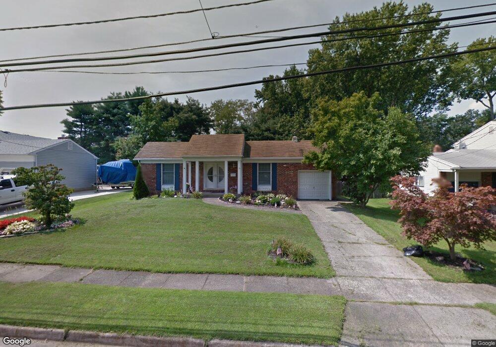
121 Apple Ln Mount Laurel, NJ 08054
Ramblewood NeighborhoodEstimated Value: $391,000 - $438,000
Studio
--
Bath
1,595
Sq Ft
$258/Sq Ft
Est. Value
About This Home
This home is located at 121 Apple Ln, Mount Laurel, NJ 08054 and is currently estimated at $411,950, approximately $258 per square foot. 121 Apple Ln is a home located in Burlington County with nearby schools including Countryside Elementary School, T.E. Harrington Middle School, and Mount Laurel Hartford School.
Ownership History
Date
Name
Owned For
Owner Type
Purchase Details
Closed on
Apr 22, 2005
Sold by
Pointon Scott A and Pointon Andrea A
Bought by
Underwood Steven and Underwood Mary Ellen
Current Estimated Value
Home Financials for this Owner
Home Financials are based on the most recent Mortgage that was taken out on this home.
Original Mortgage
$179,000
Outstanding Balance
$93,986
Interest Rate
6.05%
Mortgage Type
Fannie Mae Freddie Mac
Estimated Equity
$317,964
Purchase Details
Closed on
Jan 6, 2000
Sold by
Didomenico Perry and Didomenico Sara
Bought by
Pointon Scott A and Pointon Andrea A
Home Financials for this Owner
Home Financials are based on the most recent Mortgage that was taken out on this home.
Original Mortgage
$134,900
Interest Rate
7.79%
Mortgage Type
Stand Alone First
Create a Home Valuation Report for This Property
The Home Valuation Report is an in-depth analysis detailing your home's value as well as a comparison with similar homes in the area
Home Values in the Area
Average Home Value in this Area
Purchase History
| Date | Buyer | Sale Price | Title Company |
|---|---|---|---|
| Underwood Steven | $229,000 | -- | |
| Pointon Scott A | $142,000 | Lawyers Title Insurance Corp |
Source: Public Records
Mortgage History
| Date | Status | Borrower | Loan Amount |
|---|---|---|---|
| Open | Underwood Steven | $179,000 | |
| Previous Owner | Pointon Scott A | $134,900 |
Source: Public Records
Tax History
| Year | Tax Paid | Tax Assessment Tax Assessment Total Assessment is a certain percentage of the fair market value that is determined by local assessors to be the total taxable value of land and additions on the property. | Land | Improvement |
|---|---|---|---|---|
| 2025 | $5,932 | $187,900 | $70,500 | $117,400 |
| 2024 | $5,708 | $187,900 | $70,500 | $117,400 |
| 2023 | $5,708 | $187,900 | $70,500 | $117,400 |
| 2022 | $5,690 | $187,900 | $70,500 | $117,400 |
| 2021 | $5,583 | $187,900 | $70,500 | $117,400 |
| 2020 | $5,474 | $187,900 | $70,500 | $117,400 |
| 2019 | $5,417 | $187,900 | $70,500 | $117,400 |
| 2018 | $5,376 | $187,900 | $70,500 | $117,400 |
| 2017 | $5,237 | $187,900 | $70,500 | $117,400 |
| 2016 | $5,158 | $187,900 | $70,500 | $117,400 |
| 2015 | $5,098 | $187,900 | $70,500 | $117,400 |
| 2014 | $5,047 | $187,900 | $70,500 | $117,400 |
Source: Public Records
Map
Nearby Homes
- 174 Schoolhouse Ln
- 7 Federal St
- 25 S Church Rd Unit 128
- 25 S Church Rd Unit 129
- 25 S Church Rd Unit 138
- 25 S Church Rd Unit 131
- 29 Beaver Ave
- 411 Chapel Ave E
- 422 Chapel Ave E
- 537 Doe Ln
- 416 Chapel Ave E
- 8 Fountain Ct
- 606 Kings Croft
- 318 Kings Croft
- 418 Kingston Dr
- 708 Kings Croft Unit C0708
- 734 Kings Croft
- 102 Kings Croft
- 5 S Syracuse Dr
- 28 Forest Hill Dr
Your Personal Tour Guide
Ask me questions while you tour the home.