Estimated Value: $147,900 - $213,000
2
Beds
1
Bath
1,148
Sq Ft
$164/Sq Ft
Est. Value
About This Home
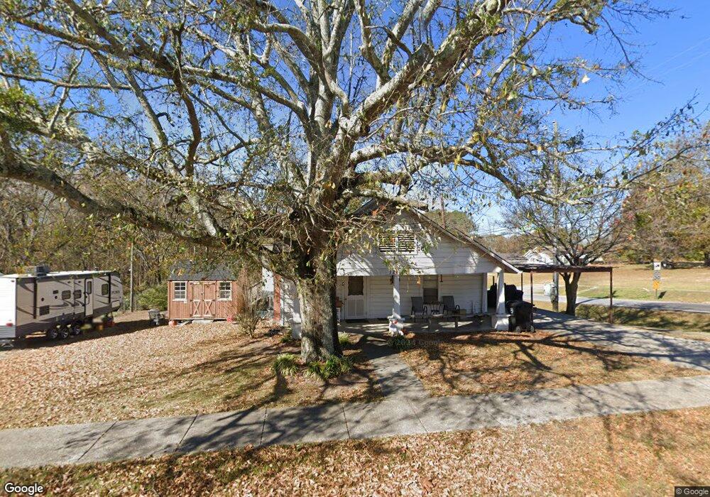
This home is located at 121 Atlantic Ave, Waco, GA 30182 and is currently estimated at $187,975, approximately $163 per square foot. 121 Atlantic Ave is a home with nearby schools including Haralson County High School.
Ownership History
Date
Name
Owned For
Owner Type
Purchase Details
Closed on
Aug 6, 2021
Sold by
Bailey Flint I
Bought by
Rogers Larry Eugene
Current Estimated Value
Purchase Details
Closed on
Jun 1, 2009
Sold by
City Of Waco
Bought by
Bailey Flint I
Purchase Details
Closed on
Jan 14, 2004
Sold by
Bailey Flint I and Bailey Peggy R
Bought by
Bailey Flint I and Bailey Peggy R
Purchase Details
Closed on
Sep 12, 2003
Sold by
Rogers Donald L Kenneth Jimmy and Rogers Donald L Others
Bought by
Bailey Flint I and Bailey Peggy R
Purchase Details
Closed on
Jun 27, 2002
Sold by
Parker Maggie H Estate By Garrett Gwen
Bought by
Rogers Donald L Kenneth Jimmy
Purchase Details
Closed on
Sep 7, 1999
Sold by
Rogers Susan Florenc
Bought by
Rogers Donald L Ken
Create a Home Valuation Report for This Property
The Home Valuation Report is an in-depth analysis detailing your home's value as well as a comparison with similar homes in the area
Home Values in the Area
Average Home Value in this Area
Purchase History
| Date | Buyer | Sale Price | Title Company |
|---|---|---|---|
| Rogers Larry Eugene | -- | -- | |
| Bailey Flint I | -- | -- | |
| Bailey Flint I | -- | -- | |
| Bailey Flint I | $54,000 | -- | |
| Rogers Donald L Kenneth Jimmy | -- | -- | |
| Rogers Donald L Ken | -- | -- |
Source: Public Records
Tax History Compared to Growth
Tax History
| Year | Tax Paid | Tax Assessment Tax Assessment Total Assessment is a certain percentage of the fair market value that is determined by local assessors to be the total taxable value of land and additions on the property. | Land | Improvement |
|---|---|---|---|---|
| 2024 | $974 | $33,113 | $4,325 | $28,788 |
| 2023 | $552 | $36,332 | $4,080 | $32,252 |
| 2022 | $804 | $29,439 | $4,080 | $25,359 |
| 2021 | $865 | $28,174 | $4,080 | $24,094 |
| 2020 | $542 | $17,640 | $4,080 | $13,560 |
| 2019 | $700 | $22,100 | $4,080 | $18,020 |
| 2018 | $345 | $10,710 | $4,080 | $6,630 |
| 2017 | $327 | $9,710 | $4,080 | $5,630 |
| 2016 | $500 | $16,320 | $4,080 | $12,240 |
| 2015 | $491 | $16,014 | $4,080 | $11,934 |
| 2014 | $491 | $15,534 | $3,600 | $11,934 |
Source: Public Records
Map
Nearby Homes
- 67 Depot St
- 0 King St Unit 7692079
- 381 King St
- 586 Old Bushmill Rd
- 0 Stonebridge Blvd Unit 143588
- 0 Mt Zion St Unit 7399245
- 101 Bush Creek Way
- 273 Sewell Rd
- 201 Stonebridge Blvd
- 6315 Highway 78
- 522 Atlantic Ave
- 327 Crest Pointe S
- 321 Stonebridge Blvd
- 319 Stonebridge Blvd
- 0 Sewell Rd Unit 10624236
- 0 Sewell Rd Unit 7665305
- 91 Sewell Rd
- 318 Stonebridge Blvd
- 0 Nitra Rd Unit 9546245
- 305 Crest Pointe S
- 135 Atlantic Ave
- 158 Wall St
- 158 Wall St
- 138 Atlantic Ave
- 149 Atlantic Ave
- 150 Atlantic Ave
- 145 Wall St
- 158 Atlantic Ave
- 31 McBurnett St
- 79 Atlantic Ave
- 164 Atlantic Ave
- 154 Wall St
- 71 Atlantic Ave
- 148 Carrollton St
- 35 McBurnett St
- 121 Wall St
- 167 Carrollton St
- 176 Atlantic Ave
- 55 Commercial Ave
- 164 Carrollton St