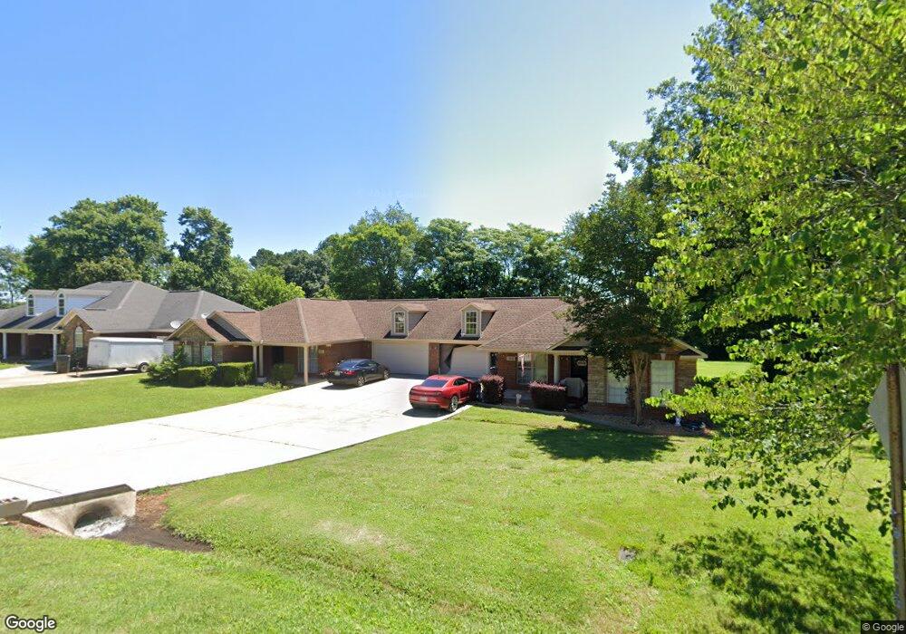
121 Aurora Dr Unit A & B Huntsville, AL 35811
Ryland NeighborhoodEstimated Value: $312,000 - $494,000
--
Bed
2
Baths
3,396
Sq Ft
$118/Sq Ft
Est. Value
About This Home
This home is located at 121 Aurora Dr Unit A & B, Huntsville, AL 35811 and is currently estimated at $401,331, approximately $118 per square foot. 121 Aurora Dr Unit A & B is a home located in Madison County with nearby schools including Mt Carmel Elementary School, Riverton Intermediate School, and Buckhorn Middle School.
Ownership History
Date
Name
Owned For
Owner Type
Purchase Details
Closed on
Jul 13, 2022
Sold by
Premium Properties Llc
Bought by
Valor Communities Llc
Current Estimated Value
Purchase Details
Closed on
Jan 10, 2020
Sold by
Powers Rental Properties Llc
Bought by
Williams Mariah
Home Financials for this Owner
Home Financials are based on the most recent Mortgage that was taken out on this home.
Original Mortgage
$327,360
Interest Rate
3.6%
Mortgage Type
VA
Purchase Details
Closed on
Dec 22, 2008
Sold by
Powers Carlos R
Bought by
Powers Rental Properties Llc
Home Financials for this Owner
Home Financials are based on the most recent Mortgage that was taken out on this home.
Original Mortgage
$195,000
Interest Rate
5.96%
Mortgage Type
Future Advance Clause Open End Mortgage
Create a Home Valuation Report for This Property
The Home Valuation Report is an in-depth analysis detailing your home's value as well as a comparison with similar homes in the area
Home Values in the Area
Average Home Value in this Area
Purchase History
| Date | Buyer | Sale Price | Title Company |
|---|---|---|---|
| Valor Communities Llc | $365,000 | South Justin | |
| Valor Communities Llc | $365,000 | None Listed On Document | |
| Williams Mariah | $320,000 | Valley Ttl & Closing Svcs Ll | |
| Powers Rental Properties Llc | -- | -- |
Source: Public Records
Mortgage History
| Date | Status | Borrower | Loan Amount |
|---|---|---|---|
| Previous Owner | Williams Mariah | $327,360 | |
| Previous Owner | Powers Rental Properties Llc | $195,000 |
Source: Public Records
Tax History Compared to Growth
Tax History
| Year | Tax Paid | Tax Assessment Tax Assessment Total Assessment is a certain percentage of the fair market value that is determined by local assessors to be the total taxable value of land and additions on the property. | Land | Improvement |
|---|---|---|---|---|
| 2024 | $1,218 | $33,820 | $3,000 | $30,820 |
| 2023 | $1,177 | $32,980 | $3,000 | $29,980 |
| 2022 | $1,042 | $29,960 | $1,100 | $28,860 |
| 2021 | $837 | $24,340 | $1,100 | $23,240 |
| 2020 | $1,652 | $45,440 | $2,180 | $43,260 |
| 2019 | $1,594 | $43,840 | $2,180 | $41,660 |
| 2018 | $1,243 | $34,220 | $0 | $0 |
| 2017 | $1,243 | $34,220 | $0 | $0 |
| 2016 | $1,243 | $34,220 | $0 | $0 |
| 2015 | $1,243 | $34,220 | $0 | $0 |
| 2014 | $1,280 | $35,220 | $0 | $0 |
Source: Public Records
Map
Nearby Homes
- 206 Antler Ridge Dr
- 232 Antler Ridge Dr
- 86+ Acres Jordan Rd
- 109 Oldwood Rd
- 106 Shields Lake Dr
- 108 Brookes Landing Dr
- 115 Somer Creek Ln
- 204 Paca Ln
- 228 Exeter St
- 232 Exeter St
- 300 Pond Spring Dr
- 301 Pond Spring Dr
- 303 Pond Spring Dr
- 230 Exeter St
- 107 Eden Ln
- 213 Somer Bridge Dr
- 111 Lo Ann Ln
- 107 Genesis Dr
- 117 Genesis Dr
- 201 Somerton Dr
- 218 Antler Ridge Dr
- 237 Antler Ridge Dr
- 241 Antler Ridge Dr
- 238 Antler Ridge Dr
- 236 Antler Ridge Dr
- 235 Antler Ridge Dr
- 242 Antler Ridge Dr
- 214 Antler Ridge Dr
- 239 Antler Ridge Dr
- 231 Antler Ridge Dr
- 210 Antler Ridge Dr
- 220 Antler Ridge Dr
- 222 Antler Ridge Dr
- 229 Antler Ridge Dr
- 227 Antler Ridge Dr
- 225 Antler Ridge Dr
- 223 Antler Ridge Dr
- 221 Antler Ridge Dr
- 219 Antler Ridge Dr
- 217 Antler Ridge Dr