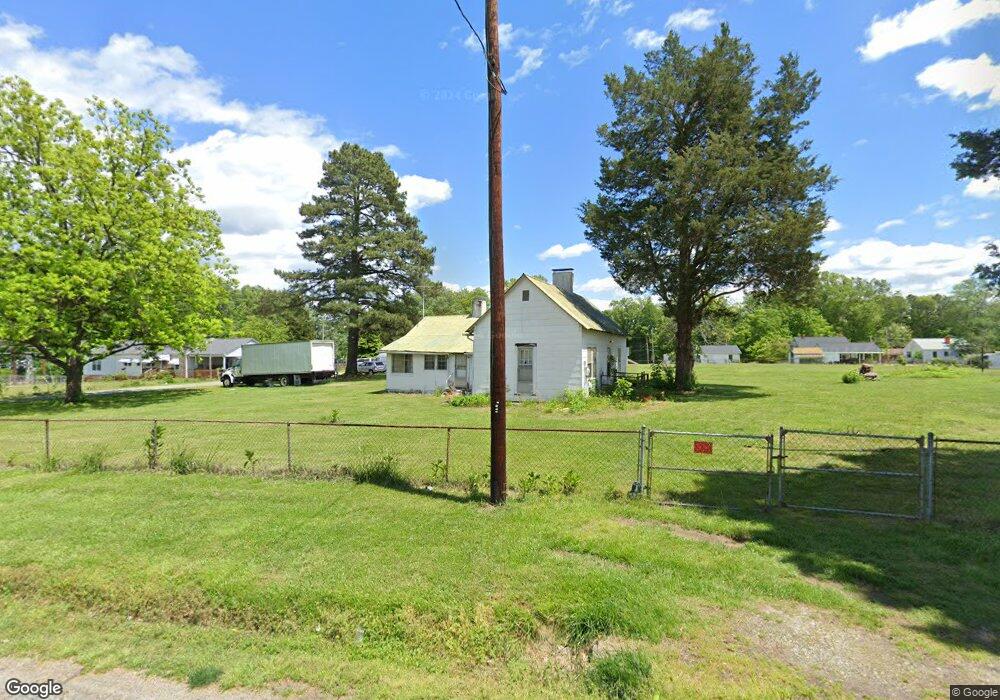
121 Avondale St High Point, NC 27260
Greater High Point NeighborhoodEstimated Value: $143,943 - $152,000
2
Beds
1
Bath
976
Sq Ft
$152/Sq Ft
Est. Value
About This Home
This home is located at 121 Avondale St, High Point, NC 27260 and is currently estimated at $148,648, approximately $152 per square foot. 121 Avondale St is a home located in Guilford County with nearby schools including Union Hill Elementary School, Jamestown Middle School, and Ragsdale High School.
Ownership History
Date
Name
Owned For
Owner Type
Purchase Details
Closed on
Oct 14, 2020
Sold by
White Kitty H and White Emmett H
Bought by
Zoom Max Management Llc
Current Estimated Value
Home Financials for this Owner
Home Financials are based on the most recent Mortgage that was taken out on this home.
Original Mortgage
$120,000
Outstanding Balance
$106,734
Interest Rate
2.9%
Mortgage Type
New Conventional
Estimated Equity
$41,914
Purchase Details
Closed on
Nov 19, 2015
Bought by
White Kitty H
Create a Home Valuation Report for This Property
The Home Valuation Report is an in-depth analysis detailing your home's value as well as a comparison with similar homes in the area
Home Values in the Area
Average Home Value in this Area
Purchase History
| Date | Buyer | Sale Price | Title Company |
|---|---|---|---|
| Zoom Max Management Llc | $160,000 | None Available | |
| White Kitty H | -- | -- |
Source: Public Records
Mortgage History
| Date | Status | Borrower | Loan Amount |
|---|---|---|---|
| Open | Zoom Max Management Llc | $120,000 |
Source: Public Records
Tax History
| Year | Tax Paid | Tax Assessment Tax Assessment Total Assessment is a certain percentage of the fair market value that is determined by local assessors to be the total taxable value of land and additions on the property. | Land | Improvement |
|---|---|---|---|---|
| 2025 | $1,206 | $87,500 | $37,500 | $50,000 |
| 2024 | $1,206 | $87,500 | $37,500 | $50,000 |
| 2023 | $1,206 | $87,500 | $37,500 | $50,000 |
| 2022 | $1,180 | $87,500 | $37,500 | $50,000 |
| 2021 | $881 | $63,900 | $28,800 | $35,100 |
| 2020 | $881 | $63,900 | $28,800 | $35,100 |
| 2019 | $881 | $63,900 | $0 | $0 |
| 2018 | $876 | $63,900 | $0 | $0 |
| 2017 | $876 | $63,900 | $0 | $0 |
| 2016 | $1,251 | $89,200 | $0 | $0 |
| 2015 | $1,258 | $89,200 | $0 | $0 |
| 2014 | $1,279 | $89,200 | $0 | $0 |
Source: Public Records
Map
Nearby Homes
- 206 Paramount St
- 404 Hickory Chapel Rd
- 2305 Delaware Place
- 735 Hendrix St
- 737 Hendrix St
- 615 Hendrix St
- 210 Paramount St
- 600 Hendrix St
- 2715 Central Ave
- 3215 E Martin Luther King Junior Dr
- 930 & 928 R1 Marlboro St
- 3304 Central Ave
- 709 Habersham Rd
- 928 Marlboro St
- 931 Marlboro St
- 3003 #REAR Oakcrest Ave
- 1451 Finsbury Ln
- 1456 London Dr
- 3335 Wiliton Way
- 509 Valleybrook Dr
- 117 Avondale St
- 116 Avondale St
- 120 Avondale St
- 114 Avondale St
- 128 Avondale St
- 123 Spring Garden Cir
- 122 Avondale St
- 119 Spring Garden Cir
- 131 Avondale St
- 129 Spring Garden Cir
- 130 Avondale St
- 117 Spring Garden Cir
- 131 Spring Garden Cir
- 112 Avondale St
- 000 Spring Garden Cir
- 113 Spring Garden Cir
- 133 Spring Garden Cir
- 109 Spring Garden Cir
- 124 Spring Garden Cir
- 120 Spring Garden Cir
Your Personal Tour Guide
Ask me questions while you tour the home.