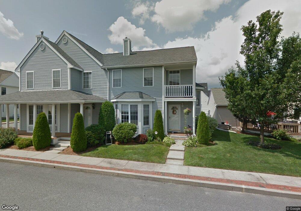
121 Boylston Dr Cranston, RI 02921
Comstock Gardens NeighborhoodEstimated Value: $464,107 - $539,000
2
Beds
3
Baths
2,004
Sq Ft
$252/Sq Ft
Est. Value
About This Home
This home is located at 121 Boylston Dr, Cranston, RI 02921 and is currently estimated at $505,277, approximately $252 per square foot. 121 Boylston Dr is a home located in Providence County with nearby schools including Orchard Farms El. School, Western Hills Middle School, and Cranston High School West.
Ownership History
Date
Name
Owned For
Owner Type
Purchase Details
Closed on
Aug 18, 2023
Sold by
Defusco Lorraine
Bought by
Defusco Dean
Current Estimated Value
Purchase Details
Closed on
Apr 28, 2017
Sold by
Russo Eugene A
Bought by
Defusco Lorraine
Purchase Details
Closed on
Dec 15, 2003
Sold by
Gibb Bruce and Gibb Victoria
Bought by
Russo Eugene and Russo Eugene
Purchase Details
Closed on
Oct 12, 2001
Sold by
Andrew J Land Dev Ri
Bought by
Gibb Barry B and Gibb Victoria
Home Financials for this Owner
Home Financials are based on the most recent Mortgage that was taken out on this home.
Original Mortgage
$181,900
Interest Rate
6.93%
Create a Home Valuation Report for This Property
The Home Valuation Report is an in-depth analysis detailing your home's value as well as a comparison with similar homes in the area
Home Values in the Area
Average Home Value in this Area
Purchase History
| Date | Buyer | Sale Price | Title Company |
|---|---|---|---|
| Defusco Dean | -- | None Available | |
| Defusco Lorraine | $315,000 | -- | |
| Russo Eugene | $290,000 | -- | |
| Gibb Barry B | $242,500 | -- |
Source: Public Records
Mortgage History
| Date | Status | Borrower | Loan Amount |
|---|---|---|---|
| Previous Owner | Gibb Barry B | $164,515 | |
| Previous Owner | Gibb Barry B | $181,900 |
Source: Public Records
Tax History
| Year | Tax Paid | Tax Assessment Tax Assessment Total Assessment is a certain percentage of the fair market value that is determined by local assessors to be the total taxable value of land and additions on the property. | Land | Improvement |
|---|---|---|---|---|
| 2025 | $5,609 | $404,100 | $0 | $404,100 |
| 2024 | $5,500 | $404,100 | $0 | $404,100 |
| 2023 | $5,855 | $309,800 | $0 | $309,800 |
| 2022 | $5,734 | $309,800 | $0 | $309,800 |
| 2021 | $5,576 | $309,800 | $0 | $309,800 |
| 2020 | $5,735 | $276,100 | $0 | $276,100 |
| 2019 | $5,735 | $276,100 | $0 | $276,100 |
| 2018 | $5,602 | $276,100 | $0 | $276,100 |
| 2017 | $5,558 | $242,300 | $0 | $242,300 |
| 2016 | $5,440 | $242,300 | $0 | $242,300 |
| 2015 | $5,440 | $242,300 | $0 | $242,300 |
| 2014 | $6,233 | $272,900 | $0 | $272,900 |
Source: Public Records
Map
Nearby Homes
- 7 Gray Coach W Unit 711
- 9 Gray Coach Ln Unit 911
- 7 Taylor Rd
- 0 Plainfield Pike
- 2073 Plainfield Pike
- 1835 Plainfield Pike
- 20 Doreen Ct
- 02 Paula Ln
- 01 Paula Ln
- 51 Janet Dr
- 117 Moccasin Trail
- 1757 Plainfield Pike
- 12 Beechwood Dr
- 129 Simmonsville Ave
- 71 Elite Dr
- 75 Elite Dr
- 82 Mohawk Trail
- 0 Anthony Dr Unit 1394338
- 27 Nardolillo St
- 12 Alvina Dr
- 121 Boylston Dr
- 121 Boylston Dr Unit 121
- 117 Boylston Dr
- 113 Boylston Dr
- 125 Boylston Dr
- 125 Boylston Dr Unit 125
- 118 Boylston Dr
- 118 Boylston Dr Unit 118
- 114 Boylston Dr
- 129 Boylston Dr
- 244 Cheshire Dr
- 240 Cheshire Dr
- 110 Boylston Dr
- 109 Boylston Dr
- 109 Boylston Dr Unit 109
- 122 Boylston Dr
- 106 Boylston Dr
- 106 Boylston Dr
- 106 Boylston Dr Unit C
- 133 Boylston Dr
Your Personal Tour Guide
Ask me questions while you tour the home.