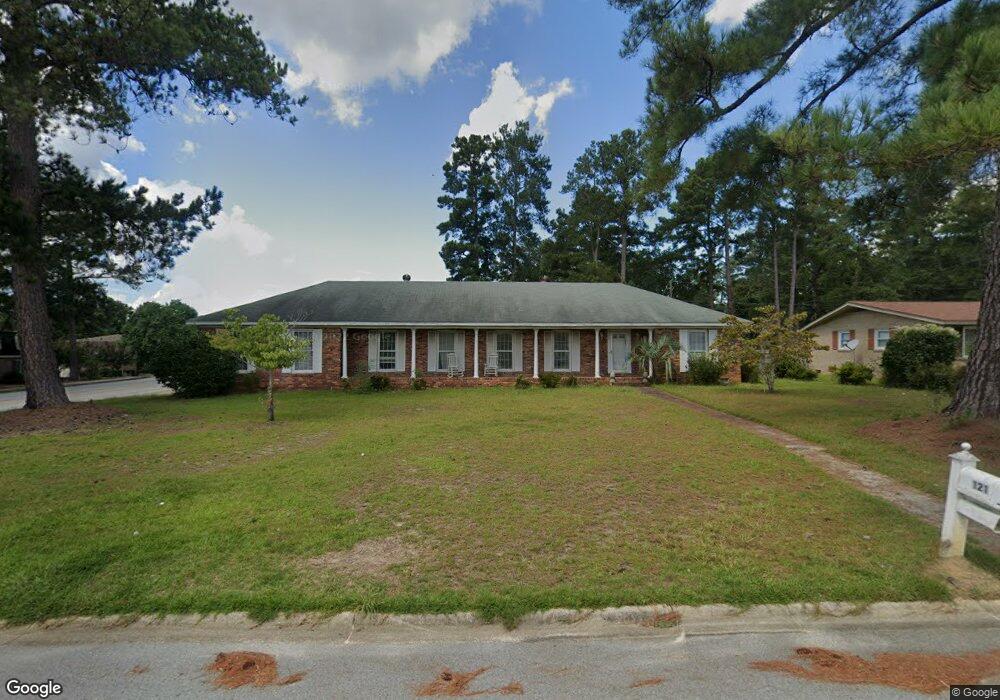
121 Burnsdowne Rd Columbia, SC 29210
Seven Oaks NeighborhoodEstimated Value: $257,863 - $300,000
4
Beds
2
Baths
1,774
Sq Ft
$155/Sq Ft
Est. Value
About This Home
This home is located at 121 Burnsdowne Rd, Columbia, SC 29210 and is currently estimated at $274,716, approximately $154 per square foot. 121 Burnsdowne Rd is a home located in Lexington County with nearby schools including Seven Oaks Elementary School, Irmo Middle, and Irmo High.
Ownership History
Date
Name
Owned For
Owner Type
Purchase Details
Closed on
Mar 16, 2023
Sold by
Miller Michael A
Bought by
Pearman Charles N
Current Estimated Value
Purchase Details
Closed on
May 14, 2013
Sold by
Brown Heather Hendrix and Fernley Karen
Bought by
Miller Michael Andrew
Purchase Details
Closed on
Dec 26, 2007
Sold by
Estate Of Miriam B Fernley and Fernley Karen L
Bought by
Fernley Karen and Brown Heather Hendrix
Purchase Details
Closed on
Aug 1, 2007
Sold by
Olsen Karen Fernley and Brown Heather Hendrix
Bought by
Fernley Miriam B
Purchase Details
Closed on
Jan 25, 2007
Sold by
Fernley Miriam B
Bought by
Olsen Karen Fernley and Brown Heather Hendrix
Create a Home Valuation Report for This Property
The Home Valuation Report is an in-depth analysis detailing your home's value as well as a comparison with similar homes in the area
Home Values in the Area
Average Home Value in this Area
Purchase History
| Date | Buyer | Sale Price | Title Company |
|---|---|---|---|
| Pearman Charles N | -- | -- | |
| Miller Michael Andrew | $124,000 | -- | |
| Fernley Karen | -- | -- | |
| Fernley Miriam B | -- | None Available | |
| Olsen Karen Fernley | -- | None Available |
Source: Public Records
Tax History Compared to Growth
Tax History
| Year | Tax Paid | Tax Assessment Tax Assessment Total Assessment is a certain percentage of the fair market value that is determined by local assessors to be the total taxable value of land and additions on the property. | Land | Improvement |
|---|---|---|---|---|
| 2024 | $1,440 | $9,400 | $1,400 | $8,000 |
| 2023 | $1,440 | $5,741 | $1,272 | $4,469 |
| 2022 | $513 | $5,741 | $1,272 | $4,469 |
| 2020 | $592 | $5,741 | $1,272 | $4,469 |
| 2019 | $439 | $4,992 | $1,200 | $3,792 |
| 2018 | $368 | $4,992 | $1,200 | $3,792 |
| 2017 | $354 | $4,992 | $1,200 | $3,792 |
| 2016 | $729 | $4,992 | $1,200 | $3,792 |
| 2014 | $729 | $4,959 | $1,200 | $3,759 |
| 2013 | -- | $5,810 | $1,200 | $4,610 |
Source: Public Records
Map
Nearby Homes
- 3725 Harrogate Rd
- 1115 Gardendale Dr
- 163 Cheshire Dr
- 139 Cheshire Dr
- 320 Brookshire Dr
- 875 Gardendale Dr
- 107 Southwell Rd
- 411 Willow Winds Dr
- 326 Townes Rd
- 224 Linsbury Cir
- 119 Wilkshire Dr
- 816 Rollingwood Trail
- 412 Blue Robin Ln
- 440 Leton Dr
- 116 Rustic Ct
- 531 Sulgrave Dr
- 1108 William And Mary Ct
- 2034 Shallow Bluff Ct
- 2046 Shallow Bluff Ct
- 2028 Shallow Bluff Ct
- 127 Burnsdowne Rd
- 133 Dunaway Ct
- 120 Burnsdowne Rd
- 133 Burnsdowne Rd
- 129 Dunaway Ct
- 126 Burnsdowne Rd
- 224 Saint Andrews Rd
- 230 Saint Andrews Rd
- 230 St Andrews Rd
- 3725 Bush River Rd
- 125 Dunaway Ct
- 218 Saint Andrews Rd
- 236 Saint Andrews Rd
- 212 Saint Andrews Rd
- 114 Tram Rd
- 234 Saint Andrews Rd
- 3711 Seawright Rd
- 206 Saint Andrews Rd
- 120 Tram Rd
- 3700 Bush River Rd Unit I-6