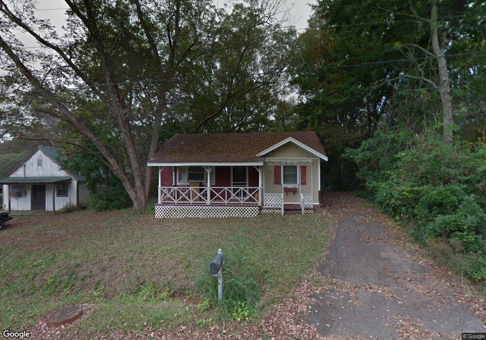
121 Clay St Maysville, GA 30558
Estimated Value: $101,000 - $225,000
2
Beds
1
Bath
740
Sq Ft
$243/Sq Ft
Est. Value
About This Home
This home is located at 121 Clay St, Maysville, GA 30558 and is currently estimated at $179,496, approximately $242 per square foot. 121 Clay St is a home located in Banks County with nearby schools including Banks County Primary School, Banks County Elementary School, and Banks County Middle School.
Ownership History
Date
Name
Owned For
Owner Type
Purchase Details
Closed on
Oct 26, 2006
Sold by
Brown Justin K
Bought by
Allen Michael D
Current Estimated Value
Home Financials for this Owner
Home Financials are based on the most recent Mortgage that was taken out on this home.
Original Mortgage
$60,800
Outstanding Balance
$35,711
Interest Rate
6.27%
Mortgage Type
New Conventional
Estimated Equity
$143,785
Create a Home Valuation Report for This Property
The Home Valuation Report is an in-depth analysis detailing your home's value as well as a comparison with similar homes in the area
Home Values in the Area
Average Home Value in this Area
Purchase History
| Date | Buyer | Sale Price | Title Company |
|---|---|---|---|
| Allen Michael D | $60,800 | -- |
Source: Public Records
Mortgage History
| Date | Status | Borrower | Loan Amount |
|---|---|---|---|
| Open | Allen Michael D | $60,800 |
Source: Public Records
Tax History Compared to Growth
Tax History
| Year | Tax Paid | Tax Assessment Tax Assessment Total Assessment is a certain percentage of the fair market value that is determined by local assessors to be the total taxable value of land and additions on the property. | Land | Improvement |
|---|---|---|---|---|
| 2025 | $891 | $49,395 | $3,542 | $45,853 |
| 2024 | $891 | $47,332 | $3,220 | $44,112 |
| 2023 | $919 | $40,837 | $3,609 | $37,228 |
| 2022 | $741 | $35,959 | $3,609 | $32,350 |
| 2021 | $421 | $20,050 | $681 | $19,369 |
| 2020 | $410 | $19,056 | $681 | $18,375 |
| 2019 | $412 | $19,056 | $681 | $18,375 |
| 2018 | $367 | $16,954 | $681 | $16,273 |
| 2017 | $427 | $19,177 | $681 | $18,496 |
| 2016 | $442 | $19,177 | $681 | $18,496 |
| 2015 | $418 | $19,716 | $1,220 | $18,496 |
| 2014 | $418 | $19,716 | $1,220 | $18,496 |
| 2013 | -- | $19,716 | $1,220 | $18,496 |
Source: Public Records
Map
Nearby Homes
- 127 Brevard St
- 82 Maywood Ct
- 129 Crane St
- 362 Sims St
- 108 Lillie Ln
- 241 Sims St
- 382 Freeman Dr
- 393 W Freeman St
- 500 W Freeman St
- 199 Deadwyler Rd
- 75 Meadow Lark Way
- Plan 2604 at Eagle Heights
- Plan 2505 at Eagle Heights
- Plan 2906 at Eagle Heights
- Plan 1709 at Eagle Heights
- Plan 1826 at Eagle Heights
- Plan 2628 at Eagle Heights
- Plan 2239 at Eagle Heights
- Plan 1902 at Eagle Heights
- Plan 2307 at Eagle Heights