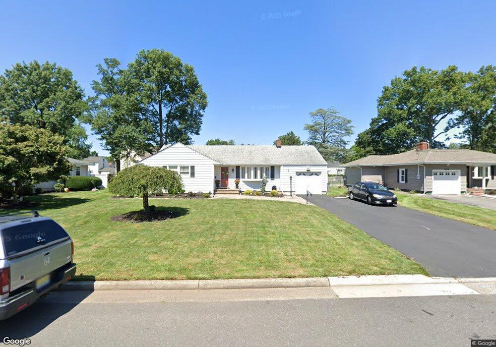
121 Clifford St South Plainfield, NJ 07080
Estimated Value: $586,000 - $668,000
3
Beds
3
Baths
2,305
Sq Ft
$276/Sq Ft
Est. Value
About This Home
This home is located at 121 Clifford St, South Plainfield, NJ 07080 and is currently estimated at $637,258, approximately $276 per square foot. 121 Clifford St is a home located in Middlesex County with nearby schools including South Plainfield High School, The Queen City Academy Charter School, and Koinonia Academy.
Ownership History
Date
Name
Owned For
Owner Type
Purchase Details
Closed on
Oct 8, 2009
Sold by
Egan Donna and Cusanelli Filomena
Bought by
Hernandez Joel and Hernandez Jillian
Current Estimated Value
Home Financials for this Owner
Home Financials are based on the most recent Mortgage that was taken out on this home.
Original Mortgage
$299,475
Outstanding Balance
$195,652
Interest Rate
5.09%
Mortgage Type
FHA
Estimated Equity
$441,606
Create a Home Valuation Report for This Property
The Home Valuation Report is an in-depth analysis detailing your home's value as well as a comparison with similar homes in the area
Home Values in the Area
Average Home Value in this Area
Purchase History
| Date | Buyer | Sale Price | Title Company |
|---|---|---|---|
| Hernandez Joel | $305,000 | Multiple |
Source: Public Records
Mortgage History
| Date | Status | Borrower | Loan Amount |
|---|---|---|---|
| Open | Hernandez Joel | $299,475 |
Source: Public Records
Tax History Compared to Growth
Tax History
| Year | Tax Paid | Tax Assessment Tax Assessment Total Assessment is a certain percentage of the fair market value that is determined by local assessors to be the total taxable value of land and additions on the property. | Land | Improvement |
|---|---|---|---|---|
| 2025 | $7,457 | $106,800 | $34,400 | $72,400 |
| 2024 | $7,132 | $106,800 | $34,400 | $72,400 |
| 2023 | $7,132 | $106,800 | $34,400 | $72,400 |
| 2022 | $6,516 | $98,800 | $34,400 | $64,400 |
| 2021 | $6,363 | $98,800 | $34,400 | $64,400 |
| 2020 | $6,270 | $98,800 | $34,400 | $64,400 |
| 2019 | $6,016 | $98,800 | $34,400 | $64,400 |
| 2018 | $5,861 | $98,800 | $34,400 | $64,400 |
| 2017 | $5,786 | $98,800 | $34,400 | $64,400 |
| 2016 | $5,727 | $98,800 | $34,400 | $64,400 |
| 2015 | $5,629 | $98,800 | $34,400 | $64,400 |
| 2014 | $5,467 | $98,800 | $34,400 | $64,400 |
Source: Public Records
Map
Nearby Homes
- 105 Firth St
- 1210 Field Ave
- 1221 Grant Ave Unit 23
- 1712 Kenyon Ave
- 1400 Kenyon Ave
- 1726 Kenyon Ave
- 1210 Maltby Ave
- 909 Sherman Ave
- 127 Remington Ave Unit 31
- 814 Sherman Ave Unit 18
- 551 Melrose Ave
- 916 Sherman Ave
- 917 Tompkins Ave
- 139 Palmer Ave
- 905 Stelle Ave Unit 7
- 132 Parkside Rd
- 1066 Allenwood Dr
- 77 Parkside Rd Unit 89
- 533 Edgar Ave
- 413 W 8th St
- 127 Clifford St
- 115 Clifford St
- 135 Clifford St
- 120 Clifford St
- 118 Clifford St
- 124 Firth St
- 116 Firth St
- 130 Firth St
- 1521 Plainfield Ave
- 1519 Plainfield Ave
- 128 Clifford St
- 1515 Plainfield Ave
- 134 Firth St
- 108 Firth St
- 1601 Plainfield Ave
- 1520 Field Ave
- 1503 Plainfield Ave
- 1600 Field Ave
- 1510 Field Ave
- 125 Rahway Ave