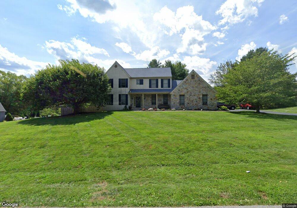
121 Davenport Rd Kennett Square, PA 19348
Estimated Value: $692,950 - $761,000
4
Beds
3
Baths
2,640
Sq Ft
$270/Sq Ft
Est. Value
About This Home
This home is located at 121 Davenport Rd, Kennett Square, PA 19348 and is currently estimated at $712,238, approximately $269 per square foot. 121 Davenport Rd is a home located in Chester County with nearby schools including Kennett Middle School, Kennett High School, and St. Patrick School.
Ownership History
Date
Name
Owned For
Owner Type
Purchase Details
Closed on
Sep 15, 2006
Sold by
Crognale Lesia P
Bought by
Crognale Anthony F
Current Estimated Value
Home Financials for this Owner
Home Financials are based on the most recent Mortgage that was taken out on this home.
Original Mortgage
$265,000
Interest Rate
6.48%
Mortgage Type
New Conventional
Create a Home Valuation Report for This Property
The Home Valuation Report is an in-depth analysis detailing your home's value as well as a comparison with similar homes in the area
Home Values in the Area
Average Home Value in this Area
Purchase History
| Date | Buyer | Sale Price | Title Company |
|---|---|---|---|
| Crognale Anthony F | -- | First Title & Escrow Inc |
Source: Public Records
Mortgage History
| Date | Status | Borrower | Loan Amount |
|---|---|---|---|
| Closed | Crognale Anthony F | $265,000 |
Source: Public Records
Tax History Compared to Growth
Tax History
| Year | Tax Paid | Tax Assessment Tax Assessment Total Assessment is a certain percentage of the fair market value that is determined by local assessors to be the total taxable value of land and additions on the property. | Land | Improvement |
|---|---|---|---|---|
| 2025 | $9,050 | $221,930 | $58,820 | $163,110 |
| 2024 | $9,050 | $221,930 | $58,820 | $163,110 |
| 2023 | $8,874 | $221,930 | $58,820 | $163,110 |
| 2022 | $8,638 | $221,930 | $58,820 | $163,110 |
| 2021 | $8,508 | $221,930 | $58,820 | $163,110 |
| 2020 | $8,349 | $221,930 | $58,820 | $163,110 |
| 2019 | $8,237 | $221,930 | $58,820 | $163,110 |
| 2018 | $8,067 | $221,930 | $58,820 | $163,110 |
| 2017 | $7,503 | $221,930 | $58,820 | $163,110 |
| 2016 | $880 | $221,930 | $58,820 | $163,110 |
| 2015 | $880 | $221,930 | $58,820 | $163,110 |
| 2014 | $880 | $221,930 | $58,820 | $163,110 |
Source: Public Records
Map
Nearby Homes
- 119 Davenport Rd
- 123 Davenport Rd
- 125 Davenport Rd
- 134 Davenport Rd
- 129 Davenport Rd
- 132 Davenport Rd
- 136 Davenport Rd
- 117 Davenport Rd
- 130 Davenport Rd
- 138 Davenport Rd
- 150 Davenport Rd
- 140 Davenport Rd
- 148 Davenport Rd
- 131 Davenport Rd
- 142 Davenport Rd
- 152 Davenport Rd
- 144 Davenport Rd
- 115 Davenport Rd
- 128 Davenport Rd
- 146 Davenport Rd