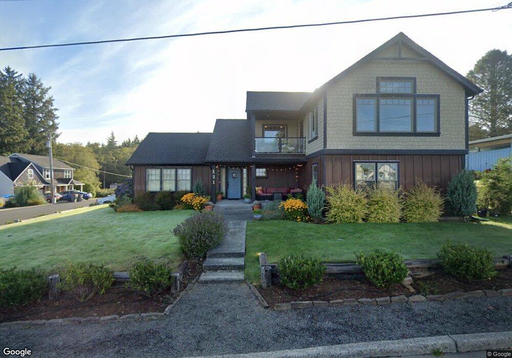
121 Hilltop Dr Seaside, OR 97138
Estimated Value: $530,000 - $781,000
3
Beds
2
Baths
1,744
Sq Ft
$395/Sq Ft
Est. Value
About This Home
This home is located at 121 Hilltop Dr, Seaside, OR 97138 and is currently estimated at $688,562, approximately $394 per square foot. 121 Hilltop Dr is a home located in Clatsop County with nearby schools including Seaside High School.
Ownership History
Date
Name
Owned For
Owner Type
Purchase Details
Closed on
Jan 11, 2013
Sold by
Bank Of America Na
Bought by
Smith Ted and Smith Julie
Current Estimated Value
Purchase Details
Closed on
Apr 5, 2012
Sold by
Girtle Robert J
Bought by
Bank Of America N A
Purchase Details
Closed on
Nov 4, 2005
Sold by
Girtle Robert J
Bought by
Girtle Robert J and Robert J Girtle Sr Revocable Living Tr
Create a Home Valuation Report for This Property
The Home Valuation Report is an in-depth analysis detailing your home's value as well as a comparison with similar homes in the area
Home Values in the Area
Average Home Value in this Area
Purchase History
| Date | Buyer | Sale Price | Title Company |
|---|---|---|---|
| Smith Ted | $165,000 | Accommodation | |
| Bank Of America N A | $165,000 | Accommodation | |
| Girtle Robert J | -- | None Available |
Source: Public Records
Tax History Compared to Growth
Tax History
| Year | Tax Paid | Tax Assessment Tax Assessment Total Assessment is a certain percentage of the fair market value that is determined by local assessors to be the total taxable value of land and additions on the property. | Land | Improvement |
|---|---|---|---|---|
| 2025 | $6,607 | $459,776 | -- | -- |
| 2024 | $6,413 | $446,386 | -- | -- |
| 2023 | $6,223 | $433,385 | $0 | $0 |
| 2022 | $6,053 | $420,763 | $0 | $0 |
| 2021 | $5,925 | $408,509 | $0 | $0 |
| 2020 | $5,787 | $396,612 | $0 | $0 |
| 2019 | $5,629 | $385,061 | $0 | $0 |
| 2018 | $5,405 | $373,847 | $0 | $0 |
| 2017 | $5,130 | $362,959 | $0 | $0 |
| 2016 | $4,479 | $352,388 | $89,940 | $262,448 |
| 2015 | $4,313 | $342,125 | $87,321 | $254,804 |
| 2014 | $2,430 | $190,332 | $0 | $0 |
| 2013 | -- | $188,125 | $0 | $0 |
Source: Public Records
Map
Nearby Homes
- 360 Hilltop Dr
- 343 Hemlock St
- 1659 Whispering Pines Dr
- 0 Alpine St Unit 601537278
- 405 S Wahanna Rd
- 1269 Avenue D
- 1265 Avenue D
- 1295 Jeffrey Dr
- VL Spruce Dr
- 0 Spruce Dr Unit 682748764
- 481 Hillside Loop
- 1299 6th Ave
- 1110 6th Ave
- 1116 6th Ave
- 1000 S King St
- 830 Oceanway St
- 720 Avenue G
- 321 N Holladay Dr
- 720 740 Avenue G
- 0 Vacant Land Unit 159249124
- 141 Hilltop Dr
- 99 Hilltop Dr
- 161 Hilltop Dr
- 161 Hilltop 1weuouo20myd
- 2021 Aldercrest St
- 140 Hilltop Dr
- 2022 Cedar St
- 160 Hilltop Dr
- 120 Hilltop Dr
- 0 Hilltop Dr Unit 15-1249
- 0 Hilltop Dr Unit Lot 7 15164754
- 0 Hilltop Dr
- 2020 Aldercrest St
- 80 Hilltop Dr
- 2041 Aldercrest St
- 2003 Cedar St
- 2042 Cedar St
- 77 Hilltop Dr
- 77 Hilltop Dr
- 60 Hilltop Dr