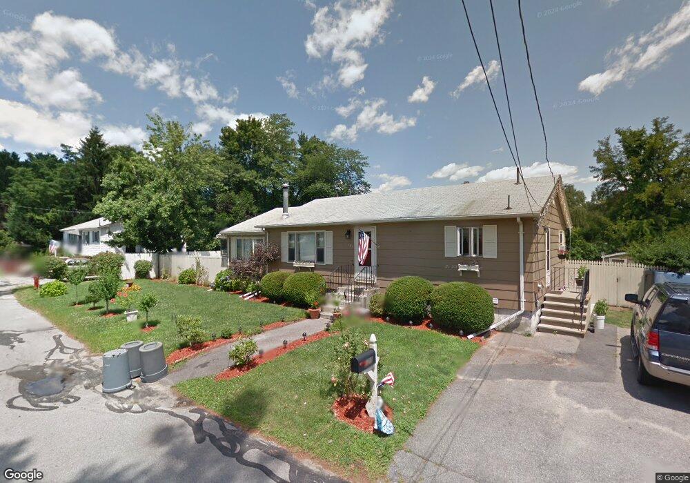
121 Homefield Ave Dracut, MA 01826
Estimated Value: $529,000 - $565,000
4
Beds
2
Baths
1,404
Sq Ft
$387/Sq Ft
Est. Value
About This Home
This home is located at 121 Homefield Ave, Dracut, MA 01826 and is currently estimated at $543,466, approximately $387 per square foot. 121 Homefield Ave is a home located in Middlesex County with nearby schools including George H. Englesby Elementary School, Richardson Middle School, and Dracut Senior High School.
Ownership History
Date
Name
Owned For
Owner Type
Purchase Details
Closed on
Nov 10, 2006
Sold by
Britton Jennifer M and Nute Jennifer M
Bought by
Difiore Antonino and Difiore Kimberly A
Current Estimated Value
Home Financials for this Owner
Home Financials are based on the most recent Mortgage that was taken out on this home.
Original Mortgage
$279,900
Outstanding Balance
$166,492
Interest Rate
6.31%
Mortgage Type
Purchase Money Mortgage
Estimated Equity
$376,974
Purchase Details
Closed on
Jan 30, 1995
Sold by
Dascensao Jorge and Dascensao Sandra
Bought by
Britton Timothy and Nute Jennifer
Create a Home Valuation Report for This Property
The Home Valuation Report is an in-depth analysis detailing your home's value as well as a comparison with similar homes in the area
Home Values in the Area
Average Home Value in this Area
Purchase History
| Date | Buyer | Sale Price | Title Company |
|---|---|---|---|
| Difiore Antonino | $279,900 | -- | |
| Britton Timothy | $115,000 | -- |
Source: Public Records
Mortgage History
| Date | Status | Borrower | Loan Amount |
|---|---|---|---|
| Open | Difiore Antonino | $279,900 | |
| Previous Owner | Britton Timothy | $114,900 | |
| Previous Owner | Britton Timothy | $20,000 | |
| Previous Owner | Britton Timothy | $6,000 |
Source: Public Records
Tax History Compared to Growth
Tax History
| Year | Tax Paid | Tax Assessment Tax Assessment Total Assessment is a certain percentage of the fair market value that is determined by local assessors to be the total taxable value of land and additions on the property. | Land | Improvement |
|---|---|---|---|---|
| 2025 | $4,381 | $432,900 | $192,200 | $240,700 |
| 2024 | $4,366 | $417,800 | $183,000 | $234,800 |
| 2023 | $4,182 | $361,100 | $159,100 | $202,000 |
| 2022 | $4,110 | $334,400 | $144,600 | $189,800 |
| 2021 | $10,132 | $304,900 | $131,500 | $173,400 |
| 2020 | $3,815 | $285,800 | $127,700 | $158,100 |
| 2019 | $3,725 | $270,900 | $121,600 | $149,300 |
| 2018 | $10,128 | $246,800 | $121,600 | $125,200 |
| 2017 | $3,480 | $246,800 | $121,600 | $125,200 |
| 2016 | $3,338 | $224,900 | $116,900 | $108,000 |
| 2015 | $3,237 | $216,800 | $116,900 | $99,900 |
| 2014 | $3,023 | $208,600 | $116,900 | $91,700 |
Source: Public Records
Map
Nearby Homes
- 45 Hoover St
- 101 Donohue Rd Unit 19
- 101 Donohue Rd Unit 3
- 109 Navy Yard Rd
- 35 Honora Ave
- 57 Lantern Ln Unit 3
- 25 Shea St Unit 8
- 161 Flower Ln Unit 5
- 382 University Ave
- 380 University Ave
- 15 Louis Farm Rd Unit 15
- 148 Flower Ln Unit 14
- 94 Hampson St
- 16 Wiggin Terrace
- 625 Mammoth Rd
- 107 7th Ave
- 33 W Meadow Rd
- 61 7th Ave W
- 14 Louis Farm Rd Unit 14
- 1410 Skyline Dr Unit 9
- 162 Gerrish Ave
- 127 Homefield Ave
- 131 Homefield Ave
- 154 Gerrish Ave
- 8 Valera St
- 152 Gerrish Ave
- 12 Valera St
- 148 Gerrish Ave
- 155 Gerrish Ave
- 14 Mercier St
- 9 Valera St
- 138 Homefield Ave
- 95 Homefield Ave
- 171 Gerrish Ave
- 20 Valera St
- 5 Hopeland St
- 17 Mercier St
- 140 Gerrish Ave
- 175 Gerrish Ave
- 149 Gerrish Ave