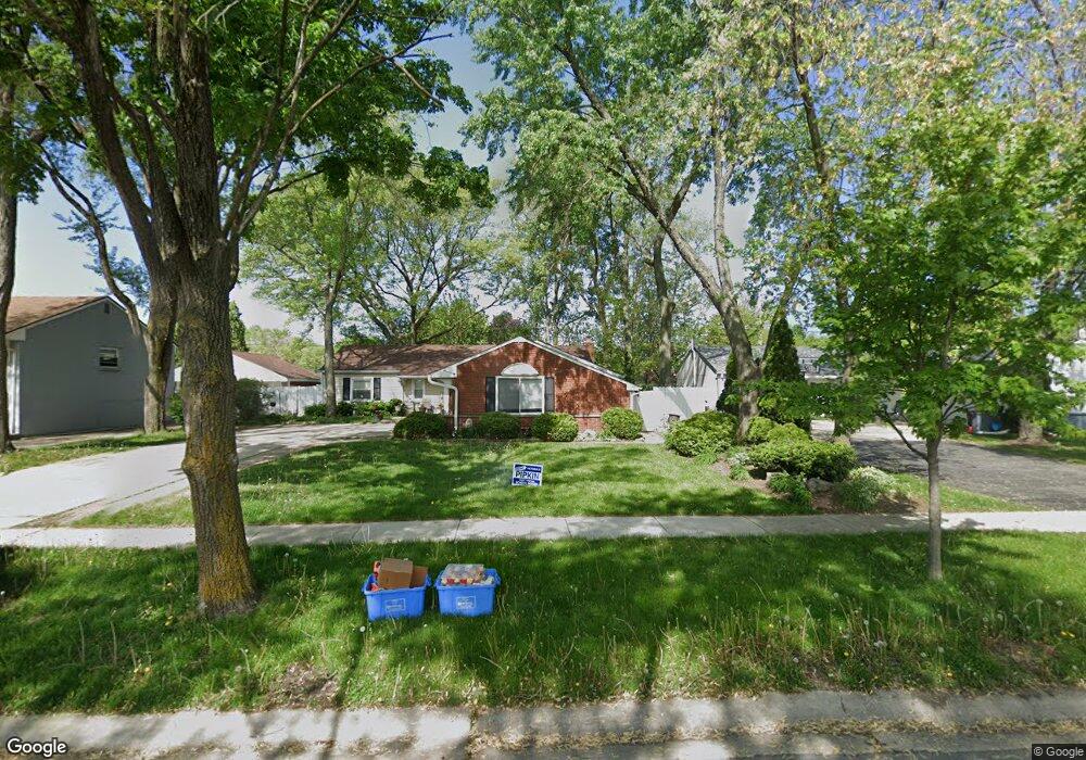
121 Kingston Rd Unit 5 Bolingbrook, IL 60440
East Bolingbrook NeighborhoodEstimated Value: $274,000 - $322,000
5
Beds
2
Baths
1,372
Sq Ft
$214/Sq Ft
Est. Value
About This Home
This home is located at 121 Kingston Rd Unit 5, Bolingbrook, IL 60440 and is currently estimated at $293,690, approximately $214 per square foot. 121 Kingston Rd Unit 5 is a home located in Will County with nearby schools including Bernard J Ward Elementary School, Hubert H Humphrey Middle School, and Bolingbrook High School.
Ownership History
Date
Name
Owned For
Owner Type
Purchase Details
Closed on
Jul 29, 1999
Sold by
Starosta Erwin L and Starosta Julie C
Bought by
Esparza Juan C
Current Estimated Value
Home Financials for this Owner
Home Financials are based on the most recent Mortgage that was taken out on this home.
Original Mortgage
$116,321
Interest Rate
8.21%
Mortgage Type
FHA
Purchase Details
Closed on
May 26, 1992
Bought by
Esparza Juan C
Create a Home Valuation Report for This Property
The Home Valuation Report is an in-depth analysis detailing your home's value as well as a comparison with similar homes in the area
Home Values in the Area
Average Home Value in this Area
Purchase History
| Date | Buyer | Sale Price | Title Company |
|---|---|---|---|
| Esparza Juan C | $116,500 | -- | |
| Esparza Juan C | $87,000 | -- |
Source: Public Records
Mortgage History
| Date | Status | Borrower | Loan Amount |
|---|---|---|---|
| Previous Owner | Esparza Juan C | $116,321 |
Source: Public Records
Tax History
| Year | Tax Paid | Tax Assessment Tax Assessment Total Assessment is a certain percentage of the fair market value that is determined by local assessors to be the total taxable value of land and additions on the property. | Land | Improvement |
|---|---|---|---|---|
| 2024 | $6,948 | $83,236 | $19,575 | $63,661 |
| 2023 | $6,948 | $74,893 | $17,613 | $57,280 |
| 2022 | $6,081 | $67,520 | $15,879 | $51,641 |
| 2021 | $5,752 | $63,132 | $14,847 | $48,285 |
| 2020 | $5,569 | $61,056 | $14,359 | $46,697 |
| 2019 | $5,263 | $57,008 | $13,407 | $43,601 |
| 2018 | $4,824 | $52,444 | $12,333 | $40,111 |
| 2017 | $4,581 | $49,710 | $11,690 | $38,020 |
| 2016 | $4,242 | $45,500 | $10,700 | $34,800 |
| 2015 | $3,951 | $43,700 | $10,300 | $33,400 |
| 2014 | $3,951 | $41,600 | $9,800 | $31,800 |
| 2013 | $3,951 | $43,800 | $10,300 | $33,500 |
Source: Public Records
Map
Nearby Homes
- 124 Seabury Rd
- 157 Vernon Dr Unit 6
- 252 S Ashbury Ave
- 207 Seabury Rd
- 220 N Ashbury Ave
- 325 Rockhurst Rd
- 473 Rockhurst Rd
- 103 Enclave Cir Unit C
- 405 Colony Ct
- 404 Galahad Rd
- 234 Malibu Dr
- 451 Yorkshire Square
- 564 White Oak Rd
- 153 Camelot Way
- 409 N Ashbury Ave
- 127 Monticello Cir
- 428 N Ashbury Ave
- 118 Camelot Way
- 417 Monet Cir
- 112 Brook Ct
- 125 Kingston Rd
- 117 Kingston Rd
- 120 S Ashbury Ave
- 124 S Ashbury Ave
- 129 Kingston Rd
- 113 Kingston Rd
- 116 S Ashbury Ave
- 128 S Ashbury Ave
- 120 Kingston Rd Unit 5
- 112 S Ashbury Ave
- 116 Kingston Rd
- 124 Kingston Rd
- 133 Kingston Rd
- 109 Kingston Rd
- 132 S Ashbury Ave
- 112 Kingston Rd
- 128 Kingston Rd
- 108 S Ashbury Ave
- 137 Kingston Rd
- 105 Kingston Rd
Your Personal Tour Guide
Ask me questions while you tour the home.