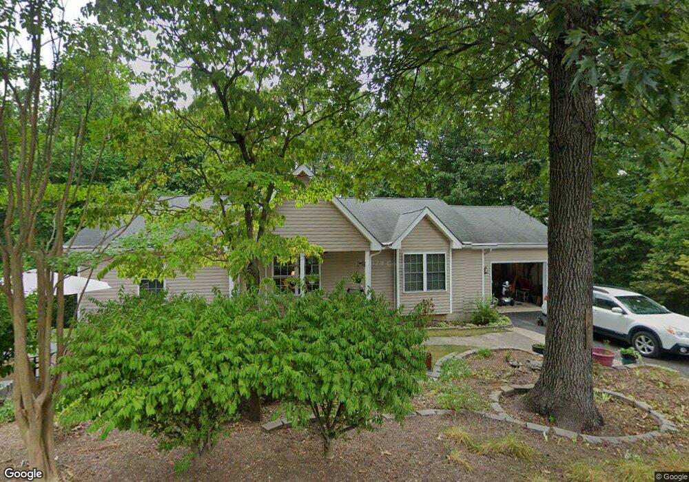
121 Laurel Hill Rd Harpers Ferry, WV 25425
Estimated Value: $355,000 - $373,000
3
Beds
2
Baths
1,407
Sq Ft
$260/Sq Ft
Est. Value
About This Home
This home is located at 121 Laurel Hill Rd, Harpers Ferry, WV 25425 and is currently estimated at $365,433, approximately $259 per square foot. 121 Laurel Hill Rd is a home located in Jefferson County with nearby schools including Blue Ridge Elementary School, Harpers Ferry Middle School, and Washington High School.
Ownership History
Date
Name
Owned For
Owner Type
Purchase Details
Closed on
May 20, 2005
Sold by
Mark Alexander Smith Homes Inc
Bought by
Kelly Michael Phillips and Kelley Linda Rowland
Current Estimated Value
Home Financials for this Owner
Home Financials are based on the most recent Mortgage that was taken out on this home.
Original Mortgage
$184,000
Outstanding Balance
$95,260
Interest Rate
5.83%
Mortgage Type
New Conventional
Estimated Equity
$270,173
Create a Home Valuation Report for This Property
The Home Valuation Report is an in-depth analysis detailing your home's value as well as a comparison with similar homes in the area
Home Values in the Area
Average Home Value in this Area
Purchase History
| Date | Buyer | Sale Price | Title Company |
|---|---|---|---|
| Kelly Michael Phillips | $230,000 | None Available |
Source: Public Records
Mortgage History
| Date | Status | Borrower | Loan Amount |
|---|---|---|---|
| Open | Kelly Michael Phillips | $184,000 | |
| Closed | Kelly Michael Phillips | $46,000 |
Source: Public Records
Tax History Compared to Growth
Tax History
| Year | Tax Paid | Tax Assessment Tax Assessment Total Assessment is a certain percentage of the fair market value that is determined by local assessors to be the total taxable value of land and additions on the property. | Land | Improvement |
|---|---|---|---|---|
| 2025 | $1,820 | $176,600 | $53,800 | $122,800 |
| 2024 | $1,715 | $166,500 | $53,800 | $112,700 |
| 2023 | $1,711 | $166,500 | $53,800 | $112,700 |
| 2022 | $1,357 | $133,900 | $34,400 | $99,500 |
| 2021 | $1,244 | $122,400 | $34,400 | $88,000 |
| 2020 | $1,177 | $123,400 | $34,400 | $89,000 |
| 2019 | $1,199 | $123,400 | $34,400 | $89,000 |
| 2018 | $1,063 | $110,500 | $23,700 | $86,800 |
| 2017 | $1,013 | $106,200 | $19,400 | $86,800 |
| 2016 | $1,007 | $106,000 | $18,300 | $87,700 |
| 2015 | $949 | $100,600 | $18,300 | $82,300 |
| 2014 | $1,131 | $96,200 | $18,300 | $77,900 |
Source: Public Records
Map
Nearby Homes
- 26 Shore Ln
- 271 Moonshine Ln
- 315 Lower Clubhouse Dr
- 326 Lower Clubhouse Dr
- Lots 2 & 3 Wolfe Hill Rd
- 133 Beechwood Ln
- 307 Johnnycake Ln
- #2 Highview Rd
- #1 Highview Rd
- 413 Highview Rd
- LOTS 11-13, 49 Sunset Ln
- Lot 6 Sunset Ln
- Lot 7 Sunset Ln
- 78 Tulip Ct
- 572 Johnnycake Ln
- 625 Gray Fox Rd
- 81 Shannondale Rd
- 262 Walters Way
- 0 Summertime Ln
- 330 Foothill Ln
- 191 Upper Clubhouse Dr
- 211 Upper Clubhouse Dr
- 308 Shagbark Ln
- 176 Laurel Hill Rd Lakeside
- 175 Laurel Hill Rd
- 350 Shagbark Ln
- 647 Laurel Hill Rd
- 245 Upper Clubhouse Dr
- 199 Laurel Hill Rd
- 53 Laurel Hill Rd
- 131 Upper Clubhouse Dr
- 146 Upper Clubhouse Dr
- 38 Lakeside Dr
- 269 Shagbark Ln
- 2176 Lakeside Dr
- 176 Laurel Hill Dr
- 114 Lakeside Dr
- 2156 Lakeside Dr
- 130 Upper Clubhouse Dr
- 239 Shagbark Ln