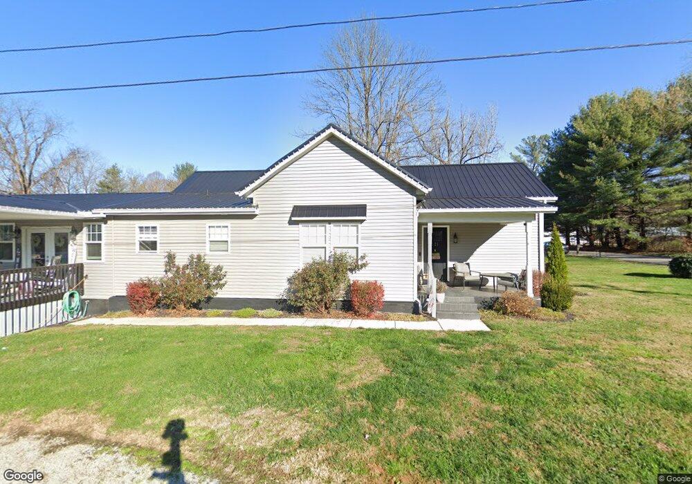
121 Long St Wheelersburg, OH 45694
Estimated Value: $123,000 - $228,000
2
Beds
1
Bath
992
Sq Ft
$159/Sq Ft
Est. Value
About This Home
This home is located at 121 Long St, Wheelersburg, OH 45694 and is currently estimated at $157,683, approximately $158 per square foot. 121 Long St is a home located in Scioto County with nearby schools including Wheelersburg Elementary School, Wheelersburg Middle School, and Wheelersburg High School.
Ownership History
Date
Name
Owned For
Owner Type
Purchase Details
Closed on
Sep 26, 2018
Sold by
Cook Danny and Cook Tonaya
Bought by
Logan John R
Current Estimated Value
Purchase Details
Closed on
Feb 7, 2017
Sold by
Bank Of America Na
Bought by
Cook Danny and Cook Tonaya
Purchase Details
Closed on
Dec 22, 2016
Sold by
Scioto County Sheriff
Bought by
Bank Of America
Purchase Details
Closed on
Apr 29, 2005
Bought by
Otworth Leonard H
Purchase Details
Closed on
Sep 30, 2004
Sold by
Burke Brian
Bought by
Federal National Mortgage
Purchase Details
Closed on
Jun 21, 2002
Sold by
Burke Brian + Tina J and Burke S
Bought by
Burke Brian
Purchase Details
Closed on
Mar 20, 2001
Sold by
Craig Randal
Bought by
Burke Brian + Tina J and Burke S
Purchase Details
Closed on
Apr 20, 1995
Bought by
Craig Randal
Create a Home Valuation Report for This Property
The Home Valuation Report is an in-depth analysis detailing your home's value as well as a comparison with similar homes in the area
Home Values in the Area
Average Home Value in this Area
Purchase History
| Date | Buyer | Sale Price | Title Company |
|---|---|---|---|
| Logan John R | $113,500 | None Available | |
| Cook Danny | $15,200 | -- | |
| Bank Of America | $16,667 | -- | |
| Otworth Leonard H | $18,000 | -- | |
| Federal National Mortgage | $26,000 | -- | |
| Burke Brian | -- | -- | |
| Burke Brian + Tina J | $33,600 | -- | |
| Craig Randal | $18,000 | -- |
Source: Public Records
Tax History Compared to Growth
Tax History
| Year | Tax Paid | Tax Assessment Tax Assessment Total Assessment is a certain percentage of the fair market value that is determined by local assessors to be the total taxable value of land and additions on the property. | Land | Improvement |
|---|---|---|---|---|
| 2024 | $1,637 | $35,950 | $4,510 | $31,440 |
| 2023 | $1,637 | $35,950 | $4,510 | $31,440 |
| 2022 | $1,634 | $35,950 | $4,510 | $31,440 |
| 2021 | $1,449 | $32,100 | $4,120 | $27,980 |
| 2020 | $1,449 | $32,100 | $4,120 | $27,980 |
| 2019 | $1,447 | $14,680 | $3,920 | $10,760 |
| 2018 | $679 | $14,680 | $3,920 | $10,760 |
| 2017 | $695 | $14,680 | $3,920 | $10,760 |
| 2016 | $481 | $13,790 | $3,720 | $10,070 |
| 2015 | $686 | $13,790 | $3,720 | $10,070 |
| 2013 | $618 | $13,790 | $3,720 | $10,070 |
Source: Public Records
Map
Nearby Homes
- 112 Cherry St
- 0 Patriot Ridge Dr
- 0 Harrison Ave
- 175 Harrison Ave
- 0 Gerlach Rd Unit 152351
- 0 Gerlach Rd
- 10391 Gallia Pike
- 0 Ohio 522 Unit 152342
- 10 Hummingbird Ln
- 636 Havenwood Dr
- 645 Havenwood Dr
- 3272 Big Pete Rd
- 3272 Big Pete Rd Unit A
- 1048 North St
- 0 York Ave Unit 154110
- 0 Lick Run-Lyra Rd
- 0 Ohio River Rd Unit 152541
- 0 Ohio River Rd Unit 152771
- 0 Ohio River Rd Unit 58630
- 716 Connie Ave